Download
1 / 30
300 likes | 400 Views
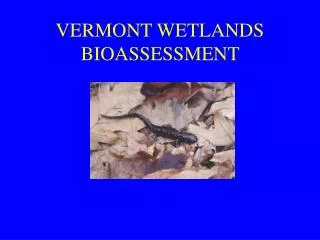
National Wetlands Inventory Mapping In Vermont. Ralph Tiner, Regional Wetland Coordinator U.S. Fish and Wildlife Service Northeast Region Hadley, MA. Background. National Program 90% of coterminous US mapped 50% digitized Regional Status 12 of 13 states mapped

E N D
National Wetlands Inventory Mapping In Vermont Ralph Tiner, Regional Wetland Coordinator U.S. Fish and Wildlife Service Northeast Region Hadley, MA
Background • National Program • 90% of coterminous US mapped • 50% digitized • Regional Status • 12 of 13 states mapped • Updating in progress on a FWS priority basis and where outside funding is received
Purpose of Mapping • To inventory wetlands across the nation for natural resource conservation purposes • To identify and classify larger wetlands based on photointerpretation (recognizing limitations inherent in this approach) • To report on the status and trends of US wetlands and for states as mapping is completed • The NWI is not designed to map all the wetlands in any locality – that would require on-the-ground surveys applying wetland delineation techniques
Limitations of Photointerpretation for Mapping Wetlands • Photo Scale • Seasonality (environmental conditions at time of photo capture) • Photo Quality • Wetlands that are difficult to photointerpret
Photo Scale vs. Area ScaleArea In One Square Inch 1:80K 1020 acres 1:58K 540 acres 1:40K ~250 acres 1:24K 92 acres 1:12K ~25 acres
Photo Scale vs. Mapping Unit Photo Scale vs. Target Mapping Unit • 1:80,000 = 3-5 acres • 1:58,000 = 1-3 acres • 1:40,000 = 1 acre • 1:24,000 = 0.25-0.50 acre • 1:12,000 = 0.10 acre
Photo Scale vs. # of Photos Scale # of Photos/Quad #Photos/VT* 1:80,000 1 160 1:58,000 1.5 240 1:40,000 4 640 1:24,000 20 3200 1:12,000 42 6720 *Estimates based on 58 sq. mi/quad and Vermont land surface area. May be approx. 220 quads (1:24K) covering the state
Pen Width vs. Ground Distance Earlier maps were hand-drawn, so pen-width was a factor. Scale000 (0.25mm) 0000 (0.18mm) 1:80K ~67ft ~50ft 1:58K 48ft 34ft 1:40K 33ft 23ft 1:24K 20ft 14ft 1:12K 10ft 7ft
Scale Limits on Wetlands • Not simply acreage dependent • Relates to shape • one-acre block vs. one-acre linear • Relates to easy or difficulty of photointerpretation of type
Wetland Type • Easy to identify types • Marshes, bogs, seasonally flooded swamps, ponds • Harder to identify types • Drier-end wetlands • Evergreen forested wetlands • Temporarily flooded wetlands • Wetlands on slopes (seepage)
Seasonality • Environmental Conditions • Leaf on vs. Leaf off • Spring vs. Fall (leaf off) • Ambient weather • Water tables and flooding • Extreme flooding vs. droughts • Snow and ice
Photo Quality • Emulsion • Black and White (panchromatic) • True Color • Color Infrared • Resolution • Processing (over vs. under exposed) • Date (best available at 1:40K or smaller; now use DOQ/DOQQ)
Original NWI Maps for Vermont • 1:80,000 CIR • October 1977 • Target Mapping Unit = 3-5 acres • Inventory done in late 1970s/1980. • Mapping Procedures • Photointerpretation • Limited Field Work • Consultation with Soil Surveys? (No hydric soils lists/indicators) • Regional QC (spot checking) • National QC (spot checking)
NWI 220,000 acres 3.7% of the state Soil Data 341,000 acres 5.5% NWI Results vs. Hydric Soils
Updated NWI Mapping • 1:40,000 CIR • 1992-1994 • Target Mapping Unit = 1 acre • Mapping Procedures • Edit original NWI data • Photointerpretation • Limited field checking • Consult with soil surveys (interpretation) • Regional QC (entire photo) • National QC (automated verification)
New Mapping Procedures (2006) • Edit existing NWI data • Photointerpretation on-screen • DOQ or DOQQ base • Limited field checking • FWS QC, automated verification • Add undeveloped hydric soil map units • FWS QC, automated verification
Enhanced NWI • Current NWI database • Add other descriptors: • Landscape Position • Landform • Water Flow Path • Waterbody Type • Use data to predict wetland functions
LLWW Descriptors • Landscape Position • Lotic, Lentic, Terrene • Landform • Floodplain, Basin, Flat, Fringe, Slope • Water Flow Path • Inflow, Outflow, Throughflow, Bidirectional Flow, Isolated • Waterbody Type • Pond and lake types, impounded rivers, etc.
Functional Assessment 9 Functions for Inland Wetlands • Surface Water Detention • Streamflow Maintenance • Nutrient Transformation • Sediment Retention • Shoreline Stabilization • Fish and Shellfish Habitat • Waterfowl/Waterbird Habitat • Other Wildlife Habitat • Conservation of Biodiversity
Updated NWI - Highlights • Smaller wetlands • Refined boundaries • Incorporates more hydric soil map units • Can be enhanced to be more descriptive • After enhancement, can use for preliminary functional assessments • Still will not map all wetlands – need ground surveys applying delineation procedures to do this; potential vernal pool mapping through remote sensing