Download
1 / 29
290 likes | 461 Views
DEMOCRATIC REPUBLIQUE OF CONGO. République démocratique du Congo (french) Repubilika ya Kongo Demokratiki (kikongo) Jamhuri ya Kidemokrasia ya Kongo (Swahili) Republiki ya Kongó Demokratiki (lingala) Ditunga dia Kongu wa Mungalaata ( tsiluba ) Presented by Roland Makenga Bizau.

E N D
DEMOCRATIC REPUBLIQUE OF CONGO République démocratique du Congo (french) Repubilika ya Kongo Demokratiki (kikongo) Jamhuri ya Kidemokrasia ya Kongo (Swahili) Republiki ya Kongó Demokratiki (lingala) Ditunga dia Kongu wa Mungalaata (tsiluba) Presented by Roland MakengaBizau
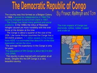
IntroductionI • Not to be confused with the neighbouring Republic of the Congo or Congo Brazzaville. It is the country that was known as Zaïre from 1971 to 1997. The Democratic Republic of the Congo, sometimes referred to as DR Congo, Congo-Kinshasa or the DRC, is a country located in Central Africa. It is the largest country in Sub-Saharan Africa by area and the eleventh largest in the world. With a population of over 75 million, the DRC is the nineteenth most populous nation in the world, the fourth most populous nation in Africa, as well as the most populous officially Francophone country.
Introduction II • It borders the Central African Republic and South Sudan to the north; Uganda, Rwanda, and Burundi in the east; Zambia and Angola to the south; the Republic of the Congo, the Angolan exclave of Cabinda, and the Atlantic Ocean to the west; and is separated from Tanzania by Lake Tanganyika in the east.The country has access to the ocean through a 40-kilometre (25 mi) stretch of Atlantic coastline at Muanda and the roughly 9 km wide mouth of the Congo River which opens into the Gulf of Guinea. It has the second-highest total Christian population in Africa.
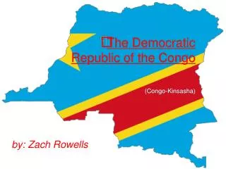
MAP OF DRC • 9 neighbors countries • North: Rca, South Sudan • South: Angola, Zambia • Est: Rwanda,Burundi, Uganda, Tanzania • West: Republic of congo
Général • Capital: Kinshasa • Other cities: Lubumbashi, Kisangani, Matadi,Goma, Bukavu, Mbuji-mayi,Kananga,Kikwit • Area: 2.345.409 Km²(2)(11) • People: 75.507.308 • Demonym: Congolese • Currency: Franc congolais(CDF) • Calling code: 00243 • Official language: French • Recognized national languages: Lingala, Kikongo,Swahili, Tshiluba • Freedom: 30 june 1960 • Legislature Parliament • - Upper house: Senate • - Lower house: National Assembly • Government: Semi-presidential
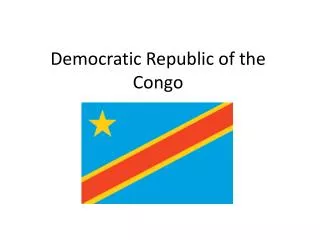
Flag and coat of arms I/II Meaning of colors • Yellow: wealth • Red: sacrifiace • Blue: Peace
Regions • Bandundu • Bas-Congo • Équateur • Kasaï-Occidental • Kasaï-Oriental • Katanga • Kinshasa • Maniema • Nord-Kivu • Orientale • Sud-Kivu
History I • The territory has been inhabited since at least 200 000 years ago . There were great kingdoms in the territory as the Kongo , the Pende, Songe , the Luba , the Kuba ... The Europeans recognize that the region 1482-1483 with the discovery of the mouth of the Congo River by the Portuguese sailor Diogo Cao . From 1879 , the explorer Henry Morton Stanley explored within the country for the future of Belgian King Leopold II. We share africa during the Berlin Conference (1884-1885) , after he became the subject of an intensive operation, which combines both missionaries adventurers in search of easy by any means fortune.
History II • Chronology • 1482-1483 : discovery of the mouth of the Congo by the Portuguese. • 1874-1877 : exploration of the Congo River by Henry Morton Stanley. • 1884 February -1885 : Berlin Conference1886 : Leopold II of Belgium became king of the Independent State of Congo ( EIC). • 1908: Leopold II of Belgium gives the EIC to Belgium, birth of the Belgian Congo. • 1959: riots in Leopoldville for independence , • 1960 June 30: Congo's independence
HistoryIII • 1961: Assassination of Lumumba. • 1965: Mobutu chief of staff of the army , overturned by a sudden President Kasavubu and he Became Zaire. • 1997: a rebel army forces , forced to flee Kinshasa. The diet falls, Weakened by the Economic Crisis, Laurent -Désiré Kabila declared himself head of state in May 1997 and the country name ounce Became the DRCongo is still changing. • 2001 : The Assassination of LD Kabila and current president is Joseph Kabila, son of Laurent- Désiré .
Geography/hydrography • The DRC is crossed by the equator, with a third of the country lying north of this line. The climate is hot and humid in the area of the river basin, and drier and cooler south. • Congo river, 4,700 km long, 50,000 m3/sec flow, with its vast pool of 3.80 million km ², it is the Nile after the second longest river in Africa, the first African river the most important by its speed and the second river in the world after the Amazon. • The Congo Basin is the second largest river basin in the world after the Amazon. As the Amazon basin, it houses one of the world's richest biodiversity in tropical rainforests, as this basin during deforestation (net deforestation of 0.16% per year in 2010).
Geography II • In general, the lakes of the DRC are grouped as follows: • Mountain lakes, particularly rich in fish are: Lake Albert, Lake Tanganyika, Lake Kivu, Lake Edward • Lakes of plates: Moero and Lake Bangweulu • Residual lakes : lakes Tumba and Mai-Ndombe, Upemba. • In the DRC, there are many other lakes, but of lesser importance which are not on this list.
Relief I • The DRC is in the form of a cup, bordered to the east, a mountain range considered one of the highest in Africa, and to the west, the mountains Mayumbe going until Atlantic Ocean by a narrow coastal plain. • North >A savannah region bounded by the watershed between the basin of the Congo and the Nile , the highlands of Kivu and Ituri . • The central basin : 800,000 km ², one third of the national territory and is partly covered by a dense equatorial forest.TheMonts de Cristal ( 1,050 m) , parallel to the Atlantic , separate interior plain of the coastal plain. • South >The rim of the bowl includes plates of the line of the watershed of the Congo - Zambezi massive Katanga
Relief II • East >powerful chain wide mountains about 50 Km long of more than 1,000 km of high and 2000-5200 m Rwenzori . A major volcanic chain, Virunga Mountains , north of Lake Kivu is one of those mountains. Some of these volcanoes are extinct , such as Mikeno ( 4.437 m) , Visoki ( 3,711 m) and Sabinio ( 3,647 m) and several others, such as Karisimbi ( 4,507 m) , Nyiragongo ( 3,470 m) and Nyamulagira ( 3.068 m) are still active
List of parks, fields and reserves • The World Heritage Sites of UNESCO are shown with PM, and Ramsar sites with R. • Garamba National Park (PM) • Kahuzi-Biega (PM) • National Park KundelunguMaiko • National Park (PM) • Mangroves Marine Park (R) • Lomani National Park (in progress) • Salonga National Park I,II(PM) • National Park Upemba • Virunga National Park (PM, R) • 63 Reserves and hunting areas
Mining I/III • Mining potential of the DRC estimated at USD 24 trillion, that justifies all desires which the subject country. DRC has deposits containing fifty minerals identified, but only a dozen of these is exploited: copper, cobalt, silver, uranium, lead, zinc, cadmium, diamonds, the gold, tin, tungsten, manganese and rare metals such as coltan. The country has more than half of the world's cobalt, 10% of its copper, 30% of those diamond and more than 70% of the reserves of coltan (3/4), a mineral that enters the composition of high-tech products. In addition to strategic reserves of minerals, including germanium, the DRC also has significant untapped deposits of gold, manganese, bauxite and iron ore.
L'agriculture reste le principal secteur de l'économie, représentant 57,9 % du PIB en 1997, et occupait 66 % de la population active. • DRC participates liberalization efforts in several regional economic organizations to which it belongs, such as ECCAS, COMESA and SADC.
People, language, culture I/III • We distinguish more of the 450 languages spoken in the country, and probably equivalent number of ethnic groups. It is generally considered that there are 4 major ethnic groups: • Pygmies:, the first inhabitants of Congo, generally hunter-gatherers in the equatorial forest.; • Bantu: arrived in Congo from southern Nigeria. They are by far the largest group, and are mostly farmers. • The East African: breeders often, they came to Congo different territories (Rwanda, Uganda, Burundi &Tanzania). • Hamites:, from Darfur in southern Sudan and Ethiopia, traditionally livestock. They include the Tutsis, the particularly large.