Download
1 / 21
210 likes | 428 Views
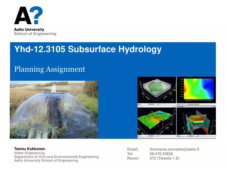
Yhd-12.3105 Subsurface Hydrology. Planning Assignment. Water Engineering Department of Civil and Environmental Engineering Aalto University School of Engineering. Teemu Kokkonen. Email : firstname.surname@aalto.fi Tel. 09-470 23838 Room : 272 (Tietotie 1 E).

E N D
Yhd-12.3105 SubsurfaceHydrology PlanningAssignment Water Engineering Department of Civil and Environmental Engineering Aalto UniversitySchool of Engineering Teemu Kokkonen Email: firstname.surname@aalto.fi Tel. 09-470 23838 Room: 272 (Tietotie 1 E)
Groundwatermodelingproject Basic components of a groundwater modeling project: • A statement of objectives. • Data describing the physical system. • A simplified conceptual representation of the system. • Data processing and modeling software. • A report containing written and graphical presentations. General protocolfor performingmodelingstudies: • Determination of modelingobjectives. • Data gathering and organization. • Development of a conceptual model. • Numericalcodeselection. (MODFLOW-2005) • Assignment of properties and boundary conditions to a grid. • Calibration (and validation). • Model execution and interpretation of results. • Reporting.
Case Jäniksenlinna • Target area • The Jäniksenlinna (artificial) groundwaterextractionplant in Tuusula • Researchproblem • Maximumyield of the plantwithartificialrecharge • Maximumyield of the aquiferwithoutartificialrecharge • Maintanacebreak in the Päijänne tunnel • The level of river Palojoki mustbelowerthan the groundwaterlevel
Steps to Complete the Assignment • Constructing a conceptualmodel for the Jäniksenlinna area • Collecting the data and creating a conceptual (mental, verbal, map) model (area to bemodelled, boundaryconditions, hydrogeologicalproperties etc.) • Exploitingspatial data • Constructing a numericalmodel • Freelyavailable USGS software used • Grid density • Densitycanvary – the denser the greater the changes in hydraulichead • Feeding the preprocessed data into the model • Calibrating the model • Pumpingexperiments • Measurements of groundwaterlevel • Itwouldbeimportantalso to validate the model • Applying the model and presenting the results
Software • ArcGIS • Proprietary software for processingspatial data • Available in Aalto computerclasses • (MapWindow) • Free GIS software • www.mapwindow.org • MODFLOW-2005 • Probably the mostwidelyusedgroundwater software in the world • USGS • Graphicaluserinterface for MODFLOW • USGS GIS software GroundwaterModeling
Data • Groundwaterstudyfromyear 1963 (in Finnish) • A studyfrom the timewhen the plantwasfounded • Groundwaterstudyfromyear 1991 (in Finnish) • Tekopohjaveden muodostuminen: imeytystekniikka, maaperäprosessit ja veden laatu – TEMU-tutkimushankeen loppuraportti (in Finnish)
Data • Soilmap 1:20 000 (GeologicalSurvey of Finland) • Vector data (.shp) • Elevation of the bedrock • Raster data (.tif) • Resolution 25 x 25 m2 • Elevation of the groundsurface • Raster data (.tif) • Resolution 25 x 25 m2 • Basic map (National Survey of Finland) • Raster data (.tif)
Data • Location of pumpingwells • Vector data (.shp) • Water level of river Palojoki from 2000 to 2009 • Excel file • Location of measurement points (.shp) • Rainfall from2000 to 2008 • Excel file • Pumping experiment from year 2010 • Excel file
GroundwaterModelAssignment #1 • Construct a conceptualgroundwatermodel for the Jäniksenlinna area, considering at least the followingaspects: • Confined or unconfined aquifer? • Where and what type of boundary conditions? • The river flowing across the area. • Artificial groundwater recharge and pumping of groundwater. • Spatial distribution of hydrogeological parameters? • Consideralso the restrictionsimposedbylack of data and computingresources • Whatwouldyoudo in the ideal case havingallrequired data and unlimitedcomputingpower? • How do you set up the conceptual model when you have the given data at hand and the available computing power is limited? Explain your decisions. • Discuss the effects of the possible simplifications that you had to do in comparison to the ideal case.
GroundwaterModelAssignment #1 • Return a short report that summarizes all issues listed on the previous slide. • Explain and give a reason for all the decision you make. • Figures taken from the GIS program will help the reader to understand your model set-up. • DL Oct 24, 2013 • Reports to bereturned to Optima
How to getstarted? • Make sure that in yourgroupeverybodyknowswhat the objectivesare • Read the backgroundmaterial • Mandle, R. J. 2002. (in particularchapters 3 [& 5]) • León, E. & Ferré, T. 2003. • USACE. 1999. (in particular chapters 3 & 5) • Divide the workwithinyourgroup • Start to workquickly and keepworkingregularly
GroundwaterModelAssignment#2 • Construct a numerical groundwater flow model for the Jäniksenlinnaarea using ModelMuse. • Use the conceptual model developed in the 1st assignment • Import necessaryfilesfromArcGIS to ModelMuse, createcomputationlgrid for the studyarea, createlayer(s) for the aquifer, assigninitial and boundaryconditions • Calibrate your model using ModelMate. • Find optimal parameter values for the horizontal hydraulic conductivity and the storage coefficient so that observed heads in the observation well match computed heads • Validate your model. • Use the calibrated model with different time series of observed heads to see how well the computed values match them
GroundwaterModelAssignment #2 • Return a short report summarizing the steps listed above and the results of calibration and validation processes. • Pay attention to clearly describing your model set-up and data (e.g. grid layout and spacing, number and type of aquifer layers, initial and boundary conditions, data used for calibration and validation, etc.) • Figures taken from MODFLOW will help the reader to understand your model set-up and calibration/validation results • Make sure youreport the calibratedhorizontalhydraulicconductivity and storagecoefficientvalues • Dead-line: Nov 14, 2013 • Reports to be returned to Optima
MODFLOW-2005 • MODFLOW – Modular three-dimensional finite-difference ground-water model • Firstpublished in 1984 • MODFLOW-2005 is a general update to the originalcode • Considered to be the de facto standard code for aquifer simulation • Simulates steady and unsteady flow • Allows an irregularly shaped flow system • Aquifer layers can be either confined, unconfined, or a combination of former • Flow from external stresses (wells, areal recharge, evapotranspiration, etc.) can be simulated • K or T and S for any layer may be heterogeneous and anisotropic • Allows both Dirichlet and Neumann boundary conditions
ModelMuse • A graphical user interface (GUI) for a set of USGS models, including MODFLOW • Provides a GUI for creating the flow and transport input files for MODFLOW–2005 as well as executing and displaying the results of the model • The main window has a top, front, and side view for editing the model, and a 3D view that can be used to display properties of the model • Provides tools to generate and edit the model grid • Has a variety of interpolation methods and geographic functions to help define the spatial variability of the model
ModelMate • A graphical user interface (GUI) to facilitate model analysis • Supports one model-analysis program, UCODE_2005, and one model software program, MODFLOW–2005 • Can be used in conjunction with ModelMuse • In this exercise project ModelMate is used to calibrate the groundwater flow model
HELP!!!!!! • Take a look at the video tutorials for ModelMuse at: • http://water.usgs.gov/nrp/gwsoftware/ModelMuse/ModelMuseVideos.html • Introductory Video • CreatingGrids– 2 • CreatingGrids– 4 • IrregularLayers in MODFLOW • Importing Data • ImportingShapefiles • Etc. • Take a look at the documentation for ModelMate • Banta, E. R. 2011. ModelMate—A Graphical User Interface for Model Analysis. U.S. Geological Survey, Reston, Virginia. • Especially “Use of ModelMate with ModelMuse”, on pg. 27-28 • Spend a momentgettingto knowModelMuse • Gothroughmenusselectingfeatures and using ”? Help” button to getused to them • Gothrough the ExampleProblems in the help system
Otherissues… • Pleaseput the finalreports of eachplanningassignmentstasks to the ’CompletedAssignment No’ folder • Thenweknowwhat to comment and evaluate and donotwastetime on exploringtemporaryfiles/results • Donotstress…
GroundwaterModelAssignment#3 • Using your numerical groundwater flow model for the Jäniksenlinnaarea find out: • The maximumyield of the groundwaterplantwhenartificialrecharge is in use • The maximumyieldwithout the artificialrecharge • Using the values of K and S fromyourcalibratedmodelextend the model (orcreate a new one) in order to beable to estimate the yield • River Palojoki, all the pumpingwells, natural and artificialgroundwaterrecharge, etc. • Stillassumeonlyoneconfinedlayer and istropic and homogenoussoilmaterial • Waterlevel in river Palojoki shouldremainbelow the groundwatertable
GroundwaterModelAssignment #3 • Prepare a 10-15 min PowerPoint-presentation of your findings • Conceptual model (the ”not-ideal” case from Assignment #1) • Model boundaries, boundary conditions, assumptions, simplifications, etc. • Results of the calibration • Model structure, initial values of K and S, final values of K and S, figures of simulated & observed H, etc. • Maximum yield in both cases • Model structure, input data and its spatial variability, assumptions, results, reliability of the results, comparison with previous studies, etc. • Each group will give their presentation in the final seminar on Wednesday Nov 27th
Peer review – maybenotapplicablethisyear… • Everyone MUST evaluate the performance of themselves and othermembers of the group as well as the overallperformance of the group • Give a grade of 0 - 5 for yourgroup and for eachmember of the group • You MUST givereasons for the grades! • Youcannotgive the samegrade for eachmember of the group • Eachstudentwillreceive the average of peerreviewscoresgivenbyothermembers of the group • Fill in the reviewsheetfound in Optima and return to Optima to your ”Harjoitukset” folderbeforeMondayDec 12th • Peer reviewwillgive an insight to groupdynamics and the resultsmayhave a smallimpact (10-15 %) whenassigning the points for the Jäniksenlinna planningexercise for eachstudent