Download
1 / 10
100 likes | 247 Views
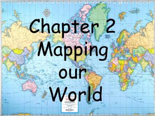
Mapping and Measuring Our World. Ernie Laden and Kate Barton Curriculum Project Education 200. Overall Goal. In a 4 th grade class room, this unit will develop students’ spatial intelligence and give them a deeper understanding of the geography of their community and the United States. .

E N D
Mapping and Measuring Our World Ernie Laden and Kate Barton Curriculum Project Education 200
Overall Goal • In a 4th grade class room, this unit will develop students’ spatial intelligence and give them a deeper understanding of the geography of their community and the United States.
Objectives • Students will improve and develop spatial awareness based on actual distance and familiar locations. • Students will gain an understanding of conversions through visual aids and measurements. • Students will analyze local and national geography and construct detailed maps of designated regions. • Students will illustrate and compare estimated distances relative to scale. • Students will improve interpersonal relations by critiquing and evaluating each others work and presenting their own work to the class.
Justification • The Connecticut Bureau of Curriculum and Instruction for 4th grade classes requires students to be able to: - “observe and describe how places and regions are identified, defined and bounded” (Social Studies Standard 9) - “locate places within their own and nearby communities in Connecticut” (Social Studies Standard 9) - “Estimate lengths and areas by comparing” and “convert distance” using appropriate measurement (Mathematics 15 A and 16) • The objectives also reflect Bloom’s Taxonomy and Gardner’s Multiple Intelligences.
Wednesday : A Closer Look • Students are shown real satellite photos from Google Earth and Yahoo Maps • Maps and photos projected onto the wall - String is used to measure distances between previously established landmarks • Students work in groups to convert measured distance to actual distance • Compare estimated distance to distance found • Redraw class map with accurate distances to specified landmarks • Homework: Determine landmark to “teach” the class
Wednesday : A Closer Look • Students are shown real satellite photos from Google Earth and Yahoo Maps • Maps and photos projected onto the wall - String is used to measure distances between previously established landmarks • Students work in groups to convert measured distance to actual distance • Compare estimated distance to distance found • Redraw class map with accurate distances to specified landmarks • Homework: Determine landmark to “teach” the class
Friday : Evaluation Day • Students will be assigned a landmark of their choice or from a number of suggestions (i.e. – Pope Park, the State Capitol) • Each student must show the class where their landmark is located and measure its distance from McDonough • Presentations can include any method of measurement taught throughout the week • Students will pinpoint their landmark on the large map.