Download
1 / 30
300 likes | 311 Views
Framework Data Content – Transportation Rail. Related Topics. NSDI Training Tracks: An initiative to define areas, topics, and materials for training within the NSDI. ISO 19100 Series:

E N D
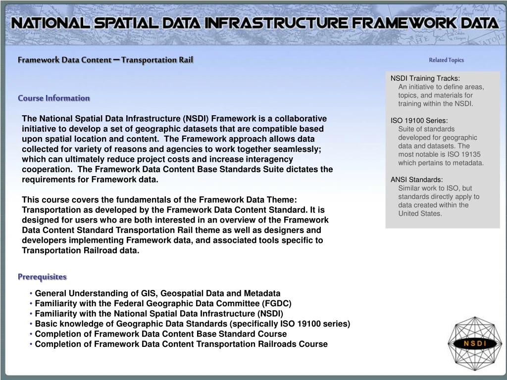
Framework Data Content – Transportation Rail Related Topics NSDI Training Tracks: An initiative to define areas, topics, and materials for training within the NSDI. ISO 19100 Series: Suite of standards developed for geographic data and datasets. The most notable is ISO 19135 which pertains to metadata. ANSI Standards: Similar work to ISO, but standards directly apply to data created within the United States. Course Information The National Spatial Data Infrastructure (NSDI) Framework is a collaborative initiative to develop a set of geographic datasets that are compatible based upon spatial location and content. The Framework approach allows data collected for variety of reasons and agencies to work together seamlessly; which can ultimately reduce project costs and increase interagency cooperation. The Framework Data Content Base Standards Suite dictates the requirements for Framework data. This course covers the fundamentals of the Framework Data Theme: Transportation as developed by the Framework Data Content Standard. It is designed for users who are both interested in an overview of the Framework Data Content Standard Transportation Rail theme as well as designers and developers implementing Framework data, and associated tools specific to Transportation Railroad data. Prerequisites • General Understanding of GIS, Geospatial Data and Metadata • Familiarity with the Federal Geographic Data Committee (FGDC) • Familiarity with the National Spatial Data Infrastructure (NSDI) • Basic knowledge of Geographic Data Standards (specifically ISO 19100 series) • Completion of Framework Data Content Base Standard Course • Completion of Framework Data Content Transportation Railroads Course
Learning Objectives Understand Transportation Data Comprehend basics of transportation framework standard Understand how to implement the standard Course modules • Understanding Transportation • Transportation Railroads (Part 7c) of the Framework Data Content Standard • Implementing the Transportation Railroad Standard • Course Review Estimated Time Estimated time for the entire course is 100 minutes.
Module 1: Understanding Transportation Time Requirement Topics • What is Transportation Data review • Types of Transportation Data review • Transportation Railroad Data • Transportation in Action • Module Exercise and Summary Estimated time for this module is 30 minutes Key Terms Transportation Framework NSDI/FGDC First Topic What is Transportation Data
What is Transportation Data Related scientific field Network Analysis: A transport network, or transportation network in American English, is typically a network of railroads, streets, pipes, aqueducts, power lines, or nearly any structure which permits either vehicular movement or flow of some commodity. A transport network is used for transport network analysis to determine the flow of vehicles (or people) through it within the field of transport engineering, typically using graph theory. It may combine different modes of transport, for example, walking and car to model multi-modal journeys. Transportation can be defined as the movement of people and goods from one place to another. Thus Transportation data, and geospatial transportation data are representations of the means in which transportation can occur. For example a state highway map, railroad timetable, and airline routes are all examples of transportation data. next Topic Types of Transportation Data
Types of Transportation Data • There are hundreds of different types and ways to represent Transportation Data. However for the purposes of Framework Data and the Framework Data Content Standard there are five thematic categories of transportation data. • Part 7, Transportation • Part 7a, Air • Part 7b, Rail • Part 7c, Railroad • Part 7d, Transit • Part 7e, Inland Waterways next Topic Transportation Railroad Data
Transportation Railroad Data Spatial data is a visual representation of a real world feature, for these materials the real world features being represented are Railroads. At a high level, the rail system described in this part of the Framework Data Content Standard is made up of rail features, which can have geographic locations and characteristics. These rail features can be interconnected in various ways to represent rail networks for routing applications. While the Transportation Rail Standard Committee initially considered defining the content for detailed, engineering level datasets, this part of the standard focuses on a generalized view of the rail network that enables the broadest variety of operational uses. It is anticipated that the current version of the part will be suitable for some engineering applications. However, the development team recognizes that all engineering needs will not be satisfied by this part of the standard. It is anticipated that future versions of the Rail part will better define the content for rail engineering datasets in order to satisfy the data sharing needs of the entire rail community. Railroad representation next Topic Transportation Railroad in action
Transportation Railroads in action Example In General terms the diagram to the left represents one way we can represent real transportation (Railroad) features and use them for analysis in GIS and other tools. The purpose of this Transportation Framework Standard is to provide a process by which data is standardized and categorized to ensure a level of consistency and interoperability. Diagram showing UP Steam Train IMS next Topic Transportation Exercise
Transportation Railroads Module 1 exercise Wyoming Railroad Conditions map The Wyoming Railroad Conditions website allows a user to locate, and access weather information about a given Railroad or set of Railroads. http://www.dot.state.wy.us/wydot/engineering_technical_programs/railroads/rr_related_links Transportation Data in action Transportation data is being applied and used in real world projects by many different agencies. These agencies use transportation data for a variety of reasons. Now that you have some basic transportation knowledge let’s see some a transportation data set in action. Step 1) Open an Internet Browser and proceed to: http://www.vhbgis.com/pw-csx.html Step 2) Read the article about how GIS is helping CSX with networking Step 3) Close all Internet windows and proceed with the course next Topic Module Summary
Module Summary Understanding Transportation • Transportation data describes how people and goods move across a landscape • Five categories of transportation data makeup the transportation framework • Many different transportation features can be collected, mapped, and utilized for a variety of reasons next Topic Module 2: Transportation Railroads (Part 7c) of the Framework Data Content Standard
Module 2: Transportation Railroads (Part 7c)of the Framework Data Content Standard Time Requirement Topics Estimated time for this module is 30 minutes • What is the Transportation Railroad Standard • Purpose for Standard • Goals of the Standard • Capacities of the Standard • Standard Related Contact Information • Module Exercise and Summary Key Terms Transportation Framework Standard Framework
Next Topic Purpose for the Standard What is the Transportation Railroads standard Quick Facts Each transportation standard part was developed and edited by thematic experts • The Transportation Railroads Framework Data Content Standard: • One of the five themes defined as Framework Transportation data • All the elements that apply to Transportation Framework Base Standard apply to the Railroads theme • Establishes a baseline for Transportation Railroad data collection and distribution • Builds on the Framework Data Content Base Standard and Framework Transportation Railroads Standard. • Only when a dataset meets the requirements set forth in its thematic standard part and the Framework Base Standard can it be considered Framework data.
Next Topic Goals of the Standard Purpose for the Standard The primary purpose of the Geographic Information Framework Data Content Standard, Part 7c: Railroads is to support the exchange of transportation data related to railroad networks. This part of the standard also seeks to establish a common baseline for the content of Railroad transportation databases for public agencies and private enterprises. It seeks to decrease the costs of acquiring and exchanging railroad transportation data for Federal, State, Tribal, local, and other governmental agency users and creators of Railroad transportation data. Benefits of adopting the part also include the long-term improvement of the geospatial transportation railroads data, improved integration of safety and enforcement data, and streamlined maintenance procedures.
Next Topic Capacities of the Standard Goals for the Transportation Railroads Standard • The goal of the transportation Railroad part of the Framework Data Content Standard is to provide common definitions and syntax to enable collaborative development, use, and exchange of data specific to railroad transportation data • The audience of this part of the standard includes Transportation data users, maintainers, and distributors. Specific guidance on the implementation of the Railroad data that meets framework specifications is outlined
Capacities for the Transportation Standard More Information The FGDC is the responsible organization for coordinating work on all parts of the Geographic Information Framework Data Content Standard. The United States Department of Transportation (USDOT), working with the FGDC, is the responsible organization for coordinating work on the Geographic Information Framework Data Content Standard, Part 7: Transportation Railroads and subparts (Parts 7a, 7b, 7c, and 7d, excluding 7e) and is directly responsible for development and maintenance of the transportation parts (excluding 7e) of the Framework Data Content Standard. • The development of this part of the Framework Data Content Standard will greatly assist in mitigating the following issues: • Duplication of data and application development • Complications exchanging transportation data and information • Difficulties integrating data • Poor framework/support for analytic activities • Difficulties managing multiple representations of features next Topic Contact Info
Who to Contact for Questions about the Transportation Railroads Standard Part Standard Coordination The FGDC is the responsible organization for coordinating work on all parts of the Geographic Information Framework Data Content Standard. The development and maintenance authority for Part 6: Transportation is held jointly by the U.S. Geological Survey and U.S. Environmental Protection Agency. The FGDC shall be the sole organization responsible for direct coordination with the InterNational Committee for Information Technology Standards (INCITS) concerning any maintenance or any other requirements mandated by INCITS or ANSI. Federal Geographic Data Committee Secretariat c/o U.S. Geological Survey 590 National Center Reston, Virginia 20192 USA Telephone: (703) 648-5514 Facsimile: (703) 648-5755 Internet (electronic mail): fgdc@fgdc.gov WWW Home Page: http://www.fgdc.gov next Topic Module 2 Exercise
Transportation Module exercise • Open the Amtrack Route Atlas:http://www.amtrak.com/servlet/ContentServer?pagename=Amtrak/Page/Routes_Index_Page&c=Page&cid=1080072922209&ssid=4 • Take a few moments to review the different routes and explore the different features of the atlas. • Use the custom route application to build a route between two stations of your choice • Notice how the spatial data is key to building custom applications, and user interfaces to allow people to utilize railroad transportation • Close the atlas and continue on with to the next module. next Topic Module Summary
Module summary • The goal of the Transportation Railroads part of the Framework Data Content Standard is to provide common definitions and model to enable collaborative development, use, and exchange of Transportation Railroad data. • Establish the content requirements for the collection and interchange of Transportation Railroads features • The Transportation Railroads part is one of the five modes of transportation systems: air, rail, railroad, transit, and water, defined as pertinent for Framework data next Topic Module 3: Transportation Railroads Requirements
Module 3:Transportation Railroad Requirements Time Requirement Topics Estimated time for this module is 60 minutes • Framework Data Content Transportation Railroads Standard Requirements • Encoding and Implementing the Standard • Module Summary Key Terms UML Coding Elements Feature Relationships First Topic Transportation Standard Requirements
Framework Data Standard Transportation Railroad Requirements In this module you will learn about the four different requirements for Framework Transportation Railroad data, as specified in the standard. Each requirement is addressed as a separate topic, however more attention may be given to certain requirements as they are the most crucial requirements for creating Framework quality Transportation Railroad data. Many of the requirements are specific UML features. For these requirements a brief description of the component will be included. Please see the UML chart and associated tables, included as an appendix in the standard for more specifics. next Topic Transportation Railroad Requirements Continued
Framework Data Standard Transportation Requirements The diagram to the right is the UML flow chart for the Framework Transportation Standard. This diagram shows the components and relationships that comprise the Framework Transportation Standard. UML is designed to show these relationships in a generic manner without specifying a coding language or specific software needed to complete the task. For more information about UML visit http://www.uml.org next Topic Transportation Railroad Requirements Continued
Framework Data Standard Transportation Railroad Requirements • The following slides include a brief description of the four main components to the Railroad Transportation Standard • Railroad system • The Railroad system model describes the geographic locations, interconnectedness, and characteristics of the railroads in the larger transportation system. The transportation system includes physical and non-physical components representing all modes of travel that allow the movement of goods, services, and people between locations. The Railroad infrastructure is a physical component of the entire transportation system. • This part of the standard defines a way to encode segments, their start and end points, and their attributes, which may have different values associated with different parts of a segment. The model has three main components: • • A Railroad segmentation model, which defines the representation of the physical segments of the Railroad network (Railroad segments), their connectivity (Railroad points), and their usage (Railroad paths) • • An event model, which defines a method to model attributes that may have values that change from one part of a segment to another and to linearly locate features along Railroad segments or paths • • A linear reference model, which defines how locations are specified along linear features. Strictly speaking, the linear reference model is not a part of this model, but is referenced because of the part it plays in handling the attribution for Railroad features. The linear reference model is described further Annex B of the Transportation Base Standard next Topic Transportation Railroad Requirements Continued
Framework Data Standard Transportation Railroad Requirements • 2. Railroad segmentation model • A Railroad feature is any type of transportation feature that is part of the Railroad system. It is a type of transportation feature. To ensure maximum utility in a variety of contexts, this Railroad model does not prescribe any specific business rules for the segmentation of the Railroad system. The Railroad network is the set of Railroad features and their topological relationships which together define all possible movements through the Railroad system. The Railroad network can be broken up into segments called RailroadSegs. RailroadSegs represent individual pieces of the physical Railroad network, such as that part of Main Street which exists between First Avenue and Second Avenue. RailroadSegs are topologically connected by RailroadPoints. RailroadPoints serve to connect two RailroadSegs. RailroadPaths prescribe a usage of part of the Railroad network. They represent a path through a set of whole or partial RailroadSegs, such as Route 66 or Washington Avenue. RailroadSeg, RailroadPoint, and RailroadPath are specializations of the transportation feature classes TranSeg, TranPoint, and TranPath, respectively All other real world entities comprising the Railroad system are represented as Railroad features. • Additional components of the Railroad segmentation model: • RailroadPoint - RailroadPoint is the specified location of an endpoint of a RailroadSeg. • Anchor Point - An anchor point is a link between the computer representation of the Railroad system and the real world. • RailroadSeg - RailroadSeg is a specified directed path between two RailroadPoints along a physical Railroad that identifies a unique segment of that system. Each segment has an identifier, with points used to start and end segments. • Railroad Segement equivalence - Different transportation agencies may define their segments differently. See Annex A in Transportation Base for further information • Anchor Section - An anchor section represents a section of Railroad between two known and recoverable locations, that is to say, anchor points. • Railroad Path - RailroadPath may be an ordered list of whole or partial RailroadSegs it uses, which may or may not be contiguous. next Topic Transportation Requirements Continued
Framework Data Standard Transportation Railroad Requirements • 3. The event model • Transportation events are the mechanism by which attributes or entities can be linearly located along either a TranSeg or a TranPath linear feature. Refer to the transportation event model in the Transportation Base for a more detailed overview of the transportation event model. Transportation events can be either attribute events or feature events. Within the Railroads part, events specific to the Railroad system are supported as specializations of transportation attribute and feature events. • Additional components of the event model: • RailroadAttributeEvent - If an attribute value of a linear feature has a single, constant value along the entire length of the feature • RailroadLinearAttributeEvent - RailroadLinearAttributeEvents provide the means of specifying the value and location of a single segment or path attribute that may apply only to part of the segment or path. The value of the segment or path attribute is specified as the attributeValue, inherited from RailroadAttributeEvent. • RailroadPointAttributeEvent - RailroadPointAttributeEvent provides the means of specifying the value and location of a single segment or path attribute that has a particular value only at a single point along the segment or path. • RailroadFeatureEvent - Features can have attributes, each with a single, constant value. • RailroadLinearFeatureEvent - A RailroadLinearFeatureEvent provides the means of specifying a linear location for a feature as a length along a segment or path. • RailroadPointFeatureEvent - A RailroadPointFeatureEvent provides the means of specifying a linear location for a feature as a single point location along a segment or path. next Topic Transportation Requirements Continued
Framework Data Standard Transportation Railroad Requirements • 4. Code Lists • Code lists for attributes have been included in the standard. Code-lists are a list of possible choices for a given feature or attribute. These code-lists are not exhaustive, but provide additional context and assistance for the creation of Railroad data. An example of the partial code list for RailroadLinearEventType is provided below. Railroad features events UML next Topic Encoding and Implementation RailroadLinearEventType Code List
Encoding and implementation The Bigger Picture The Framework Standards do not have a specific application schema that can be implemented. Implementation of the Framework Standards in relation to data and tool creation occurs at the thematic level. Each thematic part complies with the Framework Base Standard. As such a Railroad layer (for example) created in accordance with the Framework Transportation Railroads part meets all Framework requirements. • The process of encoding is simply formatting or structuring data in a regulated manner. The Framework standards are encoded by applying the application schemas through the use of several different modeling and markup languages: • Unified Modeling Language (UML) • Extensible Markup Language (XML) • Geographic Markup Language (GML) • Specific knowledge of each language is important for data and tool designers; for more information see the Framework Base Standard Training Materials. next Topic Module Review
Module 3: Transportation Requirements Summary • Four different requirements, with multiple subparts are specified by the Framework Transportation Railroads Standard • This module covers the specifications for Transportation Railroad framework data implementation • Provides rigid requirements to ensure proper structure and documentation for Transportation Railroad data • UML diagrams and data dictionaries provide specifics for programmers and data creators to develop Transportation data that meets Framework specifications next Topic Module 4: Standard Implementation
Module 4: Examples, Exercise, and Certificate Topics • Implementation Example • Review Exercise • Certificate of Completion next Topic Review Exercise
Implementation Example example The three Railroad examples to the left have all been created using different portions of the Railroads framework standard. More examples and explanations can be found in the standard annexes provided as a PDF at the end of this course. next Topic Exercise
Transportation Exercise Click on the following hyperlink:http://geoleaders.com/NSDIFrameworkServices_Usability.pdf Review the .pdf to learn more about how NSDI Framework data services are being implemented through OpenGIS techniques Pay specific attention to the Railroads section to see how the Framework data is utilized in these services next Topic Course completion
Course Certificate Congratulations, you have successfully completed the Framework Transportation Railroads Standard Training! In order to print the certificate below you will need a copy of Adobe Acrobat Reader, http://www.adobe.com/products/acrobat/readstep2.html. After you open the certificate file, type your name and today’s date on the name/date line and print. Click here to receive course certificate