Download

1 / 12
130 likes | 925 Views
BENTHIC MACROINVERTEBRATE STREAM MONITORING. Water Steward Program. Why Benthic Macroinvertebrate Monitoring?. One way to accomplish the goals set forth in our associations mission statement. To assess the current water quality.

E N D
BENTHIC MACROINVERTEBRATE STREAM MONITORING Water Steward Program
Why Benthic Macroinvertebrate Monitoring? • One way to accomplish the goals set forth in our associations mission statement. • To assess the current water quality. • To get a better sense of the impact of land use practices on the Pohatcong Creek. • To share the collected data with the communities as a tool for planning/land use issues.
Pohatcong Creek Watershed Boundary • The entire watershed is within Warren County. • The creek is approximately 20 miles in length. • Flows through 7 municipalities on its way to the Delaware River. • Approximately 58 square milesof land comprises the watershed.
Initiating the Monitoring Program • Develop a Quality Assurance/Quality Control [QA/QC] document • Find and train a group of ‘Water Stewards’ • Survey and choose monitoring sites along the length of the creek. • Establish a 3 year baseline of data.
The QA/QC • Drives the program. • It ensures that sampling is unified consistent, and replicable. • It defines the equipment, sampling intervals, procedures, and analysis. • Sampling protocol is based on the U.S. EPA Rapid Bioassessment Protocol III [EPA/440/4-89/001 May 1989].
The Water Steward • A group of 10 people established the water steward pool. • Each member completed the course “Volunteer Monitoring of Streams & Rivers - May, 1999. • The group was divided into 4 teams to cover the 30 sites selected along the creek.
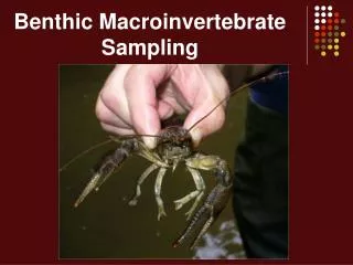
Field Work • Letter of introduction • ‘Rapid Bioassessment Protocol followed during site work. • Benthic macroinvertebrate sample is collected. • In addition, stream width, water appearance, odor, temperature, and flow velocity are recorded. • The site is sketched and a habitat assessment is performed.
Stream Assessment Monitoring System [SAMS] • Developed and written by one of the members of our watershed association. • GIS database management system to record and display the results of the stream monitoring program. • Available in two formats - a read only or a read/write version.
SAMS Features • Display detailed analysis of sampling data for each site. • Calculate the N.J. Impairment Score versus 6 other features. • View site photographs.
SAMS Features (con’t.) • Interactive identification utility of benthic macroinvertebrates which are found in our samples.
SAMS Features (con’t.) • Virtual tours of Stream Monitoring, the Watershed, or Historical Areas
PCWA Web Site • www.pcwa.org • Overview of our organization and goals. • The sights & sounds of the watershed can be viewed. • Also, provides a venue for the transfer of data between the field and SAMS updating.