Download
1 / 60
600 likes | 757 Views
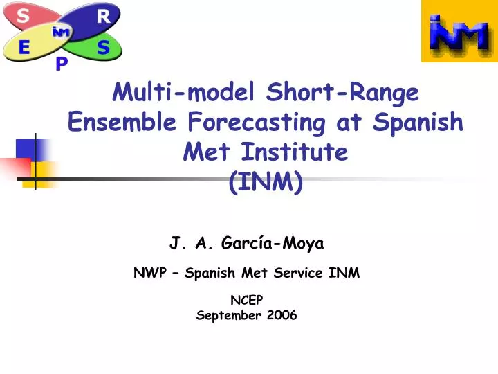
Multi-model Short-Range Ensemble Forecasting at Spanish Met Institute (INM). J. A. García-Moya NWP – Spanish Met Service INM NCEP September 2006. Acknowledgments. Special thanks to Dr. Eugenia Kalnay for her special support at the beginning of this project. Outline. Introduction

E N D
Multi-model Short-Range Ensemble Forecasting at Spanish Met Institute (INM) J. A. García-Moya NWP – Spanish Met Service INM NCEP September 2006
Acknowledgments Special thanks to Dr. Eugenia Kalnay for her special support at the beginning of this project NCEP
Outline • Introduction • EPS for short-range forecast • SREPS system at INM • Verification exercise • Verification against observations • Deterministic scores • Probabilistic scores • Verification against analysis • Deterministic scores • Probabilistic scores • Conclusions NCEP
Introduction • INM is the Spanish Meteorological Institute. • Headquarter is located in Madrid. • About 1500 people working for INM. • It is mostly an operational institute, research is about 10% of resources. NCEP
Meteorological Framework • INM has one CFO (Central Forecast Office) at the HQ, 10 RFO (Regional Forecast Offices) and one AFO (Forecast Office for the Army). • Main Weather Forecast issues are related with Short-Range forecast of extreme events. • Convective precipitation is the most dangerous weather event in Spain. NCEP
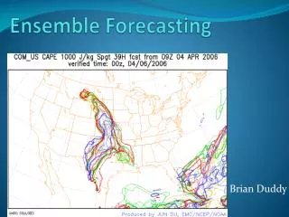
Geographical Framework • Western Mediterranean is a close sea rounded by high mountains. • In autumn sea is warmer than air. • Several cases of more than 200 mm/few hours occurs every year. • Some fast cyclogenesis like “tropical cyclones” also appears from time to time. NCEP
520 mm/24 h NCEP
Numerical Modelling • INM use numerical model Hirlam for operational NWP. • Hirlam (http://hirlam.org) is an European Project (8 countries) to develop operational NWP models. • Short range forecast up to 72 hours every 6 hours (00, 06, 12 and 18 UTC). • Two different horizontal resolutions 0.16 and 0.05 deg. latxlon. 40 vertical levels. NCEP
Hirlam 0.05 - CNN Hirlam 0.16 - ONR Hirlam 0.05 - HNR NCEP
HP Computer Cray X1e • 16 nodes, 8 MSP’s each ( ~2.4 Tf peak perf.) • Deterministic Forecast • SREPS • Climatic runs NCEP
Ensemble for Short Range • Surface parameters are the most important ones for weather forecast. • Forecast of extreme events (convective precip, gales,…) is probabilistic. • Short Range Ensemble prediction can help to forecast these events. • Forecast risk (Palmer, ECMWF Seminar 2002) is the goal for both Medium- and, also, Short-Range Prediction. NCEP
Errors of the short-range forecast • Due to model formulation. • Due to simplifications in parameterisation schemes. • Due to uncertainty in the initial state. • Special for LAMs, due to errors in lateral boundary conditions. • Due to uncertainties in soil fields (soil temperature and soil water content, …). NCEP
SREPS I • Multi-model approach (Hou & Kalnay 2001). • Stochastic physics (Buizza et al. 1999). • Multi-boundaries: • From few global deterministic models. • From global model EPS (ECMWF). • SLAF technique (Hou & Kalnay 2001). NCEP
SREPS II • Different assimilation techniques: • Optimal Interpolation. • Variational (3D or 4D). • Perturbed analysis: • Singular vectors (ECMWF, Palmer et al. 1997). • Breeding (NCEP, Toth & Kalnay 1997). • Scaled Lagged Average Forecast (SLAF, Hou & Kalnay 2001). NCEP
Multi-model • Hirlam (http://hirlam.org). • HRM from DWD (German Weather Service). • MM5 (http://box.mmm.ucar.edu/mm5/). • UM from UKMO (Great Britain Weather Service). • LM (Lokal Model) from COSMO consortium (http://www.cosmo-model.org). NCEP
Multi-Boundaries From different global deterministic models: • ECMWF • UM from UKMO (Great Britain Weather Service) • AVN from NCEP • GME from DWD (German Weather Service) NCEP
SREPS at INM • Mummub: Multi-model Multi-boundaries • 72 hours forecast four times a day (00, 06, 12 y 18 UTC). • Characteristics: • 5 models. • 4 boundary conditions. • 4 latest ensembles (HH, HH-6, HH-12, HH-18). • 20 member ensemble every 6 hours • Time-lagged Super-Ensemble of 80 members every 6 hours. NCEP
Current Ensemble • Mummub: Multi-model Multi-boundaries • 72 hours forecast twice a day (00 & 12 UTC). • Characteristics: • 5 models. • 4 boundary conditions. • 20 member ensemble every 12 hours NCEP
Road Map NCEP
Post-processing • Integration areas 0.25 latxlon, 40 levels • Interpolation to a common area • ~ North Atlantic + Europe • Grid 380x184, 0.25º • Software • Enhanced PC + Linux • ECMWF Metview + Local developments • Outputs • Deterministic • Ensemble probabilistic NCEP
Monitoring in real time • Intranet web server • Deterministic outputs • Models X BCs tables • Maps for each couple (model,BCs) • Ensemble probabilistic outputs • Probability maps: 6h accumulated precipitation, 10m wind speed, 24h 2m temperature trend • Ensemble mean & Spread maps • EPSgrams (work in progress) • Verification: Deterministic & Probabilistic • Against ECMWF analysis • Against observations NCEP
Intranet web server NCEP
Whole Area Zoom over Spain Monit 2: all models X bcs NCEP
Monit 3: Prob 24h 2m T trend How will be tomorrow compared with today? NCEP
Monit 4: Spread – Ensemble mean maps Spread at key mesoscale areas NCEP
>=1mm >=5mm >=10mm >=20mm Probability maps Case Study 06/10/2006 at 00 UTC • More than 15 mm/6 hours NCEP
Verification • We show here the 2006 first half (6months) verification results, against both references observations and ECMWF analysis, which look promising: • Calibration: with synoptic variables Z500, T500, Pmsl • Response to binary events: reliability and resolution of surface variables 10m surface wind, 6h and 24h accumulated precipitation NCEP
Verification exercise • Interpolation to a common area • ~ North Atlantic + North Africa + Europe • Lat-lon Grid 380x184, 0.25º • ~180 days (Jan1 to Jun30 2006). • Two different references: • Analysis: ECMWF (6h and 24h det fc for Acc. Prec.) • Observations: TEMP & SYNOP • Verification software • ~ ECMWF Metview + Local developments • Deterministic scores • Synoptic variables: Bias & RMSE for each member & Ens Mean • Probabilistic ensemble scores • Synoptic variables: Calibration • Surface variables: Response to binary events NCEP
Interpolation NCEP
Obs verification -deterministic scores • Bias & RMSE with forecast length • For: • All members • And ensemble mean • Z500, T500, Msl Pressure NCEP
Z500 Bias & RMSE Bias&RMSE Z500 Implementation error for this member? Despite the error the Ensemble Mean has very good verification! NCEP
T500 Bias & RMSE Bias&RMSE T500 Ensemble Mean is almost the best! NCEP
Msl P Bias & RMSE Bias&RMSE MslP NCEP
Obs verification - Probabilistic scores • Ensemble calibration: • Synoptic variables: • Z500, T500, Pmsl • Scores: • Rank histograms • Spread-skill • Response to binary events: • Surface variables: • 10m surface wind (10,15,20m/s thresholds) • 6h accumulated precipitation (1,5,10,20mm thresholds) • 24h accumulated precipitation (1,5,10,20mm thresholds) • Scores: • Reliability, sharpness (H+24, H+48) • ROC, Relative Value (H+24, H+48) • BSS, ROCA with forecast length NCEP
Z500 Z500 H+48 H+24 Z500 • Z500 under-dispersive • A bit under-forecast NCEP
T500 T500 H+48 H+24 T500 • T500 under-dispersive, but better • Fairly flat rank histograms NCEP
Binary events • Binary events X = {0,1} at every point • Accumulated precipitation in 24 hours >= 5mm • Useful to decompose the forecast in thresholds • Performance computed using contingency tables (CT’s) NCEP
Contingency tables • It is the best way to characterize a binary event fc(X)={1,0} ob(X)={1,0} NCEP
Contingency tables: scores • Several scores can computed from CT’s NCEP
>=10m/s >=15m/s >=20m/s >=10m/s >=15m/s >=20m/s • Quite reliable • Near/over no-skill line, 20 m/s few cases 10m Wind H+24 10m Wind H+48 NCEP
Wind ROC & ROCA • Quite good ROC curves • Decreasing performance with threshold • Same performance with FC length? H+48 H+24 10m Wind ROCA NCEP
6h accumulated precipitation • Binary event thresholds • 1, 5, 10, 20mm / 6h • Reliability & sharpness • Resolution • ROC • ROCA • Brier Skill Score • Economic Value RV NCEP
>=1mm >=5mm >=10mm >=20mm >=1mm >=5mm >=10mm >=20mm 6hAccPrec Rel&Sharp • Quite reliable, apart from 20mm • 1,5,10mm near no-skill line • 20mm under no-skill line, few cases 6hAccPrec H+24 6hAccPrec H+48 NCEP
6hAccPrec ROC & ROCA • Quite good ROC curves • Worse with threshold • Slightly worse with FC length H+48 H+24 6h Acc Prec ROCA NCEP
24h accumulated precipitation • Binary event thresholds • 1, 5, 10, 20mm / 24h • Reliability & sharpness • Resolution • ROC • ROCA • Brier Skill Score • Economic Value RV NCEP
>=1mm >=5mm >=10mm >=20mm >=1mm >=5mm >=10mm >=20mm 24hAccPrec Rel&Sharp • 1mm Poorly reliable, very sharp • 5,10,20mm quite reliable • 1mm far under no-skill line • 5,10,20mm near no-skill line 24h Acc Prec H+30 24h Acc Prec H+54 NCEP
24hAccPrec ROC & ROCA • Good ROC curves • Small degradation with threshold • Flat with FC length? H+54 H+30 24h Acc Prec ROCA NCEP