Download
1 / 41
410 likes | 570 Views
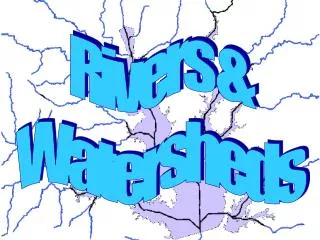
U12B: Watersheds. What are they? Why are they important? Topography What watershed do we live in? How does the river change as it travels toward the mouth?

E N D
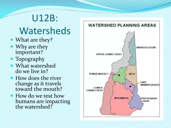
U12B: Watersheds • What are they? • Why are they important? • Topography • What watershed do we live in? • How does the river change as it travels toward the mouth? • How do we test how humans are impacting the watershed?
Watershed The land area from which water (runoff and groundwater), sediment and dissolved materials drain into a common body of water.. We can study sustainability of an ecosystem by testing the watershed http://www.uvm.edu/~inquiryb/webquest/sp09/tghttp://www.uvm.edu/~inquiryb/webquest/sp09/tgasperiasperi
Divide - The point where two watersheds connect, ridge separating two watersheds (mountain range) .Ridge - A line of higher elevationGroundwater - locate it on the map http://www.fairfaxcounty.gov/dpwes/watersheds/whahttp://www.fairfaxcounty.gov/dpwes/watersheds/whatistis
Stream- A body of water with a detectable current, confined within a bed and banks. http://www.garrettcasey.com/pictures/09012003/StreamRock.html
http://tomclarkblog.blogspot.com/2009/06/trout-kill-on-sacramento-river.htmlhttp://tomclarkblog.blogspot.com/2009/06/trout-kill-on-sacramento-river.html http://tomclarkblog.blogspot.com/2009/06/trout-kill-on-sacramento-river.html Headwaters- The place where a river begins (usually a spring). The original point from which the river flows. http://tomclarkblog.blogspot.com/2009/06/trouthttp://tomclarkblog.blogspot.com/2009/06/trout-kill-on-kill-on
River Mouth- The place where a river ends, emptying into the ocean. http://picasaweb.google.com/lh/photo/wUA_hpHhttp://picasaweb.google.com/lh/photo/wUA_hpHZFNte5gWNy2qzMQZFNte5gWNy2qzMQ
Glacier EvidenceGlacial Till- Unsorted soil composed of silky gravely sand and clay with cobbles and boulders mixed in (think oatmeal raisin cookie). http://pbisotopes.ess.sunysb.edu/reports/dem_2/till-draping.htm
Topography- The study of Earths land forms http://www.photius.com/countries/hungary/geographttp://www.photius.com/countries/hungary/geographyhy
Elevation- The height of the land above some point • http://www.yellowmaps.com/map/united-stateselevatihttp://www.yellowmaps.com/map/united-states-elevationon
Contour Line- A line on a map that connects points of equal elevation http://explore.ecb.org/videos/VLC_media?P1=VLC177&REFEREhttp://explore.ecb.org/videos/VLC_media?P1=VLC177&REFERER=OTHERR=OTHER
Contour interval- The distance in elevation between two contour lines http://academic.brookhttp://academic.brooklyn.cuny.edu/geology/levesonlyn.cuny.edu/geology/leveson
Slope- The steepness of the land http://www.therockerbox.com/how_to_use_a_map_5.htm http://geology.isu.edu/geostac/Field_Exercise/wildfirehttp
Aquifer- A large underground reservoir of water that can give significant water supplies to wells. http://water.usgs.gov/ogw/gwrp/saltwater/fig5.html
New Hampshire, 100,000 years ago • Glacier - Over 100,00 years ago covered most of North America – 1 mile thick. • Smoothed Mountains – The glacier moved and shaped the mtns • Receding - or melting started 30,000 years ago as weather changes occurred. • Lake Merrimack - the “melt” ended approximately 8,000 years ago. This lake extended from Manchester to Plymouth. • Rivers - The lake dried up over the next few thousand years leaving the rivers we see today. .
Merrimack Watershed • OBSERVE the stream then river as we travel from NH to the Atlantic Ocean in MA
Low order stream – closer to headwaters http://photography.nationalgeographic.com/photography/photo-of-the-day/mountain-stream-white-mountains.html
What are of the headwaters found in NH? • In the northern mountains Describe the speed of the stream at the headwaters? • The headwaters have the fastest speeds
http://gonewengland.about.com/library/users/ucsquamriverfoliage.htmhttp://gonewengland.about.com/library/users/ucsquamriverfoliage.htm
Higher order stream – closer to mouth http://www.chantryisland.com/remember.jpeg
The mouth of the Merrimack in Newburyport, MA which is bordered by Salisbury Beach to the north and Plum Island to the south, is considered one of the most dangerous inlets on the East Coast, if not the country
What do you notice about the Merrimack as it travels from the headwaters to the mouth? • Speed Faster headwaters, slower mouth • Shading More shade (cooler) vs. More open (warmer) • Turbulence More turbulence (mixing) vs. Less turbulence (mixing) • Dissolved Oxygen (DO) More DO vs Less DO
“The Merrimack River is the 2nd largest provider of drinking water in New England. It serves drinking water to 300,000 people including the city of Nashua and surrounding towns as well as to downstream communities in Massachusetts, including the cities of Methuen, Lowell and Lawrence” NH Dept of Environmental Services Everything from car parts to a dishwasher, all pulled from the river in 2009
How are humans impacting the Merrimack Watershed? How do we do that? Need to perform tests on the water!!! • Either by testing for diversity of macroinvertebrates • or by performing experiments using physical, biological and chemical tests
STREAM ORDERDoes the Merrimack River differ in size during it’s path to the Atlantic?
Stream Orders • Ecologists classify flowing water by a system called “stream orders” • The stream order system starts with first order streams • When 2 first order streams join, they form a second order stream • When 2 second order streams join, they form a third order stream and so on • The area of land drained by a stream system is called its watershed!
Low Order Stream (headwaters) • Low order • Fast speed (2.2m/s) • Headwaters (mountains) • Cold • Cobble/ stone bottom • Higher dissolved oxygen (DO) 11ppm • Higher total solids • Abundant turbulence
Low Order Stream continued • Narrow/shaded • Shallow • No plants • Trout • Macroinvertebrates: stoneflies, caddisflies, mayflies, nonswimmers • Food chain starts with washed in plant material
High Order Stream (mouth) • High order (5+) • Slow speed (0.6 m/s) • Lowlands, plains • Warm temperatures • Sand/mud/silt on bottom • Lower DO (5 ppm) • Lower total solids • Little turbulence
High Order Stream continued • Wide, open, not shaded • Deep • Submerged and emergent plants and phytoplankton • Bass and sunfish • Macros: caddisflies, worms, midges; burrowers and swimmers • Producers start food chain