Download
1 / 37
370 likes | 488 Views
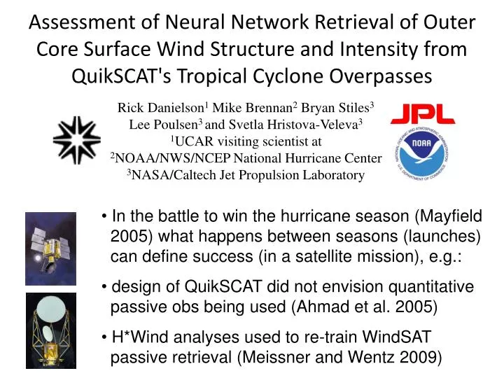
Assessment of Neural Network Retrieval of Outer Core Surface Wind Structure and Intensity from QuikSCAT's Tropical Cyclone Overpasses. Rick Danielson 1 Mike Brennan 2 Bryan Stiles 3 Lee Poulsen 3 and Svetla Hristova-Veleva 3 1 UCAR visiting scientist at

E N D
Assessment of Neural Network Retrieval of Outer Core Surface Wind Structure and Intensity from QuikSCAT's Tropical Cyclone Overpasses Rick Danielson1 Mike Brennan2 Bryan Stiles3 Lee Poulsen3 and Svetla Hristova-Veleva3 1UCAR visiting scientist at 2NOAA/NWS/NCEP National Hurricane Center 3NASA/Caltech Jet Propulsion Laboratory • In the battle to win the hurricane season (Mayfield • 2005) what happens between seasons (launches) can define success (in a satellite mission), e.g.: • design of QuikSCAT did not envision quantitative • passive obs being used (Ahmad et al. 2005) • H*Wind analyses used to re-train WindSAT • passive retrieval (Meissner and Wentz 2009)
Scatterometer Platforms SMAP: 2014 1.3 GHz (L) (only Gulf of Mexico?)
Isaac at 2300 UTC Aug 27 Retrieval Training • Operational QuikSCAT winds • required an active-sensing • backscatter-wind relationship: • “JPL-V1” (“V2” too strong) • Meissner and Wentz (2009) • re-trained passive-sensing • WindSAT on H*Wind; was • impetus for an update to V2: • “Ku-2011” (used in JPL-V3) • Neural network passes V3 • winds, except in rain where • only speed is modified (assuming rain attenuation and/or • backscatter is not completely dominant) • Ueno and Bessho (2011) • examined wind asymmetry using • only QuikSCAT’s active sensing • (Ku-2011 rain response?) 45 kt (NHC ~60kt)
NRCS scatterplots for 20,30, and 40 m/s H*WIND(QuikSCAT/H*WIND matched within 2 hours, Clear conditions) • In rainfree conditions (rain impact quantity <= 2.5), QuikSCAT HH pol 46 degree incidence NRCS values are sensitive to wind speed and direction in the 20-40 m/s range. • QuikSCAT VV 54 degree incidence values have less sensitivity. (Blue, Green, Red) = (20,30,40) m/s + or -10% H*WIND HH pol, 46° Inc. VV pol, 54° Inc.
NRCS scatterplots for 20,30, and 40 m/s H*WIND(QuikSCAT/H*WIND matched within 2 hours, Rainy conditions) • In rainy conditions (rain impact quantity > 2.5), the wind sensitivity of both polarizations are reduced especially for VV pol, but still apparent at least for moderate rain. (Blue, Green, Red) = (20,30,40) m/s +or -10% H*WIND HH pol, 46° Inc. VV pol, 54° Inc.
CTD QRAD rain rate Rain Impact MLE speed Backscatter values QuikSCAT MLE speed QRAD rain rate Neural Network Structure Speed Net 2 FINAL OUTPUT SPEED Version 3 speed CTD Rain Corrected Speed Network 1 Trained on AMSR/SeaWinds Hurricane Speed Net 1 Trained on 72 QuikSCAT/H*WIND scenes from 2005
Rainfree NRCS vs Wind Speed QuikSCAT (co-pol) 50-60 m/s sensitivity limit (Fernandez et al. 2006) OSCAT (co-pol; by histogram matching) Cross-pol sensitivity limit? (Vachon and Wolfe 2011)
Global Comparisons • comparing 21600 cyclone overpasses of Oct 1999 – Nov 2009 • (see http://tropicalcyclone.jpl.nasa.gov) to IBTrACS yields: • 6903 NHC-JTWC scenes (or 5952 WMO scenes) with neural • net coverage of the center and 73 neural net training scenes
QuikSCAT vs H*Wind (Atlantic) • collocations between 50 and 500 km • NNet bin averages are closer together, but suggest positive bias • JPL-V2,V3 weaker winds, bin averages farther apart, and negatively biased
QuikSCAT vs SFMR and GPS drops • NNet has slight positive bias at < 40m/s (H*Wind also positively biased) • DiNapoli et al. (JAOT 2012) suggest poor rain flagged QuikSCAT winds • in H*Wind analyses, but maybe V2 (over-)retrievals are an issue too(?)
QuikSCAT–NHC Best Track 34-kt Radii (km) Max. Wind (m/s) 50-kt Radii (km) 64-kt Radii (km) Green denotes superior QuikSCAT retrieval
34-kt Radii (km) Difference (H*Wind/QScat – NHC) Aug 24 2006 NHC 125 kt
TC motion > Shear Shear > TC motion Ueno and Kunii (JMSJ 2008)
QuikSCAT–NHC Best Track Asymmetry of a scene is sum over all valid 34/50/64-kt radii of Quad radius – Quad Avg Quad Avg
Summary • QuikSCAT neural net active+passive+geometric • wind retrieval seems to mitigate rain impacts in TC • outer core. By comparison with H*Wind, SFMR, GPS • drops, IBTrACs • a) neural net seems to have a slight high bias, but • b) rain contamination is reduced at low winds • c) more extreme wind speeds can be retrieved • Small TCs, more common in the East Pacific, are • expected to be difficult to resolve (by most satellites) • Outer core asymmetry (from 34/50/64-kt radii) is • slightly greater than that of operational best estimates • and H*Wind analyses, but is its shear and precipitation • dependence really synonymous (Ueno and Bessho 2011)? • Acknowledgements : UCAR, NOAA, and NASA’s Ocean Vector Winds program
OSCAT Neural Net Experiment • OceanSAT-2 flyover of Cyclone Thane, Dec 28, 2011 • Radar backscatter produced by ISRO using updated calibration • Winds retrieved by NASA JPL at 12.5 km resolution, making use of improved calibration of high resolution “slice” backscatter measurements • OceanSAT-2 flyover of Hurricane Irene, Aug 27, 2011 • Radar backscatter produced by ISRO using initial calibration • Winds retrieved by NASA JPL at 25 km resolution
OSCAT Neural Net Experiment • OceanSAT-2 flyover of Cyclone Thane, Dec 28, 2011. • Updated Calibration • 12.5 km resolution • OceanSAT-2 flyover of Hurricane Irene, Aug 27, 2011. • Updated Calibration • 12.5 km resolution • Neural Network wind speeds retrieved using histogram matching of brightness temperature and NRCS inputs
References • Ahmad, K. A., W. L. Jones, T. Kasparis, S. W. Vergara, I. S. Adams, and J. D. Park (2005), Oceanic rain rate estimates from the QuikSCAT Radiometer: A Global Precipitation Mission pathfinder, J. Geophys. Res., 110, D11101, 26 pages, 2005. • Chan, Kelvin T. F., Johnny C. L. Chan, “Size and Strength of Tropical Cyclones as Inferred from QuikSCAT Data”. Monthly. Weather. Review., 140, 811–824. 2012. • Chavas, D. R. and K. A. Emanuel, “A QuikSCAT climatology of tropical cyclone size,”Geophysical Research Letters, VOL. 37, L18816, doi:10.1029/2010GL044558, 2010. • Donelan M. A., Haus B. K., Reul N., Plant W. J., Stiassnie M., Graber H. C., Brown O. B., Saltzman E.S (2004). “On the limiting aerodynamic roughness of the ocean in very strong winds”. Geophysical Research Letters, 31(18), -. Publisher's official version: http://dx.doi.org/10.1029/2004GL019460, Open Access version : http://archimer.ifremer.fr/doc/00000/10873/ • Fernandez, D. Esteban; Carswell, J. R.; Frasier, S.; Chang, P. S.; Black, P. G.; Marks, F. D. “Dual-polarized C- and Ku-band ocean backscatter response to hurricane-force winds,” J. Geophys. Res., Vol. 111, No. C8, 2006. • Congling Nie; David G. Long; , "A C-Band Wind/Rain Backscatter Model," Geoscience and Remote Sensing, IEEE Transactions on , vol.45, no.3, pp.621-631, March 2007, doi: 10.1109/TGRS.2006.888457 • Stiles, B.W.; Dunbar, R.S.; , "A Neural Network Technique for Improving the Accuracy of Scatterometer Winds in Rainy Conditions," Geoscience and Remote Sensing, IEEE Transactions on , vol.48, no.8, pp.3114-3122, Aug. 2010 • Stiles, B. W., and Yueh, S. H., “Impact of rain on Spaceborne Ku-Band Wind Scatterometer Data,” IEEE Transactions on Geoscience and Remote Sensing, Vol 40, No 9, pp 1973-1983, 2002. • Uhlhorn, E. W., and P. G. Black, J. L. Franklin, M. Goodberlet, J. Carswell, and A. S. Goldstein, 2007: “Hurricane surface wind measurements from an operational Stepped Frequency Microwave Radiometer”. Mon. Wea. Rev., 135, 1370–1385.
Neural Network Configuration • Proof of concept: • where Ku attenuation • is incomplete, a neural • network can distinguish • rain and wind info locally • using only multiple views • Stiles, Hristova-Veleva, • et al. (2010) simulated • two-way path-integrated • extinction & backscatter • from WRF hydrometeors QuikSCAT wind speed Rita Sept 21 2005
Wind Speed Neural Network • Training: • Validation: 72 H*Wind Analyses (from 2005) by HRD (<10h shift) 1329 Atlantic overpasses with 38 (non-2005) H*Wind analyses by UNC Rain / No Rain Nets • single layer networks with • up to 50 nodes and • O[1000] weights Rain Impact Net Multiple Speed Nets • 10 QuikSCAT inputs: • active JPL-V3 wind retrieval • passive noise channel rain rate (Ahmad et al. 2005) • active backscatter: 2 looks (fore and aft), 2 polarizations • (H and V), and 2 scales (12.5 km and 87.5 km)
Wind Speed Neural Network Rain / No Rain Nets • single layer networks with • up to 50 nodes and • O[1000] weights Rain Impact Net Multiple Speed Nets • 10 QuikSCAT inputs: • active JPL-V3 wind retrieval • passive noise channel rain rate (Ahmad et al. 2005) • active backscatter: 2 looks (fore and aft), 2 polarizations • (H and V), and 2 scales (12.5 km and 87.5 km)
Recommended Use of AMSU Radii (NHC study by Montalvo and Landsea) • Given the skill (substantial improvement over stratified climatology) in the AMSU size estimates and the frequent lack of other tools, its use is recommended in the absence of aircraft reconnaissance • Considerations in its use: • 34 kt radii too small, 64 kt too large – can adjust by ~20% • AMSU is too round – make right front quad larger by ~20%, make left rear quad smaller by ~20% • AMSU method does not have enough sensitivity – smallest TCs aren’t small enough, largest TCs aren’t big enough • Can weight the AMSU 34 kt and 50 kt radii more for hurricanes than tropical storms • Can weight the AMSU 64 kt radii more for major hurricanes than Category 1 and 2 hurricanes
Synopsis of Technique • Using a simple neural network (e.g. Stiles and Dunbar, 2010), we fit a nonlinear mapping • From 9 scatterometermeasurements and one geometry indicator • To wind speed. • Inputs are: • 8 sets of backscatter values • 2 different azimuths, • 2 different polarizations, • 2 different spatial scales (12.5 and 87.5 km) • a rain rate from the scatterometer noise channel [Ahmad et al, 2005]. • cross track distance as a proxy for viewing geometry • Information from latest of version (3) of QuikSCAT global wind retrieval product • Speed corrected for rain • Maximum likelihood speed (no correction for rain) • Rain Impact quantity • Ground truth speeds are from H*WIND data from 2005 Atlantic hurricanes. • Structure employs a set of sub-networks to simplify the mappings needed. • Attempt to correct wind direction in rain is left for future work. • Nominal direction retrievals from JPL QuikSCAT L2B products are maintained. National Hurricane Center Visitor Seminar