Download
1 / 19
190 likes | 215 Views
Dive into the world of digital terrain models and elevation data with technologies like LiDAR and SRTM, vital for mapping, surveying, and environmental studies. Uncover insights for infrastructure planning, ecology, and disaster management.

E N D
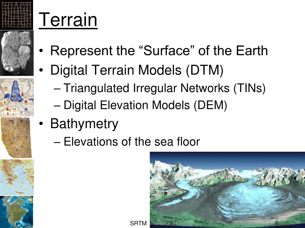
Terrain • Represent the “Surface” of the Earth • Digital Terrain Models (DTM) • Triangulated Irregular Networks (TINs) • Digital Elevation Models (DEM) • Bathymetry • Elevations of the sea floor SRTM
Applications • Roads, utilities, canals, housing… • Ecology/Ecosystem Studies • Flood Control • Agriculture • Soil Erosion http://www.datapointed.net/2009/11/the-steeps-of-san-francisco/
Data Collection • Surveys • Shuttle Rader Telemetry Mission (SRTM) • Elevations for the entire world at 30 meters • Light Detection and Ranging (LiDAR) • Much higher resolution
Tools • Color ramps: Visualization • Hill shades: Backgrounds • “3D” display: Visualization • Histogram: How much surface at each elevation range? • Contours: Topographic maps • Classification: Appropriate uses • Slope: How steep? • Aspect: Toward the sun? • Resample: Reduce artifacts • Stream paths • View sheds
Surveying • Differential GPS with Laser measuring • Can be < 1 cm • GSP • 10 to 30 meters
GTOPO 30 arc seconds ~ 1 kilometer NASA
SRTM • Shuttle Radar Telemetry Mission • 80% of the Earth’s surface • Vertical Accuracy < 20 meters • Horizontal Accuracy < 20 meters • Spatial Resolution ~ 30 meters • http://www2.jpl.nasa.gov/srtm/dataprod.htm#Gallery http://www2.jpl.nasa.gov/srtm/statistics.html
SRTM NASA
GTOPO To SRTM NASA
ETOPO – Global Relief 1 arc-minute ~ 2 kilimeters
LiDAR • Light Distance and Ranging redcrosspdx.blogspot.com
LiDAR • Lower Newton Creek