Download
1 / 7
70 likes | 171 Views
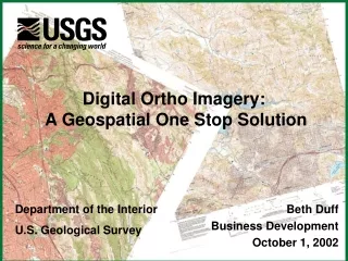
The National Map in support of Geospatial One Stop. Cooperative Topographic Mapping Program. Department of the Interior U.S. Geological Survey. One Stop Solutions - Elevation. Module One – Standards Build on existing work, construct, not re-invent NDEP Elevation Guidelines

E N D
The National Mapin support ofGeospatial One Stop Cooperative Topographic Mapping Program Department of the Interior U.S. Geological Survey
One Stop Solutions - Elevation • Module One – Standards • Build on existing work, construct, not re-invent • NDEP Elevation Guidelines • ISO 19123, Coverage Geometry • FGDC National Standard for Spatial Data Accuracy • FGDC Content Standard for Geospatial Metadata • Modules Two and Three- Inventory • NDEP Data Call • NDEP Program Call • Delivery to the Clearinghouse
NDEP Membership • Bureau of Land Management • Natural Resources Conservation Service • U.S. Forest Service • U.S. Geological Survey • National Oceanic and Atmospheric Administration • National Imagery and Mapping Agency • U.S. Army Corp of Engineers • Federal Emergency Management Agency • National Aeronautics & Space Administration • National States Geographic Information Council • U.S. Census Bureau
One Stop Solutions - Elevation • Module Four- Interoperable Web Based Clearinghouse Services: • Partnership-based program designed to build integrated Federal, State and Local services (utilizing organizationally and physically distributed linked servers) • Open interoperable interfaces being pursued, prototyped and implemented
One Stop Solutions - Elevation • Module Five- Deployment of Commercial Grade Portal Services • This is where the data are made available in web based access • USGS Seamless Data Server / National Elevation Dataset