Download
1 / 10
120 likes | 276 Views
Geographic Information Systems (GIS). Nick Hankerson Danielle Witt Amy Yardley April 18, 2007. What is GIS?. A system for capturing, storing, analyzing and managing data and associated attributes which are spatially referenced to the earth. (wikipedia.com) Spatial Data. Why use GIS?.

E N D
Geographic Information Systems (GIS) Nick Hankerson Danielle Witt Amy Yardley April 18, 2007
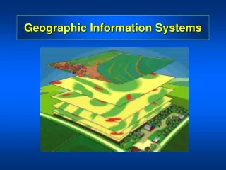
What is GIS? • A system for capturing, storing, analyzing and managing data and associated attributes which are spatially referenced to the earth. (wikipedia.com) • Spatial Data
Why use GIS? • Businesses can use GIS for demographic reasons such as • Locating likely customer populations. • Where to establish new branches, sales divisions and storage facilities. • Governments use GIS for • Planning and organizing geographic data • Keep track of public works and roads • Computing the locational consequences of actions.
GIS software • ESRI - ARCGIS • Clark Labs - IDRISI • GEO-3D Inc.
Who uses GIS? • Pepsi and Coke • Weyerhaeuser • Mortgage companies • Real estate agencies • Health Care providers
The Technology Behind GIS • 2D images • Vector – GIS application that uses points to store and plot lines and polygons for infinite precision of geographic areas. • Raster – GIS application that uses pixels to store andplot geographic areas.
Vector • Measures type, length and time of geographic region • Used most often in transportation, utility and marketing applications. Disadvantages: Advantages: • Complex data structure • Difficult to compute • Cannot store image data • Less efficiently stored • Compact data structure • Low storage cost • Best for map output • Can overlay displays easily
Raster • Transfers a spatial area into pixels and gives them a value • Resolution of images depends upon pixel size • Measures land Advantages: Disadvantages: • Easy to create • Efficient storage of dense data • Easy to compute with. • Great for image data. • Must pre-define spatial resolution • Requires large storage space • Can be inefficient • Harder to overlay • Poor with linear features
Some Examples • Most GIS systemssupport both vector and raster systems but not simultaneously. • Market leaders • ArcGIS • IDRISI • 3D Intergraph
Sources • http://rwsmaps.griffel.se/Guadeloupe3D(RasterMap).jpg • http://www.esri.com/index.html • http://www.forestpal.com/fgis.html • http://www.gisjobs.com/resources.html • http://www.knowledgebank.irri.org/sam/SAM/images/SAM2_a12/Raster%20map.jpg • http://www.vcrlter.virginia.edu/~jhp7e/advgis/local/lectures/rastervsvector05.pdf?meid=51 • www.GIS.com • www.Idrisi.ca/ • www.wikipedia.com