Download
1 / 34
360 likes | 544 Views
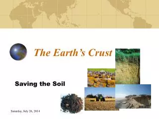
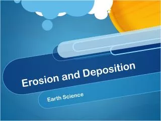
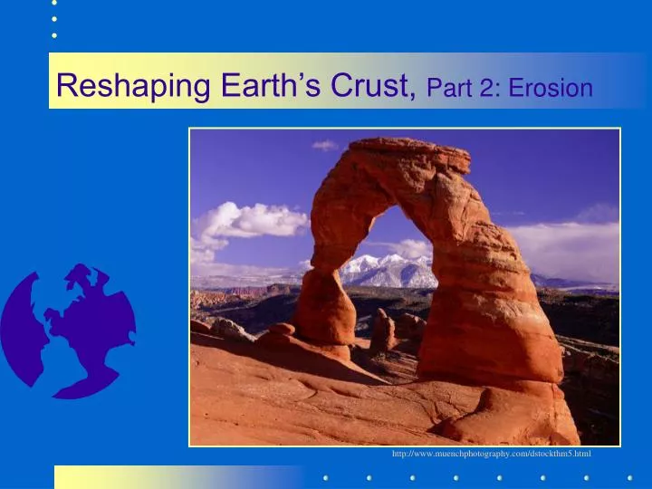
Reshaping Earth’s Crust, Part 2: Erosion. http://www.muenchphotography.com/dstockthm5.html. Erosion . Is the removal of rock, soil or sediment by moving water , wind , ice or gravity 3 basic components: the picking up of rock material ( erosion )

E N D
Reshaping Earth’s Crust, Part 2: Erosion http://www.muenchphotography.com/dstockthm5.html
Erosion • Is the removal of rock, soil or sediment by moving water, wind, ice or gravity • 3 basic components: • the picking up of rock material (erosion) • the actual movement (transportation) • the ultimate “laying to rest” (deposition) EARTHSCIENCE@Phuhs.schrock
Geologic agents: rivers groundwater ocean waves and currents glaciers wind gravity (oh...man, too!) the LANDFORMS we see are shaped by the erosional and depositional work of one or more of these agents Erosion, cont. EARTHSCIENCE@Phuhs.schrock
Rivers...most dominate agent http://www.geo.cornell.edu/geology/classes/Geo101/101images.html EARTHSCIENCE@Phuhs.schrock
Rivers • Rivers erode because • have the ability to pick up rock fragments • and transport them to a new location • Size of the fragments transported depends on velocity of the stream http://www.edu-source.com/GCpages/CVOpage4.html EARTHSCIENCE@Phuhs.schrock
Sediment Load • They carry sediments in 3 ways • Solution (dissolved load) • Suspension (carried within the water) • Bed load (pushed along the bottom) • As velocity decreases, the water is unable to carry as much sediment, so deposition occurs EARTHSCIENCE@Phuhs.schrock
What are meanders? • A sharp bend, loop or turn in a stream's course EARTHSCIENCE@Phuhs.schrock
How do oxbow lakes form? • A meander becomes so curved that is cuts across the narrow neck of land, making a separate “meander” or lake http://www.tulane.edu/~sanelson/geol111/streams.htm EARTHSCIENCE@Phuhs.schrock
Young River • V-shaped valley with steep sides • Waterfalls • rapids http://www.serve.com/wizjd/parks/yellowstone/yellowstone.html EARTHSCIENCE@Phuhs.schrock
Old River • Broad, shallow plain (flood plain) • Many meanders and oxbow lakes • Delta at the mouth (where it flows into ocean) • This is the lower Mississippi http://earth.jsc.nasa.gov/photoinfo.cgi?PHOTO=STS062-086-107 EARTHSCIENCE@Phuhs.schrock
Delta: fan shaped deposit of sediments at the mouth of a river http://epod.usra.edu/archive/epodviewer.php3?oid=54592 EARTHSCIENCE@Phuhs.schrock
Ground Water • Ground water • water stored beneath earth’s surface in openings in soil and rock • Aquifer • body of rock that can store much water (porosity) • and from which water flows freely (permeability) EARTHSCIENCE@Phuhs.schrock
Porosity • The amount of open spaces in a rock or sediment http://agcwww.bio.ns.ca/schools/EarthNet/english/glossary/p/porosity.html EARTHSCIENCE@Phuhs.schrock
Permeability • The ease with which water flows through open spaces in a rock or sediment • dependent upon how well the pore spaces are connected http://agcwww.bio.ns.ca/schools/EarthNet/english/glossary/p/permeability.html EARTHSCIENCE@Phuhs.schrock
Regions of Ground Water Zone of Aeration is the zone below the surface in which openings in soil and rock contain air and some moisture Water Table is the boundary between these two zones Zone of Saturation is below the zone of aeration where all the pore spaces are completely filled with water. EARTHSCIENCE@Phuhs.schrock
Ground Water Erosion • As ground water (weak carbonic acid) passes through permeable rock (especially limestone), • Chemical weathering takes place • Limestone is dissolved, forming large cavities underground • Features • Caves or caverns • Stalagmites , Stalactites • Sink holes http://www.luraycaverns.com/ EARTHSCIENCE@Phuhs.schrock
Sinkhole • Circular depression formed when the roof of a cavern collapses • This one occurred in Winter Park, FL http://www.dc.peachnet.edu/~janderso/physical/grdh2o.htm EARTHSCIENCE@Phuhs.schrock
Sink Hole (with Porches in it) EARTHSCIENCE@Phuhs.schrock
Karst Topography • Land where the effects of chemical weathering due to ground water are clearly visible (sinkholes & caverns) • Common in Florida EARTHSCIENCE@Phuhs.schrock
Karst Topography http://geollab.jmu.edu/vageol/outreach/fieldtrips/rockingham/caves.html EARTHSCIENCE@Phuhs.schrock
Karst Topography Satellite photo of karst topography in Florida. (NASA) EARTHSCIENCE@Phuhs.schrock
Glaciers • Continental glaciers (ice sheets) • 96% of all glaciers • Found in Antarctica and Greenland • Covered most of Canada and northern USA during the last ice age (up until about 18,000 years ago) • Mountain or Valley glaciers • Found in the valleys of some mountains • Rivers of ice EARTHSCIENCE@Phuhs.schrock
Mountain glaciers in Alaska viewed from the space shuttle, 300 km above surface Future U-shape valleys Mountain Glaciers http://earth.jsc.nasa.gov/photoinfo.cgi?PHOTO=STS028-097-085
Mountain Glacier: Rivers of Ice http://www.usd.edu/esci/figures/GeologyToday.html EARTHSCIENCE@Phuhs.schrock
River Valley to Glacial Valley Visit this site http://www.nps.gov/olym/uv.htm EARTHSCIENCE@Phuhs.schrock
V-shaped to U-shaped Valleys Glaciers scour river valleys down when they move to give the valley a U-shaped profile http://darkwing.uoregon.edu/~millerm/Ushapes.html EARTHSCIENCE@Phuhs.schrock
Glacial Deposits • Moraines • large accumulations of rock debris piled up by glaciers • Cape Cod is a moraine http://www.geo.duke.edu/geo41/gla.htm http://tvl1.geo.uc.edu/ice/Image/misc/exitdouble.html EARTHSCIENCE@Phuhs.schrock
Gravity • Mass wastingis the downslope movement of rock and soil, under the influence ofgravity. Also called “mass movement.” • Examples: • Rock falls • Landslides • Creep http://www.geog.ouc.bc.ca/physgeog/contents/11h.html EARTHSCIENCE@Phuhs.schrock
Wind • Soil erosion • One of the best examples in history of severe wind erosion is the Dust Bowl of the 1930s • Sand dunes http://www.geo.lsa.umich.edu/~crlb/COURSES/117/Lec28/lec28.html EARTHSCIENCE@Phuhs.schrock
Man as an Agent of Erosion Erosion Copper Mine in Arizona http://www.mc.maricopa.edu/academic/phy_sci/Geology/copper/ EARTHSCIENCE@Phuhs.schrock
Man as an Agent of Erosion Glen Canyon Dam EARTHSCIENCE@Phuhs.schrock
Retard reforestation strip farming terracing Rates of Soil Erosion • Accelerate • deforestation • overgrazing • plowing EARTHSCIENCE@Phuhs.schrock
Alluvial Fan To the left is the Panamint Mountain Range. To the right is Death Valley http://www.geog.ouc.bc.ca/physgeog/contents/11g.html EARTHSCIENCE@Phuhs.schrock