Download
1 / 9
100 likes | 211 Views
Map Projections. projection – in mapmaking, a way of drawing the round earth on a flat surface. Title page 8 “Map Projections.” Write the term projection and the definition (see the glossary). Map Projections. projection – in mapmaking, a way of drawing the round earth on a flat surface.

E N D
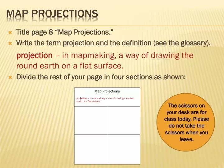
Map Projections projection – in mapmaking, a way of drawing the round earth on a flat surface. Title page 8 “Map Projections.” Write the term projection and the definition (see the glossary). Map Projections projection – in mapmaking, a way of drawing the round earth on a flat surface. • Divide the rest of your page in four sections as shown: The scissors on your desk are for class today. Please do not take the scissors when you leave.
Turn to textbook page 7 • Label each quarter of your page: • Goode’s Interrupted Equal-Area • Robinson • Winkel-Tripel • Mercator Map Projections
Goode’s Interrupted Equal-Area Map Projections Shows continents close to true shape and size. Helpful to compare land areas.
Map Projections Robinson Land in W and E nearest the equator is most accurate. Distorted near N and S poles.
Map Projections Winkel-Tripel Not as distorted near poles as the Robinson projection. Used by the National Geographic Society.
Map Projections Mercator Shows direction and land shape accurately, but not size and distance. Areas near poles are distorted. Areas near equator are more accurate.
Cut out the map projections and glue them in the correct quarter of your page. Map Projections
Fold paper HOTDOG style. Divide into 8 equal sections Cut along dividing lines. FOLDABLE INSTRUCTIONS
Write the following on your tabs: • Absolute location • Continent • Cultural feature • Elevation • Ocean current • Physical feature • Relief • Sea level • When finished, attach to the back of page 8 VOCABULARY! Inside, for each term: LEFT SIDE: definition RIGHT SIDE: illustration Use the Geographic Dictionary on page 14 – 15 in your textbook.