Download
1 / 20
200 likes | 316 Views
Development of a Gulf of Mexico Coastal Ocean Observing System (GCOOS). Robert (Buzz) Martin State Scientific Support Coordinator Oil Spill Prevention & Response Texas General Land Office. Outline. What is GCOOS?

E N D
Development of a Gulf of Mexico Coastal Ocean Observing System(GCOOS) Robert (Buzz) MartinState Scientific Support CoordinatorOil Spill Prevention & ResponseTexas General Land Office
Outline • What is GCOOS? • What’s been done? - Meetings - Priorities - Existing Capabilities - Resolution • Key next steps.
What is GCOOS? • The nascent “Regional Association” representing the Gulf of Mexico in the yet-to-be formed Federation of Regional Coastal Ocean Observing Systems. • An organization of groups and individuals that share a vision for the future of coastal ocean observations as expressed in the GCOOS Resolution and mission statement.
First Steps Over the past 2-3 years, several meetings have been held to discuss a regional ocean observing system for the Gulf of Mexico In January 2003, agreement among a key group of operators or users of observing system elements in the Gulf was reached to share data and to work toward development of a regional observing system.
Benefit of Meetings • Identified many activities that can serve as the initial building blocks for a regional ocean observing system for the Gulf of Mexico, including: continuing ocean observations, satellite products, modeling efforts, and other products. • Recognized that support for these activities comes from many sources. • Helped participants see that they provide information that could have broader use if integrated and enhanced.
Initial Priority Actions • Complete and circulate for signature a Resolution agreeing to form a Regional System; • Refine the Inventory of existing observing system elements in the Gulf of Mexico (including costs); • Create an organization of users; • Establish data sharing first • Obtain commitments for data sharing • Utilize assistance offered by NVODS, NDBC, and NCDDC; • Identify and publicize products • Create a Gulf of Mexico Portal http://www.gcoos.org • Share, compare, and validate models.
inventory - identify and entrain those responsible into the design process organization of users - mechanism to ensure system remains accountable and responsive to needs identify and publicize products - system will require sustained, broad-based support establish mechanism for data sharing - ensures system can be integrated with other regional coastal observing systems both nationally and internationally resolution - a statement of intent and shared goals sharing, comparing, validating models - move beyond academic exercises Purpose of Initial Priority Actions
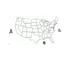
Existing Capabilities: The Inventory
1,000 miles Gulf of Mexico Observing Sites
TWDB USF TAMU Model Products (10+) Examples USF
Resolution(Implementation Section) The Signatories hereby resolve to work together toward: • establishment of a Gulf of Mexico Regional Coastal Ocean Observing System (GCOOS); • development of regional governance structures and coordination; • common data management standards.
Implementation (continued) • and to openly share non-proprietary data and metadata, non-commercial data and products, model code, and related information. • GCOOS will not compete with the private sector because it will not distribute commercial products and services, which are those produced by commercial enterprises. • The Signatories will actively seek collaborations with other nations bordering the Gulf of Mexico in the design and implementation of this regional observing system.
Who can sign the resolution? Signatories to this resolution: 1) are actively engaged in some aspect of coastal ocean observing systems in the Gulf of Mexico or 2) are principal end-users of data, products and services from coastal ocean observing systems in the Gulf of Mexico.
Signatories may include, but are not limited to: • research institutions, • port or harbor authorities, • water management districts, • non-governmental organizations, • local government agencies, • state & federal agencies, • private industry, or • other entities with these characteristics.
Vernon Asper for University of Southern Mississippi Peter R. Betzer for University of South Florida Jim Byous for Gulf Fiber Corporation Jim Cato, Florida Sea Grant George Crozier for Dauphin Island Sea Lab and Mobile Bay National Estuary Program Dean A. Dunn for National Coastal Data Development Center (NCDDC) Norman L. Guinasso for Texas Automated Buoy System (TABS) Gregg Jacobs, NRL Stennis Space Center Gary Jeffress for Texas Coastal Ocean Observing Network (TCOON) Mark Luther for the Coastal Ocean Monitoring and Prediction System and the Tampa Bay Physical Oceanographic Real-Time System Robert (Buzz) Martin for Texas General Land Office Gil McRae, Florida Fish & Wildlife Conservation Commission Douglas J. Meffert for Long-term Estuary Assessment Group (LEAG) Avichal Mehra for DMEFS Patrick Michaud, Texas A&M University - Corpus Christi Paul Moersdorf, NOAA's NDBC Christopher N. K. Mooers, Rosenstiel School of Marine and Atmospheric Science Frank Muller-Karger, University of South Florida Worth D. Nowlin, Jr., Texas A&M University James J. O'Brien, Florida State University John C. Ogden, Florida Institute of Oceanography Shirley Pomponi for Harbor Branch Oceanographic Institution David Prior, Executive Vice-President and Provost for Texas A&M University Nancy N. Rabalais, LUMCON for NGOMEX Hypoxia Studies Mary Jo Richardson, Texas A&M University Mitchell A. Roffer, Roffer's Ocean Fishing Forecasting Service, Inc. (ROFFS) Kerry St. Pe for Louisiana Universities Marine Consorium (LUMCON) Thomas M. Soniat, Nicholls State University, for DermoWatch Robert Stickney, Seagrant,Texas A&M University LaDon Swann, Mississippi-Alabama Sea Grant Consortium, Auburn University John W. (Wes) Tunnell, Jr., (TAMU) for Center for Coastal Studies and Harte Research Institute for Gulf of Mexico Studies Nan Walker, Coastal Studies Institute, Louisiana State University 32 Signatories ...
Key Next Steps • We have begun with meetings between organizers and Sea Grant Marine Advisory Services personnel. First meeting with Texas MAS on 14 October 2003 in Corpus Christi, TX. • On 31 October 2003, NOAA made a 3 year grant to Texas A&M Research Foundation to provide funding to developers of GCOOS to: • develop the user base, • create a governance structure, • develop a business plan, • data and product sharing, and • share, compare, and validate models.
Gulf of MexicoCoastal Ocean Observing System Contact http://www.gcoos.org wnowlin@tamu.edu