Download

1 / 21
210 likes | 342 Views
Grassland Management Unit. Lesson 1 – Soil Interpretation. Grassland Differences. What is different about these two grasslands? What do you think causes these differences?. Where is our 50’ x 50’ square on the map to the right?. Steps:

E N D
Grassland Management Unit Lesson 1 – Soil Interpretation
Grassland Differences • What is different about these two grasslands? • What do you think causes these differences?
Where is our 50’ x 50’ square on the map to the right? • Steps: • 1. Look for physical landmarks around. (tree lines, roads, buildings) • 2. Once you think you are in the correct spot, face north. Does all the landmarks match where you are? • 3. Determine the Soil Map Unit # you are within. Make sure you find the correct number. All the answers from here on out are based on finding this number!
Estimating Slope in Field • Method 1 – Using Clipboard • 1. Locate stakes on side of 50x50 • 2. Stand on downhill stake. • 3. Keep clipboard eye level and view someone on the uphill stake. • 4. If clipboard aligns with their eyes = 0% • If clipboard aligns with their waist = 3 feet / 50 feet = 6% slope • If clipboard aligns with their ankles = 5 feet / 50 feet = 10% slope • Method 2 – Hand Shooting 1. Stand about 50 feet from the 50x50 area, as indicated in the drawing above. 2. Stretch out your arm level. 3. Starting at the high stake, move your arm (keeping it level) toward the low stake. 4. Using people standing at the high stake and low stake, estimate how many feet of drop. 5. Use the calculating on #4 from method 1 to determine your slope estimate. 50 x 50 Stake 1 Stake 2 Stand here
Determine how far down into the soil roots can grow until it hits Fragipan (X) Bedrock / dolomite limestone (R) Weathered Bedrock (CR)
Pick the smallest number in this column, above the bedrock/weathered bedrock layer
Layer 1: 0” – 3” = 3” x .15-.19= .17 = 0.51” Layer 2: 3” – 60” = 57” x .11-.17= ..14 = 7.98” Total AWC 8.49” AWC – Answer C - moderate
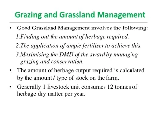
Application • Complete the Soils Interpretation Scorecard for the 2nd 50’ x 50’ area:
C C 6x0.21=1.26 38x0.135=5.13 16x0.15=2.40 8.79 A C C C A C B B