Download
1 / 37
600 likes | 1.4k Views
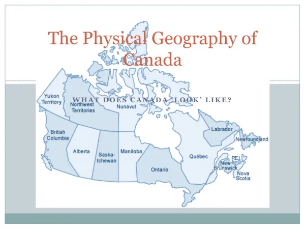
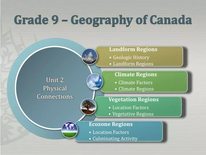
Grade 9 – Geography of Canada. PowerPoint has new layouts that give you more ways to present your words, images and media. . Unit 2 Physical Connections. Unit 2 – Physical Connections 4 Weeks. Landform Regions Geologic History Plate Tectonics Geologic History Geologic History Assignment

E N D
Grade 9 – Geography of Canada PowerPoint has new layouts that give you more ways to present your words, images and media. Unit 2 Physical Connections
Unit 2 – Physical Connections4 Weeks • Landform Regions • Geologic History • Plate Tectonics • Geologic History • Geologic History Assignment • Mineral Categories • Metals, Non-Metals, Fossil Fuels, Building Materials • Physiographic Regions • Highland • Lowlands • Shield • Landform Map • Key Terms • Plate Tectonics • Erosion • Fossils • Geologic Time • Eras • Canadian Shield • Folding • Igneous Rock • Metamorphic Rock • Sedimentary Rock • Ice Age • Glaciers
Plate Tectonics • Plate tectonics is the theory that helps explain the geologic process of both constructive and destructive forces of the earth. • How are mountain made? • What causes Earthquakes and Volcanoes? • How do continents move?
Layers of the Earth’s CrustSiMa and SiAl • Silicone and Magnesium are the two main elements of the ocean floors and the crust that is found under the continents • Silicon and Aluminum are the main elements found in the earth’s continental crust
Convection Currents Convection within Earth's mantle is the driving force for plate tectonics Super-heated, lower density magma rises from the bottom of the mantle toward the crust where is cools enough to then descend back to the lower regions of the mantle where its density increases. It is then reheated and the process starts again
Convection and Plate Boundaries • As a result of convection currents, the earth’s crust undergoes a phenomenal amount of pressure. This pressure is released when the crust develops fissures (rips) and is applied in three forces: • Diverging Force • Converging Force • Horizontal Force
Mid-Oceanic Ridges When convection currents diverge, enough force is created to actually cause a fissure (rip) in the earth crust. These fissures allow the pressurized magma to escape through to the earth surface creating new rock. These new areas of rock are called Mid Oceanic Ridges
Subduction Zones • When convection currents converge, enough force is created to actually force dense oceanic crust (SiMa) under the less dense continental crust (SiAl). Where the ocean plate dives underneath the continent, a deep trench forms at the edge of the continent. Trenches within subduction zones are the deepest depressions of the Earth.
Subduction Zones • Subduction creates three potential life threatening side-effects: • Earthquakes – As oceanic land masses pass under continental land masses • Volcanoes – Causes as melted plumes of oceanic crust melt and rise to the surface through the continental crust • Tsunamis - Caused the underwater earthquakes and shifts in plate positions
Subduction Zones While new rock is created at mid-oceanic ridges, old oceanic rock is recycled through volcanic activity at subduction zones
Canada’s Physiographic Regions • Constructive Geologic Forces • Faults/Folds • Earthquakes • Volcanoes • Destructive Geologic Forces • Weathering-Breaking down of rock • Erosion-Transportation of broken rock
Canada’s Physiographic Regions • Due to our planet’s constructive and destructive geologic forces, not only did the present-day shape of Canada take quite a long time to develop, but it will continue to change until these processes are stopped.
Important Rock Crap • What is a rock? • A group of minerals in a solid state. • What is a mineral? • An inorganic substance that occurs naturally in the earth’s crust • What is an ore? • A rock with enough of a given type of mineral to make it economically profitable to mine it
Types of Rocks • Igneous Rocks • Formed when molten rock cools – The oldest of all rocks – Also known as Precambrian rock. • Examples include granite and basalt
Types of Rock • Sedimentary Rocks • Formed when eroded rocks and organic materials are laid down and compressed under water. - Examples include limestone, sandstone and shale
Types of Rock • Metamorphic Rocks • An igneous or sedimentary rock that has undergone such a great amount of heat and pressure that its composition changes, creating an entirely new type of rock • Examples include sandstone quartz, limestone marble, shale slate
Canada’s Physiographic Regions A vast horseshoe-shaped area around Hudson Bay covering eastern and central Canada, and a small part of the northern United States. Some 1.9 million square miles, very nearly half of Canada's total area, is occupied by the Canadian Shield. Made of solid igneous rock and home to metallic minerals Canadian Shield • Folded series of mountain ranges on Canada’s Pacific coast. Comprised of four distinct sections: • Rocky Mountains • Interior Plateau • Coastal Mountains • Island Mountains Western Cordillera Home to metallic and non-metallic minerals as well as fossil fuels
Canada’s Physiographic Regions Formed under a warm and shallow sea that covered the entire area. Composed of sedimentary rock and home to fossil fuels and non-metals Interior Plains Formed at the end of the last ice age as a result of melting glaciers. Home to most of Canada’s largest cities. Construction materials are found here. Great Lakes & St. Lawrence Lowlands
Canada’s Physiographic Regions Canada’s Atlantic provinces are mostly made from North America’s oldest mountain chain. These heavily worn mountains now house valuable metallic and non-metallic minerals as well as a fair amount of fossil fuels Appalachian Mountains Pretty-much useless except for the availability of vast amounts of hydroelectricity. Hudson Bay Lowlands
Canadian Physiographic Regions These two physiographic regions are pretty much useless…with some exceptions of course! Innuitian Mountains Arctic Lowlands
Unit 2 – Physical Connections • Climate • Climate Factors • LOWER – Near Water • Bill Nye Climate Video • Climate Regions • Types of Precipitation • Climate Graphs • Monograph Assignment • Natural Vegetation Regions • Natural Vegetation Factors • Regions and Types of Vegetation • Planet Earth DVD
Unit 2 – Physical Connections • Ecozones • Culminating Activity • Survivor
Unit 2 – Physical Connections4 Weeks • Landform Regions • Geologic History • Plate Tectonics • Geologic History • Geologic History Assignment • Mineral Categories • Metals, Non-Metals, Fossil Fuels, Building Materials • Physiographic Regions • Highland • Lowlands • Shield • Landform Map
Unit 2 – Physical Connections • Climate • Climate Factors • LOWER – Near Water • Bill Nye Climate Video • Climate Regions • Types of Precipitation • Climate Graphs • Monograph Assignment • Natural Vegetation Regions • Natural Vegetation Factors • Regions and Types of Vegetation • Planet Earth DVD
Unit 2 – Physical Connections • Ecozones • Culminating Activity • Survivor