Download
1 / 48
490 likes | 713 Views
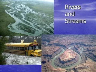
Rivers and Flooding. . . Solar radiation. . Vapour. Precipitation. . Interception by plants. Transpiration. Evaporation. . Drip flow. . . Surface or overland flow. Surface storage. . Storage in plants. Infiltration. Soil throughflow.

E N D
Solar radiation Vapour Precipitation Interception by plants Transpiration Evaporation Drip flow Surface or overland flow Surface storage Storage in plants Infiltration Soil throughflow Soil storage Osmosis (taken into plants through roots) River channel River flow Percolation Ground storage (in rocks) Groundflow (rocks) Inputs Storage Transfers Outputs
LAG TIME PEAK DISCHARGE RECESSION LIMB RISING LIMB STORM FLOW River flow or discharge (m³/sec) BASE FLOW Peak of precipitation event (storm) Discharge is the amount of water in the river Time
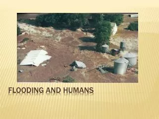
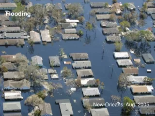
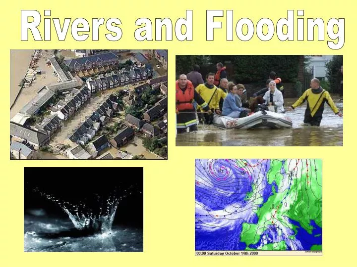
FLOODING IN SE ENGLAND (SUSSEX AND KENT) OCTOBER 2000 River Medway
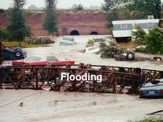
Why?? • A low pressure system was over Britain bringing very heavy rain. • 180mm fell in 72 hours! • Soils became saturated so water ran off the surface reaching the rivers quickly • High tides stopped floodwaters escaping to the sea • Towns have been built on floodplains. Rain moved quickly over impermeable surfaces. There was less interception from vegetation.
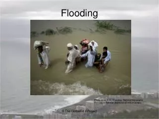
Why does Bangladesh suffer from severe flooding? • Low lying & flat • Poor and over crowded • Thousands of people live on flood plains • 3 rivers meet in the centre of the country • Monsoon rains from May to September • Deforestation in Nepal, India and Northern Bangladesh • Silt washed down from the Himalayas
In 1998 the floods in Bangladesh were the worst ever experienced. They lasted for over 2 months and over half of the country was under water. • 1200 people were killed and millions of families were left homeless. • Water is knee deep for may months and people are forced to live in cramped conditions in the flood waters. • Disease spreads quickly. • People die as they are washed away in the flood waters. • Food production stops as farmers land is flooded.
The formation of Waterfalls • Hard rock lies on top of soft rock. • They erode at different rates (speeds). • The soft rock erodes quickly to leave the hard rock overhanging. • This overhang eventually collapses and the debris falls to the base of the waterfall. • This debris erodes a deep plunge pool at the foot of the waterfall. • The process is repeated and over time the waterfall face retreats backwards.
When a river reaches a meander most of the water is directed to the outside of the bend. Most of the energy is focussed here. The outside of the bend is undercut, collapses and retreats leaving a RIVER CLIFF. EROSION DEPOSITION The water on the inside of the meander the water flows slowly. As the river loses energy I will deposit sediment. This develops a SLIP OFF SLOPE.
As lateral erosion continues the meanders become more exaggerated. This can cause the river to flow too slowly! Erosion on two outside bends can bring them closer together During floods the channel may break through the neck of the bends and straighten its course
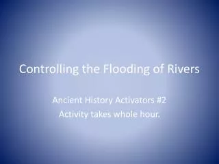
Levees Straighten Channel Dam Flood Protection Methods Lining with Concrete Planting Trees Contour Ploughing
Coasts • The cliff is no longer straight due to the different rates of erosion. • The headlands JUT out to sea • The bays are wide inlets Swanage Bay Swanage bay is a famous example of bays and headlands. Two headlands (Peveril point and Hardfast point) are made from hard chalk and limestone. The softer clay has eroded much more quickly to form swanage bay. At Hardfast point lies Harry and his wife! (stack & stump!)
Longshore Drift (LSD) Hopefully you know this one!
Blakeney Spit A bar is a long stretch of beach material (sand or shingle) that joins together two headlands. A lagoon usually forms behind the bar. An example of a sand bar is Slapton Ley in Devon.
Rapid Erosion at Holderness • Why rapid erosion? • Cliffs are made of clay which is soft and crumbles easily. • The beach is being removed by LSD and moved to Spurn head (spit). • Mappleton is disappearing at one of the fastest rates in Europe. • People are losing their homes and businesses.
Sea wall Revetments Rip Rap Beach rebuilding Groynes Offshore breakwater Gabions Coastal Defences
Earthquakes Plate Tectonics Volcanoes
Plate Tectonics • Remember! • The Earth’s surface is cracked into large pieces called plates. • The plates move in different directions. Earthquakes and volcanoes occur where the plates meet. • These are called plate boundaries. • Constructive • Destructive • Collision • Conservative
Collision Plate Boundary – Two plates move TOWARDS each other and form fold mountains. E.G. Himalayas. Conservative Plate Boundaries – Two plates SLIDE PAST each other either in different directions or at different speeds. E.G. San Andreas Fault in LA.
Constructive Plate Boundary – two plates move AWAY from each other. E.G. Mid Atlantic Ridge. Destructive Plate Boundary – Two plates move TOWARDS each other and one sinks. E.G. Mount Vesuvius in Pompeii
Japan is positioned on the boundary of the Eurasian plate and the Philippines plate. The Kobe Earthquake 1995 At 5.46am on January 17th 1995, whilst many of its citizens were still asleep, the Japanese city of Kobe was hit by largest earthquake in Japan since 1923. It measured 7.2 on the Richter Scale. Kobe lies only 20 KM away from the epicentre. • 20, 000 building collapsed. • 3500 people died. • 250,000 people left homeless. • Cracks in roads. • $50 billion damage. • Trains came off there rails. • Roads and motorways collapsed. • 100 hectares damaged by fires.
What caused Mount Pinatubo to Erupt? (June 1991) • 30Km cloud of ash covering a radius of 600km. • 200,000 buildings collapsed. • 1 million animals died. • 100 people died from lahars • Advanced warnings meant that thousands of people could be evacuated safely. The Philippine plate is sinking beneath the Eurasian plate because the plate is heavier. As it sinks the plate rub together forming friction and heat. As the plates heat up they melt. As the volcano fills up with magma, pressure builds up. When the pressure becomes too much the volcano erupts.
What are the main characteristics of a CBD? What are the characteristics of the inner city?
Old Industrial Glasgow Glasgow has a long history. During the industrial revolution it was the second largest city in the British Empire. It thrived because of ship building along the River Clyde and the coal deposits needed for such industry. However, most of the population lived in very poor standards - Tenement buildings. These had no running water or toilet facilities. Most were disease ridden and rat infested! Unemployment and poverty was widespread at this time.
Redevelopment in Glasgow The Gorbles area in Glasgow was cleared of its slums and redeveloped. This is called Comprehensive Redevelopment. Everybody was moved out of the tenements and the area was cleared. It was known as the GEAR Project. Glasgow Eastern Area Scheme. It was designed to solve the terrible living conditions in the inner city area. Jobs were created, business encouraged to grow, the environment was improved. However, it wasn’t all a success.
The Suburbs • Half of the British population live in the SUBURBS. • They are the areas of houses and gardens of similar size and type. Sprowston is an example of a suburb of Norwich. • Housing density is relatively low especially compared to the CBD and inner city. • Built around the 1920’s and 30’s on land found at the edge of the city. Large numbers of people moved to the suburbs to improve their own standard of living this process was called SUBURBANISATION.
Why leave the RURAL Countryside? Why move to the Bright Lights of the City? • Natural Disasters • Lack of food • Overpopulation • Mechanisation • Lack of employment • Poor quality of life • Lack of services • Reliable source of food • Search for better jobs • Schools and hospitals • Better quality of life • Bright lights of the city • Better range of services and entertainment
A Favela ‘ Temporary accommodation often found at the edge of an LEDC city where new arrivals squat on land. What are the problems of living in a Favela? • Think about…. • Housing • Education • Transport • Family Life • Healthcare • Employment • How can they be improved? • Self help, low cost improvements??
Population Distribution • Population distribution describes the way in which, people are spread out across the Earth’s surface. The distribution is uneven.
Population Density Can you name some examples of sparse & dense? Key Words Densely Sparsely Describes the number of people living in a given area (kilometres squared).
Key Terms • Birth Rates • Death Rates • Natural Increase • Fluctuating • Increase • Decrease • Rapid • Steady What is happening in stages 1 -4?
Population Pyramids – What do they tell us about a country? • Key Terms • Birth rates • Death rates • Dependency Ration • Ageing Population • Young population
Kerala, India • Birth rate is usually high in LEDC’s like India because: • Contraception not widely available or often used. • Large families as parents need their children to work. • High amount of infant deaths (mortality) so people have more children. • Some countries don’t have access to abortions. • Religion, some religions to not believe on abortion or contraception. • Kerala India have taken measures to reduce their population: • Vaccinations have raised life expectancy lowering the BR. • Contraception and sterilisation. • Schooling, increase in literacy rate in women, therefore choosing a career. • Women with careers and don’t need to have children for work as they are paid minimum wage.
Voluntary Migration
PUSH Provider (-ve) PULL Receptor (+ve)
Migration • Mexico to USA • People are legally and illegally migrating to USA for employment reasons. They are moving from an LEDC to a rich MEDC. Improvements would be seen as education, healthcare, wages, housing, quality of life etc. • The people that leave Mexico are often the best educated and skilled people, leaving behind unskilled labour. Mexico spirals into decline as a result. • The USA have to set up strict boarder controls to try and stop illegal immigrants from entering.
Costa del Sol Tourism is one of the fastest growing industries in the world today. It creates employment and money and allows people to earn a living. There are many reasons for this. In the UK people have greater affluence than ever before and can afford to take more or longer holidays We now work a shorter hours and have more paid holidays per year than ever before. Transport has improved greatly since the Second World War which allows us to travel around the world cheaper and quicker than ever before. The Costa del Sol has many things to offer including the climate, beaches and scenery. Tourism creates jobs for local and allows the economy of the area to develop. However, tourism can bring numerous problems. For example, the money generated from tourism leaves the country and rarely benefits the locals. The Spanish government are protecting areas, and are marketing the area as an up market resort. They are promoting areas and activities that are less damaging such as cycling and hiking. New buildings and hotels are being built small and have to blend in with the local scenery.
Attractions: Climate, scenery, mount Kenya, safari, beaches, coral reefs, animals, culture, Massai Mara tribes, diving, etc …. Kenya • Problems • Mass tourism can create antagonism. • Profits will go overseas. • Overstretches infrastructure. • Tourism leads to traffic congestion and pollution. • Clearance of natural vegetation and the loss of ecosystems. • Benefits • Improved landscaping and architectural standards. • Creates employment. • Promotes interest in historic buildings and monuments, encourage funding for conservation. • Encourages travel, mobility and social integration, which in turn will lead to a reduction in prejudice and racial tension. • Solutions • Compulsory dress code in certain areas. • Hotels are small and fit in to local scenery. • Number of tourists are controlled. • Money spent on improving schools and water supplies.
Causes Effects
National Parks Where are they located? • 1949 – ‘areas of great natural beauty giving opportunity for open-air recreation, established so that natural beauty can be preserved and enhanced, and so that the enjoyment of the scenery by the public can be promoted’. • National Parks are normally located within easy reach of major conurbations. This means that lots of people live in a close proximity to them. They are able to take part in recreational activities within the parks. • Motorways have improved access.
Traditional Uses The Norfolk Broads • There are many traditional uses of the Norfolk Broads. • They include • Reed cutting • Windmill Pumps • Farming • Wherries
? Advantages and disadvantages of using a National Park ?