Download
1 / 32
330 likes | 558 Views
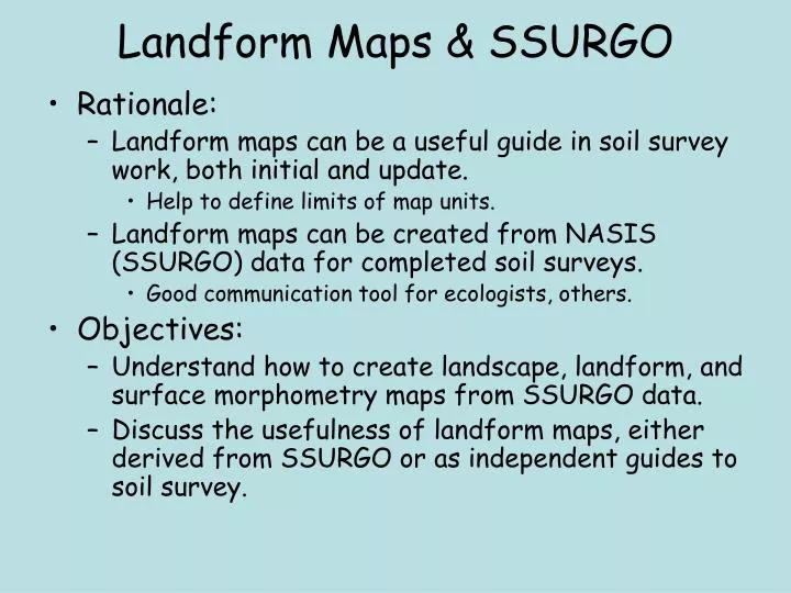
Landform Maps & SSURGO. Rationale: Landform maps can be a useful guide in soil survey work, both initial and update. Help to define limits of map units. Landform maps can be created from NASIS (SSURGO) data for completed soil surveys. Good communication tool for ecologists, others.

E N D
Landform Maps & SSURGO • Rationale: • Landform maps can be a useful guide in soil survey work, both initial and update. • Help to define limits of map units. • Landform maps can be created from NASIS (SSURGO) data for completed soil surveys. • Good communication tool for ecologists, others. • Objectives: • Understand how to create landscape, landform, and surface morphometry maps from SSURGO data. • Discuss the usefulness of landform maps, either derived from SSURGO or as independent guides to soil survey.
Creating Landform maps from SSURGO: Relevant tables Mapunit Component Component Geomorphic Description Component 3-Dimensional Surface Mophometry Component Slope Shape Surface Mophometry (not demonstrated) Component 2-Dimensional Surface Mophometry
Component Geomorphic Description table(for Boone county, MO) Note Feature Type items: landscape or landform. Feature Name items: these are what you’ll map.
A “simple” make-table query for county landscapes Component Geomorphic Description Dominant component: try to get 1 record per map unit Feature Name Restrict Feature Type to “landscape”
Table result; Join this to the SSURGO spatial data via ArcMap (no need to export table)
Landform map of Boone county How do these differ? (Like before, but restrict to “landform” feature types)
Landform map closeup: some database problems - “terrace” and “stream terrace” indistinguishable - some ridges are coded as “hills” - some benches are coded as “ridges” (mapping problem?)
(no mtns in Boone co) (uplands here) 3D Surface Morph. Table Could be more than one record per component 2D Surface Morph. Table Only for upland unit components Could be more than one record per component
Make-table query for upland 2D (Hillslope Profile) and 3D (Geomorphic Component – Hills) features 3D Surface 2D Surface Geomorphic component - hills Hillslope profile
Watch for multiple records per map unit This unit occurs on both summits and backslopes (2 records in the Component 2D Surface Morphometry table), and on interfluves and sideslopes (2 records in the Component 2D Surface Morphometry table). Which record do you want to join to your map??
3D Surface Mophometry 2D Surface Mophometry
Creating consistency in NASIS terminology within an MLRA • Problem: terms for landscape, landform, surface morphometry, parent materials, etc., are often not consistently populated in NASIS. • GDS provides excellent general definitions, but is not a “key”. • Individuals working independently can (and do) come up with different NASIS entries for the same features. • General Solution: Create an MLRA Tech Note providing guidance for NASIS terminology within an MLRA. • e.g., Alaska MLRA 11 NASIS Technical Note, • e.g., MLRA 116B (Missouri: Springfield Plateau) guidance document. • See Geomorphic_Description_System_116A_B.docx in references folder.
Example for MLRA 116B: Springfield Plateau • Landscapes: NASIS entries before the Project: • Basin • Mountains or Deeply Dissected Plateau • Plateau • River Valley • Upland • NULL • Landscapes: NASIS entries after the Project: • Hills • Plateaus • River Valleys
Example from MLRA 116B: Relationships among landscapes and landforms Hierarchical. Within a given landscape, only certain landforms are “allowed”. Example: Divides occur only on a Plateau landscape. Also include 2D and 3D Surface Morphometry relationships in this table (see accompanying Word document). Gets complicated, & takes some thought. Ideally, this creates a four-level hierarchical system to classify map unit components via NASIS: - Landscape - Landform - 2D Surface Morphometry - 3D Surface Morphometry
SSURGO-derived Landscape map Springfield Plateau MLRA116B Missouri (state-centric: sorry!)
Landscapes within the Springfield Plateau Salem Plateau (Ozark Highlands) Cherokee Prairie (Osage Plains) KS OK AR
Landforms within the Springfield Plateau Salem Plateau (Ozark Highlands) Cherokee Prairie (Osage Plains) KS OK AR
Hillslope Position (2D surface Morphometry) within the “Hills” Landscape
“Nested” landforms Example: Butler county, MO 131A (Mississippi Valley)
Proposed “Braided Stream Terrace” landform Scott county, NE of Butler county without and with soil lines. “Bar” and “Channel” landforms within a “Braided Stream Terrace” landscape?
Landforms dominantly in 131A Note “nested” landform designators
Secondary landforms within the “braided stream terrace” landform
Example from published soil survey • Fresno co, CA • Kerry Arroues • David Howell*, GIS support • Uses dominant component (complexes & associations) • NASIS data *retired!
Landform Mapping:connecting soils and landformsat the map unit level • Many map units are multi-component • Complexes • Associations • Components may or may not be on the same landform • One-to-many relationship between spatial data (soil delineations) and landforms. • Creates difficulties in mapping. • How can you assign a landform to a map unit? • Choose the dominant component. • Add a field in NASIS. • MUTEXT table: Skovlin et al, MT • Overlap table: Kautz et al, AK • Soil Data Viewer Rule Manager Application. • ??? Haven’t tried it yet.
Jay Skovlin technique: one landform & parent material group per (multi-component) map unit. Improves ease of map unit spatial management: keep map units on specific parent materials & landforms. Landform/Parent Materials map, Bitterroot Valley area, MT (blank areas are unmapped; 2007)
Denali landform map Derived via SSURGO One landform per MU Overlap Table technique
Soil Data Viewer Rule Manager Application • This is set up to allow states and MOs to add local interpretations to Web Soil Survey and Soil Data Viewer. • Missouri did this for a Black Walnut Suitability Index. • I don’t know why you couldn’t do this for, say, landform, even though this is not, strictly speaking, an “interpretation”. • If you did this, you would be able to map Landscapes, landforms, etc., via both WSS and SDV. • No confusing MS Access Make-Table queries, no additional NASIS data entry (?). • I haven’t tried it. Any ideas or comments?
More discussion • David Howell (CA): • “… maps created from SSURGO attributes are not really landform maps. They are soil map unit polygons symbolized by dominant landform…. There are a variety of reasons why the soil map unit polygons may not coincide with landforms, e.g., correlation combinations of map units, minor components, management considerations etc. • It would be better to have an independent map of landforms used to guide the placement of soil map unit polygons.” • What do you think? • Landform map from SSURGO; is it worth the trouble? • Component level? Map unit level? • Independent landform map; how do you derive it? • Upper Peninsula, Michigan • Landforms of the Jornada Basin, NM (Monger & Nolen)