Download
1 / 20
210 likes | 228 Views
International Association of Geodesy (IAG): GPS and GNSS for Science. G. Beutler Astronomi cal Institut e , Universi ty of Bern Member of IAG Executive Committee and of IGS Governing Board National Space-Based Positioning, Navigation, And Timing (PNT) Advisory Board Hilton Arlington

E N D
International Association of Geodesy (IAG): GPS and GNSS for Science G. Beutler Astronomical Institute, University of Bern Member of IAG Executive Committee and of IGS Governing Board National Space-Based Positioning, Navigation, And Timing (PNT) Advisory Board Hilton Arlington 901 North Stafford Street Virginia 22203 October16-17, 2008 International Association of Geodesy
International Association of Geodesy (IAG): GPS and GNSS for Science • The International Association of Geodesy (IAG) • Global Navigation Satellite Systems (GNSS) • The International GNSS Service (IGS) • Leadership • Strategic engagement • Future challenges • General remarks concerning the activities of the2007-2008 National Space-Based PNT Advisory Boardfrom the IAG perspective International Association of Geodesy
About Geodesy and IAG • Geodesy is based on three pillars • geometry and kinematics of/on Earth and in its environment, • Earth orientation and rotation, and • The Earth‘s gravity field including its variability • Geodesy provides the metrological basis for positioning, navigation, surveying&mapping, global change studies. • IAG, the International Association of Geodesy, coordinates International activities related to the above pillars. • The space age brought a revolution in geodesy and led to the creation of four services relevant for GNSS, • International Earth Rotation Service (IERS) in 1989 • IGS (International GNSS Service) in 1991/1994 • ILRS (Intl. Laser Ranging Service) and • IVS (Intl. VLBI Service) around the year 2000. International Association of Geodesy
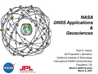
GPS: USA , about 30 satellites in 6 planes • GLONASS: 10-17 satellites in 3 planes • GALILEO: 2 test satellites (GIOVE A,B) in orbit, in 2013 27/30 sats in 3 planes GPS GLONASS GALILEO Active and Emerging GNSS In addition China is developing a global/regional system COMPASS with geostationary and MEO satellites. International Association of Geodesy
About Geodesy and IAG • Since 1994 Global Navigation Satellite Systems (GNSS) play an essential role in geodesy to • maintain and densify the International Terrestrial Reference Frame (ITRF, issued by the IERS) • monitor Earth rotation • monitor the atmosphere • determine precise LEO orbits (LEO=Low Earth Orbiter) • determine the Earth‘s gravity field (!) • In geodesy GNSS will continue to play a leading role for next 20-30 years. • The IGS (International GNSS Service) is acting on behalf of IAG for the scientific exploitation of all GNSS. International Association of Geodesy
About the IGS • The creation of the IGS was initiated in Edinburgh in 1989 with I.I. Mueller, G. Mader, B. Melbourne, and Ruth Neilan as protagonists • The IGS became an official IAG service in 1994. • The IGS first was a pure GPS Service, it was renamed as the International GNSS Service in 2004. • Today, the IGS is a truly interdisciplinary service in support of Earth Sciences and Society committed to use the data from all GNSS. • Since its creation the IGS Central Bureau is located in the USA with Ruth Neilan as director – who stands for continuity and leadership. International Association of Geodesy
About the IGS Monitor station motion in „real time“ IGS Network in 2008 In 1992 the IGS GPS network was based on about 20 geodetic receivers, 400+ receivers are active and their data retrievable today International Association of Geodesy
About the IGS • Development of the IGS combined GPS/GLONASS network (from Dach et al., 2008 IGS Workshop) International Association of Geodesy
About the IGS • In 1992 the IGS started off as an orbit determination service (decimeter accuracy) for about 20 GPS satellites. • Today, the IGS providesephemerides (accuracy of 2-4 cm) for about 30 GPS satellites and for all GLONASS satellites (<10 cm), i.e., for all currently active GNSS satellites. • In addition the IGS provides • archive of all globally relevant GNSS observations since 1991 • satellite and receiver clock corrections (sub-ns accuracy) • polar motion (PM) and length of day (lod) (cm accuracy) • coordinates and velocities for 200+ sites (cm / mm/y accuracy) • atmosphere information • The IGS products are accurate, reliable and robust, available in a timely manner. International Association of Geodesy
About the IGS • The IGS • provides leadership to the Civilian GPS/GNSS community striving for the highest achievable accuracy by studying • systematic errors (case for SLR reflectors) • system peculiarities (case of 30+ constellation) • different GNSS and their combination to the benefit of users • reaches out to the entire GNSS community by making available precise • GPS • GLONASS • in future hopefully also GALILEO orbits and clocks in one and the same reference frame. • identifies future challenges by its strategic planning International Association of Geodesy
Case for SLR reflectors Satellite‘s position w.r.t. the Sun • ... Elevation of the Sun above the orbital plane u ... Argument of latitude (satellite – Sun) International Association of Geodesy
Case for SLR reflectors G05 + G06 (cm) International Association of Geodesy
Case for SLR reflectors • From:Yang Fumin(1), Chen Wanzhen(1), Zhang Zhongping(1),Wang Yuanming(1), Zhang Haifeng(1) • Zhao You(2), Fan Cunbo(2) and Han Xingwei(2) • (1) Shanghai Observatory, Chinese Academy of Sciences, Shanghai, China • (2) Changchun Observatory, Chinese Academy of Sciences, Changchun, China International Association of Geodesy
SLR Reflectors on GNSS Satellites • SLR provides the only independent check (in the radial direction) of GNSS orbits – determined with the GNSS signals and carriers. • The payload required to enable SLR tracking is minor (about 10 kg, the SLA on Compass has 2.5 kg), the costs marginal. • SLR tracking to GNSS, internationally coordinated by the ILRS, was successfully performed for • GPS (PRN 05 & 06) • All GLONASS satellites • GIOVE-A & -B (GALILEO) • COMPASS-M1 (launched in spring 2007) International Association of Geodesy
GNSS Peculiarities July 7, 2006: sub-satellite tracks of: GPS PRN 06, with daily repeat orbit and GLONASS R06, orbit repeating after 8 days. • The GNSS constellations differ considerably (inclinations, daily vs. 8-day repeat orbits for GPS and GLONASS, respectively) • Different constellations improve the geometry, help to understand systematic errors International Association of Geodesy
GNSS Peculiarities • Observing GPS and GLONASS from one site: Mean inclinations of GPS and GLONASS ore different (Dach et al., 2008) International Association of Geodesy
GNSS Peculiarities • Observing one GPS and one GLONASS satellite over ten days from two different sites (roughly) at the same latitude (Dach et al., 2008) International Association of Geodesy
Case for 30+ Satellites • PDOP (Positional Dilution of Precision): <1 : excellent, > 4 bad. • Motivation (a) 30+ constellation, (b) combine systems International Association of Geodesy
International Committee on GNSS • The ICG was set up by the United Nations Office for Outer Space Affairs (UNOOSA) • ICG is „A forum to discuss Global Navigation Satellite Systems (GNSS) to benefit people around the world“ • As opposed to the IGS the emphasis is not on scientific, but on outreach issues where system providers and users are working together. • The Third Meeting of the International Committee on Global Navigation Satellite Systems (ICG) is organized by the Jet Propulsion Laboratory (Ruth Neilan), Pasadena, USA, 8 - 12 December 2008. International Association of Geodesy
Report on PNT 2007-2008 Activities • From the IAG perspective the draft report on the 2007-08 activities is already in excellent shape (in particular the Executive Summary). • It is a concise summary of the Board‘s 2007-08 activities and provides in itself the best argument to continue the Board‘s activities. • The IAG is very pleased that the case of • Commitment to a 30+ constellation • SLR reflectors on GPS satellites • get appropriate attention and that • International collaboration is viewed as an important issue. International Association of Geodesy