Download
1 / 16
160 likes | 513 Views
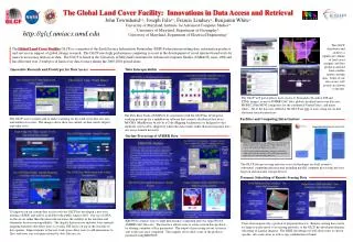
The Global Land Cover Facility. Presentation for WGISS-25 February 26, 2008 University of Maryland, Department of Geography. What is the GLCF?. A Non-Governmental Science Information Center Making quality Earth science data easily available to researchers

E N D
The Global Land Cover Facility Presentation for WGISS-25 February 26, 2008 University of Maryland, Department of Geography
What is the GLCF? A Non-Governmental Science Information Center Making quality Earth science data easily available to researchers Developing tools for data access and data sharing Innovating visualizations for spatial data Land cover research & production A research facility sponsored by NASA & University of Maryland Joint activity between the University of Maryland Institute for Advanced Computer Studies (UMIACS) and Geography Department John Townshend = Director NASA MEaSUREs, REASoN, ESIP, ACCESS, EOS, ESDS programs
Data Collections Available Data Collections Earth observation imagery and land cover products Landsat scenes MODIS composites ASTER IKONOS, QuickBird SRTM AVHRR – derived land cover products MODIS – derived land cover products Landsat – derived land cover products special collections
Data Access Policies Data Access Policies All data is free to any user via anonymous FTP Registration is not required to access 95% of archive Archive is reliable Archive is available 24/7 Customer support provided
Collections Policies Collections are: Earth observation imagery useful to generating land cover products Or land cover products derived from Earth observation imagery peer reviewed and/or supported by extensive methodology, calibration and validation documentation. accompanied online by helpful web pages with standardized, brief overview information supported through GLCF customer service
Formats & Interoperability Format Policies: Formats make a big difference to users – make it easy GeoTIFF, WGS84, UTM/Geographic Reformat of SRTM & MODIS layers to community need Consider Earth science community format needs, but also: Earth scientists in GIS community other GIS users conservation scientists land managers (planners, local govt) academics (teaching materials) commercial users (realtors, graphic artists, insurance, utilities, news media, transportation planners.
Simple, Effective Visualization Application • Goal to provide easy access: • registration not required • minimal clicks to actual data • improved previews • reliable • ESDI can be bypassed to FTP • no fees = quick access A primary application was developed at GLCF for accessing spatial data collections visually: the Earth Science Data Interface (ESDI).
Application and Data Discovery Development • Goal of making data easy for user to access: • Continue to enhance ESDI, often per user requests • A suite of applications designed for online processing of imagery into land products: the Land Cover Change Community-based Processing and Analysis System (LC-ComPS) (J.Masek PI). Also designed for free reuse. • data grids (SRB, Globus), OPeNDAP, “sister” sites • The GLCF has developed applications for the collection of performance metrics and success stories so that government or business managers can better recognize their project activities.
Distribution of Spatial Data Of the last 2.5 million visits, GLCF logs only identified 51% of domains. Of those domains, the following were recognized: 15 TB available 807 TB distributed 57 million hits (Jan 31, 2008) Since 2003, downloads have shifted from 90% US domains to 65% non-US domains
1989 GLCF Land Cover Activities 1999 Land Cover Focus Regional and global forest cover and forest cover change products Deforestation Mapping Group semi-automated techniques for processing 30 meter resolution Landsat imagery into FCC products products for Central Africa, the non-Brazilian Amazon, Paraguay Development of land cover automation techniques Current research and development of Support Vector Machine (SVM) processing of Landsat and ASTER imagery into FCC products. FCC Product
GLCF Achievements: UNEP Distribution NASA/USGS GeoCover data UMD GLCF formatting, packaging Nations data used UNEP distribution US Government policy to distribute Landsat GeoCover collection for free through UNEP Each developing world nation received a free subset of the collection covering their area on hard drives
http://glcf.geodata.cn GLCF & IGSNRR Cooperative John Townshend from the University of Maryland signed a data exchange agreement with Liu Jiyuan, Director General of the Institute of Geographical Sciences and Natural Resources Research in the People's Republic of China, on September 3, 2005. • GLCF provided a copy of the 3.5 TB, 3-epoch, global coverage, Landsat GeoCover collection to IGSNRR on hard drives – free. • IGSNRR put the data online in Chinese, on their country’s Internet. • GLCF receives volume metrics • GLCF will receive collections of non-NASA data and products from the sister group to provide in English via GLCF systems. Since 2005, the GLCF has cooperated in an agreement with a sister institution at the Institute of Geographical Science and Natural Resources Research (IGSNRR) in Beijing whereby:
Future GLCF Directions Updated collections access Continuing work in online LC application development Continuing work in data discovery research: Lattice Grid, Sisters, OGC Continuing work with collaborators in Earth science & Conservation Continuing research in LC modeling and production, including ASTER program products to include 2005 NA FCC & composites MEaSUREs program products will include: Global fine resolution (< 100 m) surface reflectance ESDR for three epochs centered around 1990, 2000, and 2005; Fine resolution (< 100 m) forest cover change (FCC) ESDR between the three epochs; Fragmentation products derived from the fine resolution FCC products; Global 250-m vegetation continuous field (VCF) based FCC ESDR for 2000 to 2005; FCC products to 250 m, 500 m, 1 km, and 0.05° grids for use by carbon, biogeochemical and hydrological modelers; Subsets of the above products for protected areas of the world and their buffer zones. All will be made available online with free access
Visit the GLCF www.landcover.org Earth observation data & products: Available 24 hours per day, 7 days per week Free No registration required