Download
1 / 25
250 likes | 362 Views
David F. Zierden Center for Ocean-Atmospheric Prediction Studies The Florida State University Tallahassee, FL Alabama Water Resources Conference October 13, 2005. Climate Variability and Forecasting in the Southeast U.S. SECC Partners.

E N D
David F. Zierden Center for Ocean-Atmospheric Prediction Studies The Florida State University Tallahassee, FL Alabama Water Resources Conference October 13, 2005 Climate Variability and Forecasting in the Southeast U.S.
SECC Partners Florida State Univeristy – climate studies, coupled modeling, climate forecasts, forestry University of Florida – extension, crop modeling, decision support tools University of Miami – climate, economics, water resources, assessment University of Georgia – climate, extension, crop modeling University of Auburn – extension, economics, insurance University of Alabama Huntsville – climate, water resources
Japan Meteorological Agency (JMA) ENSO Index SST Anomalies averaged over the red shaded portion of the equatorial Pacific Ocean Smoothed with a five- month running average to reduce noise
Predicting El Nino/La Nina • Warm/Cold events are tied to the seasonal cycle • Events and their climate impacts tend to peak in NH winter • Phase can be forecast as early as late summer for the next 6-9 months • Phase is difficult to forecast in Spring for the following seasons
Climate Forecast from NOAA Temperature Precipitation
El Niño/La Niña and Hurricanes El Niño La Niña
Impact Freezes of the last century Freeze Date ENSO State *Dec 1894 Neutral Feb 1899 Neutral Dec 1934 Neutral Jan 1940 Neutral *Dec 1962 Neutral Jan 1977 Neutral Jan 1981 Neutral *Dec 1983 Neutral Jan 1985 Neutral *Dec 1989 Neutral Jan 1997 Neutral * High Impact
Mallory Swamp Fire during the last La Niña
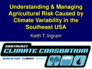
ENSO and Wildfires April • La Niña typically increases acreage burned in Florida from around 60,000 acres to 200,000 or more. (Jones, Shriver, and O’Brien, 1999; Brenner, 1999). • Effective mitigation (supression, contolled burns, herbicides) has bias historical burn records. • Foresters need downscaled predictions in time and space to effectively manage resources. Anomalous Wildfire activity (acres burned) during La Niña episodes Percent Change -100 -50 -25 25 50 100 200 500 1000
Wildfire Threat forecast • The end product is a monthly, county-by-county forecast of the KBDI. • Graphic shows the probability of at least 7 days in the month being above or below critical thresholds. • Thresholds were determined with input from forestry and wildfire experts. • Forecast was based on the Neutral ENSO phase.
Where can I get this Information??? www.agclimate.org