Download
1 / 29
290 likes | 1.3k Views
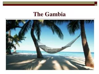
BARRIERS TO DEVELOPMENT IN THE GAMBIA. Madieu Sulaiman Ebrima Cham 17 th December 2004 NSAC. THE GAMBIA PART 1. BRIEF HISTORY GEOGRAPHY POLITICS CLIMATE POPULATION ETHNIC GROUPS ECONOMY FOOD ENVIRONMENT. MAP OF AFRICA. Brief History.

E N D
BARRIERS TO DEVELOPMENT IN THE GAMBIA Madieu Sulaiman Ebrima Cham 17th December 2004 NSAC
THE GAMBIA PART 1 • BRIEF HISTORY • GEOGRAPHY • POLITICS • CLIMATE • POPULATION • ETHNIC GROUPS • ECONOMY • FOOD • ENVIRONMENT
Brief History • 1816: Captain Grant (Bathurst) • 1897 – 1905: Major Battle Fought • 1950: Formation of political party • Feb. 18, 1965: Independence • April 1970: Republic • 1981: Abortive coup • 1981-1988: Confederation with Senegal • July 1994: Military take over • Sept. 1996: Presidential Election • OCT. 2001: Presidential Election
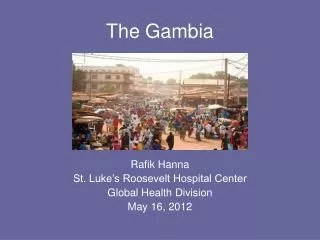
GEOGRAPHY • West Africa • 13 28 N, 16 34 W • Area: 11,300 sq. km. • Land: 10,000 sq. km • Water 1,300 sq. km • One of the smallest countries in Africa • Almost an enclave of Senegal • Floodplain of the Gambia River flanked by some low hills • Highest point: 53 m.
POLITICS • Multi-party system • Head of state-H.E.Alhaji Dr.Colonel (Rtd) A.J.J Jammeh • Vice-pres Hajj Isatou Njie Siady • Cabinet ministers • General Assembly-53 • Judiciary-Appeal, Supreme, High magistrate court,
Climate • Tropical • Hot, Rainy Season, June – November (26°C - 36°C) • Cooler, Dry Season, November – May (21°C - 26 °C)
Population • July 2004 Census: 1,546,848 people • 0-14 years: 44.7% • 15-64 years: 52.6% • >65 years: 2.7% • Pop. Growth Rate: 2.98% • Birth rate: 40.3 births/1000 pop. • Death rate: 12.08 deaths/1000 pop. • Net Migration Rate: 1.57 migrants/1000 pop.
Ethnic Groups • Mandinka: 42% • Fula: 18% • Wolof: 16% • Jola: 10% • Serahuli: 9% • Other: 5% • Official Language: English
Economy • About 75% of the population depends on agriculture • Industry, commerce and other services: 19% • Government: 6% • Agriculture products: rice, millet, sorghum, corn, sesame, cassava, 85% peanuts • Tourism is the major income industry
FOOD MAIN DISHES • BENACHINE • DOMORDA • PLASAS • STEW • SUPER KANJA
Current Environmental Issues • Deforestation • Desertification • Beach erosion
Barriers To Development Part 2 • Age • Origin • Land Tenure System • Gender • Religion • Political Affiliation or Belief • Traditional Beliefs • Size of the community
Age • Elders command respect • Guide decision making process in the community • Often dictate what should happen in the community
Origin • The indigenes of the community feel superior to the rest (We own here) • Dominant in the decision making process
Land Tenure System • Land belongs to the Indigenes • The Indigenes control land use • Women do not own land • Men control land use
Gender • Women are inferior to men • Women have that inferiority complex • Illiteracy rate is higher in women • Yet more responsive to change and development but voiceless in society
Religion • Influence decision making • Eg. Schools rejected in communities
Political Affiliation or Belief • Members of the same political party share the same opinion • Members of opposing political parties hardly agree on issues
Traditional Beliefs • Traditional beliefs are still respected and upheld in certain communities • They are meant to nurture the respect they owe their ancestors
Size of the Community • People living in larger communities are less dependent on each other • Literacy rate is high • See development as a priority • Larger communities tend to be more responsive to change and development
Government Interventions • Decentralization Policy - Area council chairmen and mayors - Ward councillors - Village development committees (VDCs) • National Civic Education Council (NCC) - Political education - Good governance - Democracy - Constitutional rights
State lands act • Reserve lands created • Minister for women’s affairs • Women’s bureau • Free education policy for the girl child • Minister for religious affairs • Supreme Islamic Council • Christian Council • Revised curriculum for the “madrasa” • Islamic/Bible knowledge in the school system