Download
1 / 32
330 likes | 512 Views
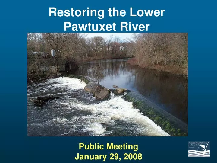
Restoring the Lower Pawtuxet River. Public Meeting January 29, 2008. Meeting Agenda. 7:10-7:15 Welcome (Bob Nero, Chairman, PRA) 7:15-7:25 River Restoration in R.I. (Dir. Mike Sullivan, DEM) 7:25-7:45 Project Overview (Tom Ardito, NBEP)

E N D
Restoring the LowerPawtuxet River Public MeetingJanuary 29, 2008
Meeting Agenda 7:10-7:15 Welcome (Bob Nero, Chairman, PRA) 7:15-7:25 River Restoration in R.I. (Dir. Mike Sullivan, DEM) 7:25-7:45 Project Overview (Tom Ardito, NBEP) 7:45-8:15 Restoration Alternatives & Recommendations (Jim MacBroom, MMI) 8:15-8:45 Open Discussion 8:45-9:00 Funding & Next steps (Ardito)
The Pawtuxet River Authority was created by an act of the RI Legislature in 1972. TITLE 46Waters and Navigation CHAPTER 46-24Pawtuxet River Authority SECTION 46-24-2 § 46-24-2 Pawtuxet River authority created. – A board to be known as the Pawtuxet River authority is hereby created. The board shall be a body corporate and politic, constituting a public benefit corporation, and shall serve as the governing body of the authority for the purposes of this chapter. The powers of the corporation shall be vested in and exercised by the majority of the members of the board hereby created and in office.
Current Projects 1. Fish passage at Pawtuxet Falls 2. Canoe launch and nature area at Pocasset 3. Pontiac canoe launch and 48 acre wildlife area 4. Riverwalk at Royal Mills 5. Veterans Square fishing and canoe access 6. Riverwalk & Harris Dam fishing area 1 2 3 6 4 5
Project Overview • Introductions • Purpose of the project • Fish biology/watershed ecology • Project process
Project Partners • Pawtuxet River Authority and Watershed Council • Narragansett Bay Estuary Program • Save The Bay, Inc. • R.I. Coastal Resources Management Council • R.I. Corporate Wetlands Partnership • R.I. Department of Environmental Management • U.S.D.A. Natural Resources Conservation Service • National Oceanic and Atmospheric Administration • U.S. Environmental Protection Agency • U.S. Fish and Wildlife Service • And, we hope, YOU!!! People who care about the environment of the Pawtuxet River & the community of Pawtuxet Village
Why Restore the Lower Pawtuxet? Goal: • To restore historic runs of migratory fish (particularly river herring and shad) to the lower Pawtuxet River Purpose: • To improve the environment of the Pawtuxet River, Narragansett Bay, and historic Pawtuxet Village Benefits: • Increase Fish & Wildlife in Pawtuxet River and Narragansett Bay • Improve Rhode Island’s Fresh and Salt Water Fisheries • Restore Historic Ecological Connection between Bay and Watershed • Restore Historic Natural and Cultural Feature of Pawtuxet Village
R.I. Inland Fisheries Commission, 1869: “This generation has seen our streams filled with shad and herring…..The principle rivers in the State which were formerly the home of the salmon, shad and herring, are the Blackstone, Pawtuxet and Pawcatuck, and these have become so obstructed with dams, that they no longer offer a passage to their upper waters, which nature prompts the fish to seek at spawning time.”
“Target Species” River Herring or “Buckies” Alewife(Alosa pseudoharengus) Blueback Herring(Alosa aestivalis) American shad(Alosa sapidissima)
Historic Pawtuxet Falls Fishing for Buckies, About 1910 Early 1900’s
1800’s Many changes over time
CONCRETE Pawtuxet Falls Today BEDROCK CONCRETE
Restoration Process (What We’re Doing) • Feasibility Study: Completed 2005 • Hydrologic Modeling & Alternatives Analysis: Completed 2007/08. Considerations included: • Fish passage for target species • Visual Impacts (Aesthetic Considerations) • Other Environmental Impacts (Habitat, Wetlands, Water Quality) • Recreation (canoeing, kayaking, fishing) • Sediment (movement, exposure, erosion, siltation) • Flooding • Maintenance • Cost of Alternatives • Next steps: • Finalize alternative • Begin permitting • Funding & Construction (2009, pending $$)
Scope of Work • Sediment Sampling and Analysis • Bathymetric Survey • Hydraulic Modeling • Alternatives Evaluation • Fish Passage • Ecological implications • Sediment Stability • Recreation • Morphology / Hydraulics
Dams Culverts Bridges Tide Gates Utility Crossings High Velocity Shallow Water Poor Substrate Water Temperature Low Oxygen Fish Passage Barriers
Restoration Alternatives • No Action—Leave River As-Is • Full Dam Removal • Partial Dam Removal • Full Removal with construction of New Rock Ramp Upstream • Denil Fish Ladder
STUDY PROCESS DAM MANAGEMENT ALTERNATIVES DATA COLLECTION DAM SAFETY BASE DATA HAZARD CLASSIFICATION NID PHYSICAL INSPECTION FEMA SPILLWAY CAPACITY STATE AGENCIES SITE DATA SIZE CLASSIFICATION DESIGN PLANS TOPOGRAPHY OPERATIONAL HAZARDS HISTORY WETLANDS STRUCTURAL / GEOTECH . OWNERSHIP RARE SPECIES AS - BUILT DATA HYDROLOGY USE GEOLOGY NO YES IS DAM HISTORIC VALUE EMERGENCY SAFE? REPAIRS OR SEDIMENTS PUBLIC & DRAWDOWN WATER QUALITY REGULATORY PARTICIPATION REPAIR OR MARGINAL REPLACE DAM DAM IDENTIFY ALTERNATIVES RETAIN DAM AND IMPOUNDMENT ELIMINATE DAM AND IMPOUNDMENT PROVIDE FISH PASSAGE LOWER CREST HIGH LEVEL NO ACTION U/S FISH D/S FULL LOW LEVEL PARTIAL BY - PASS RAMP LADDER RAMP REMOVAL BY - PASS BREACH CHANNEL OTHER LIMITED FEASIBILITY STUDY VERY SMALL OR LOW RISK YES SITE SPECIFIC TOPICS DAM, SIMPLE DECOMMISSION NO PUBLIC & REGULATORY PARTICIPATION, SELECT DETAILED FEASIBILITY STUDY ALTERNATIVE HYDRAULIC ANALYSIS SEDIMENT TESTING SEDIMENT TRANSPORT CHANNEL MORPHOLOGY U/S AND D/S IMPACTS WETLAND IMPACTS IMPLEMENTATION LAND USE / AESTHETICS CONSTRUCTION PLANS AQUATIC SPECIES SPECIFICATIONS RECREATION COST ESTIMATES For additional information, LAND RIGHTS FUNDING please contact: WATER RIGHTS EASEMENTS James MacBroom, P.E. UTILITIES REGULATORY PERMITS ACCESS CONSTRUCTION ADMINISTRATION FINANCIAL IMPACTS SITE RESTORATION CONSTRUCTION METHODS AS - BUILTS 716 - 726 South Main Street SITE RESTORATION OPERATIONAL PLAN Cheshire, Connecticut 06410 Telephone (203) 271 - 1773 EROSION CONTROL EMERGENCY RESPONSE PLAN Fax (203) 272 - 9733 E - Mail: jimm@miloneandmacbroom.com Study Process Design Management Alternatives
Engineering Issues • Type & Condition of Dam (Safety) • Site Limitations (Utilities, Access) • Up & Downstream Issues (Bridges/Structures, Tributaries) • Environmental Permitting • Alternatives Analysis
Design Variables • Channel Morphology • Channel Gradient • Profile Pattern • Channel Width & Depth • Mannings Roughness Coefficient • Materials • In-Channel Features • Sediment Transport / Stability
Fish Criteria 8 6 TOO DEEP DEPTH (FEET) 4 TOO FAST 2 TOO SHALLOW 0 6 8 0 4 2 VELOCITY (FPS)
Full Removal Existing Conditions Low Tide Full Removal Low Tide
Partial Removal Existing Conditions Low Tide Partial Removal Low Tide
Summary of Water Surface ElevationsControlled Breach Mean April Flow @ Low Tide
Fish Ladder Design Criteria • Low Velocity • Water Depth • Fish Entry • Fish Exit • Upstream Flow Control • Variable River Stages • Vertical Rise
Fish Ladder Existing Conditions Proposed Conditions
Funding & Next Steps • Feb. 2008 • Evaluate Public Comments • Meet with Regulators • March 2008 • Finalize Preferred Alternative • Another Public Meeting to Present • 2008 • Permitting • Design & Engineering • Fundraising: Non-Federal Match, approx. $100,000 • 2009: Construction