Download
1 / 7
70 likes | 188 Views
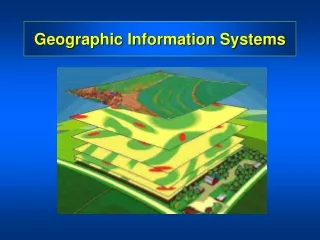
Geographic Information Systems (GIS) Group. Wingyan Chung, SCU OMIS Albert Esterline, NCAT CS Greg Ferrara, NCSU Ron Hughes, NCSU Lawrence Kiage, Georgia State U Richard Plant, UC Davis Group Session 3 Report, Sat. 8:00-9:00 am. GIS Concepts. Effects of Map Scale Data capture

E N D
Geographic Information Systems (GIS) Group Wingyan Chung, SCU OMIS Albert Esterline, NCAT CS Greg Ferrara, NCSU Ron Hughes, NCSU Lawrence Kiage, Georgia State U Richard Plant, UC Davis Group Session 3 Report, Sat. 8:00-9:00 am
GIS Concepts • Effects of Map Scale • Data capture • Database management and data schema/structure • Data quality • Programming • Visualization • Data transformation • Pattern analysis • Display / delivery / communication • Network analysis • Geospatial analysis
Terminology Difference • Same terms but different meaning • Data structure • Database schema • Scale -- spatial scale vs. performance • Topology (e.g., point) • Different terms but same/close meaning • Pattern analysis vs. data mining
Computing/IT as a tool • Programming • .NET, Visual Basic, Java, Javascript programming • GIS visualization software • Data management • MS Access database management • SQL queries • Pattern analysis (trends) • Simulation • Web technologies (not widely taught now) • XML family, Web services, protocols
Computing/IT as a concept • Data management and analysis • Data modeling, knowledge representation • Database design and development • Data mining concepts • Programming skills • From a user to a developer (SE cycle) • Programming skills and patterns • User interface design concepts • Simulation • Process modeling and visual representation
Ideal Implementation (1) • Using SE methodology at advanced GIS projects • May need students from different disciplines for a common exciting goal • Problem-based learning - use cool X to teach uncool Y • A capstone course, example project: • Precipitation estimates on different locations • Get estimates of nearest weather stations => need computational geometry concept and algorithm design • Finding Malaria hotspots / Socially-responsible GIS apps. • Process modeling • Creating traffic model using Petri-net • Multi-agent simulation (e.g., forest fire modeling) • Modeling an area’s soil erodibility, habitability
Ideal Implementation (2) • Social computing in the Introduction to GIS course (also in intro CS course) • Location-aware computing, GPS apps, mash-up, Google map • Privacy, IP, ethics • Accessibility of location information, open-source GIS software • (* GIS typically is not a major, but a part of geography or something else (exception))