Download

1 / 20
200 likes | 214 Views
Explore global population clusters, distribution patterns, and density calculations through thematic maps and examples. Learn about major population concentrations and emerging regions while understanding different types of density measurements.

E N D
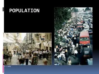
Population Issue #1
Bellwork: 09.17.2019 • You will complete a Frayer Model for one of your key vocabulary terms for the past unit. Definition Characteristics/Facts Term Thematic Map Examples Non-Examples
Today’s vocabulary terms: • Population Distribution • Population Density • Arithmetic Density • Physiological Density • Agricultural Density • Arable • Ecumene Population Issue #1
Population Concentrations • Four Major Clusters • East Asia • South Asia • Europe • Southeast Asia • Up and coming clusters • Northeastern US • Atlantic coast of Africa
Sparsely Populated Regions • Where people don’t live • Dry Lands • Wet Lands • Cold Lands • High Lands • The ecumene: the portion of the Earth’s surface occupied by human settlement.
Population Density • Arithmetic Density: total number of people divided by total land • Physiological Density: the number of people supported by a unit of area arable land • Agricultural Density: ratio of number of farmers to amount of arable land
MOST POPULOUS STATES 9 3 10 1 6 8 2 7 4 5
Today’s Agenda: 09.18.2019 • Bellwork • Reading Quiz Ch2. Key Issues 1-3
Bellwork 09.18.2019 • The map shows the distribution of dairy farms across the lower 48 of the United States. Each dot on the map represents approximately ten dairy farms. • Identify ONE type of boundary data shown on the map. • Identify the region of the United States where most dairy farms are located. • Describe TWO geographic features not shown on the map that would help explain the patterns of dairy farming shown on the map.