Download
1 / 34
350 likes | 464 Views
Dive into the science of geography with a focus on Earth systems, mapping, remote sensing, and GIS technology. Understand the relationships among natural systems, society, and cultural activities across geographic areas.

E N D
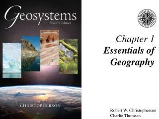
Chapter 1Foundations of Geography Elemental Geosystems 4e Robert W. Christopherson Charlie Thomsen
Essentials of Geography • The Science of Geography • Earth Systems Concepts • Location and Time on Earth • Maps, Scales, and Projections • Remote Sensing and GIS
The Science of Geography • Geography – from geo “Earth” and graphein “to write” • Geography is • a method, not a body of knowledge • holistic • eclectic • Geographers use spatial analysis • Geographers use Earth systems science
Geography is • The science that studies the relationships among • natural systems, • geographic areas, • society, • cultural activities, • and the interdependence of all of these over space.
Physical Geography is • The spatial analysis of all the physical elements and processes that make up the environment.
Earth Systems Concepts • Systems Theory • Open systems • Closed systems • System feedback • System equilibrium
Leaf as a System Figure 1.4
Global Effects of Mount Pinatubo Figure 1.5
Earth’s Four Spheres • Atmosphere • Hydrosphere • Lithosphere • Biosphere Figure 17.3
Earth’s dimensions Figure 1.8
Eratosthenes’ Measuring Earth in 247 B.C. Figure 1.9
Location and Time on Earth • Latitude • Longitude • Great circles • Prime Meridian and standard time
Latitude Figure 1.10
Longitude Figure 1.12
Great Circles and Small Circles Figure 1.13
Prime Meridian and Standard Time Figure 1.14
Maps, Scales, and Projections • Map – a generalized view of an area, as seen from above and reduced in size • Scale – ratio of map units to ground units • Projection – process of transforming spherical Earth to flat map
Classes of Projections Figure 1.18
Global Positioning System (GPS) • Used to map and locate objects on the Earth’s surface • One basic input to GIS
Remote Sensing • Active remote sensing • Passive remote sensing
Active and Passive Remote Sensing Figure 1.21
Geographic Information Systems (GIS) • GIS systems combine spatial and attribute data • Maps can contain multiple data layers: • Physical features • Cultural features • Layers can be added to create composite overlay
GIS System Figure 1.23
End of Chapter 1 Elemental Geosystems 4e