Download
1 / 13
130 likes | 162 Views
Stay updated on the drought conditions in the Ohio Valley region with this bi-weekly discussion from NWS Wilmington. Get insights on rainfall patterns, soil moisture, and long-range outlooks to help you plan ahead. The report covers the impact of evapotranspiration rates, recent rainfall percentages, and projections for the coming months. Learn about the variability of rainfall, drought coverage, and tips for dealing with persistent dry conditions. Keep track of weather patterns and prepare for potential drought fluctuations.

E N D
Drought Monitor and Medium to Long Range Outlooks Julie Dian-Reed NWS Wilmington July 2, 2012 julia.dian-reed@noaa.gov Service Hydrologist
NWS Wilmington Drought Page • Discussion (updated bi-weekly) is specifically for NWS Wilmington area • Graphics update as available and are relevent for Ohio valley
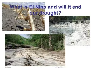
Spring 2012 • Spring 2012 was the warmest on record for Ohio Valley • Evapotranspiration rates were above normal • Drying expanded to the Northeast through the Spring • 8th driest spring for Indiana and 11th driest in Tennessee
60-day Rainfall Percent of Normal • What began over Indiana is growing into Ohio
Percent of Normal Last 30 days • Rainfall was generally below normal • Less than 50% of normal in parts of Ohio • Driest areas in parts of southern Indiana, southern Illinois and Kentucky with less than 0.50 inches of rainfall
Percent of Normal Last 14 days • Note the high variability of Rainfall • Some areas ‘hit/miss’ with precipitation
Current Drought Monitor • Increase in drought coverage in last few weeks due to below normal rainfall and very high temperatures • Main drought area is from Tennessee into Kentucky and Indiana and Illinois • Drought Product only updated each Thursday • Input from NWS, State Climatologists, Climate Scientists
July 2-8 • Hot and humid weather persists • Scattered storms especially early in the week and again on the weekend • Some risk of severe storms from the 4th-6th • Widespread 90s with 100s not out of the question by the weekend
Outlook Through Mid July • Below normal rainfall will persist in the lower Ohio basin. Likely not as dry as June. • Soil moisture is an important factor in summer rains. The drier the soil, less low level moisture to allow developing storms to persist = Less Rain
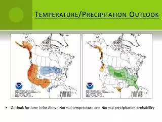
July Outlook • While Signal for above normal temperatures remains, less confident in below normal precipitation through especially the 2nd half of July
July-September Rainfall Outlook • There is a chance for some rainfall improvement as we go into August or September as soil moisture becomes less of a factor • However, confidence is not high in this forecast
July-September Drought Outlook • Drought will persist in the lower Ohio Valley through summer • Variability in occasional Thunderstorm Complexes will result in drought expansion and contraction at times
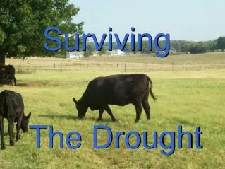
Drought Outlook Summary • Drought will likely persist in lower Ohio Valley into Cumberland Valley this summer • Drought will fluctuate in areal coverage and intensity over the short-term with rains and hot weather fluctuations • Official NWS outlook calls for possibly some improvement by autumn • Confidence is low currently, but if an El Nino develops this winter, dry weather could re-strengthen in parts of Ohio and Cumberland Valley