Download
1 / 17
170 likes | 179 Views
Utilize image processing to map bear distribution and analyze bear occupancy in river spots. Help students and the public explore questions about bear behavior. Develop hypotheses using spatial analysis and ImageJ software. Collaborate with educational institutions and botanical gardens for research and education.

E N D
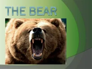
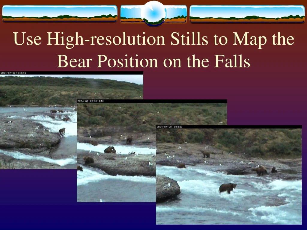
Use High-resolution Stills to Map the Bear Position on the Falls
Mapping the bear distribution • Spatial analysis of bear “occupancy” in river spots – combines video with image processing • Helps students and the public ask questions about bear distribution. • How much personal space do fishing bears have? • Do bears tolerate closer associations during good fishing? • Do females with very young cubs avoid times and locations with many other bears?
Maps help test hypotheses Hypothesis: Females with cubs of the year avoid other bears by distancing themselves from other bears or by coming to the falls when other bears are not there. This female is far away from the other bears in the main aggregation at the falls.
Image J analysis of bear populations • Simple mapping program in Image J – the marking tool. • Produce montages of the river scans (researchers) • Provide montages and directions for analysis to HS teachers, students, and undergraduates, and graduate students • Collect data from students, compare quality of data, and record data
Web Discovery Interface for Education – Incorporate Maps Calendar and Times
Web Interface for Education – lab notebook blog – daily discoveries
Example of daily discovery: Female places herself between threatening male and young
Archived Video of Research from Wolong will be compared with the Research Video of Grizzly Behavior Panda Nursing Behavior
Partnership with Xishuangbanna Tropical Botanical Garden • Partner projects looking at the diversity of gene function in a model system, Arabidopsis, with the biodiversity preserved in the Tropical Botanical Garden. • Time lapse imaging of mutant and wild type Arabidopsis plants: Discover the function of new genes. • Time lapse imaging of rainforest plants: Discover the diversity of plant gene function in a natural environment.
Plant Genomics and Imaging. Objective of this design: To engage students in authentic scientific inquiry outside the “normal” student concepts to allow them to see scientific inquiry as a dynamic, creative process. Specific Project: Using both wild and mutated varieties of seed, students take time lapse video of germination and early development. Students will compare the wild to the mutated varieties to make predictions of the function of the gene based on observation.
Time lapse movie of mutant and wild type Arabidopsis – wild type growth
Comparison of Time-Lapse Movies of Arabidopsis with Time-Lapse Movies of Rainforest Plants. • Flower movements. • Leaf movements. • Plant Growth and Development • Different movements of plants in the Rainforest Canopy using Rainforest Cams
Upper Canopy Camera Canopy Camera View from Upper Camera Under Canopy Camera View from Canopy Camera View from Under Camera
Upper Canopy Camera Canopy Camera Under Canopy Camera Rainforest Web Cam Camera Placement Viewed from Above
Rainforest Web Cam Digitizing and Streaming to Internet Stream to CNIC Server for web stream To Museum Via LAN Link with Texas A&T Video and Audio from Remote Cameras A Computer in the Administrations Building Digitizes and Streams Video and Audio. Camera control signals are received via the Internet and sent via UHF to remote cameras.