Download
1 / 11
170 likes | 418 Views
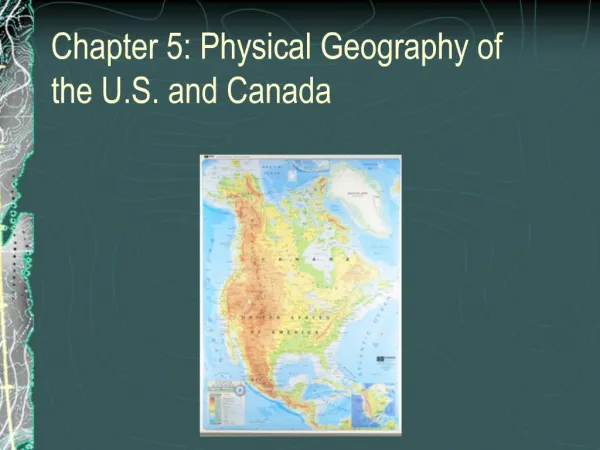
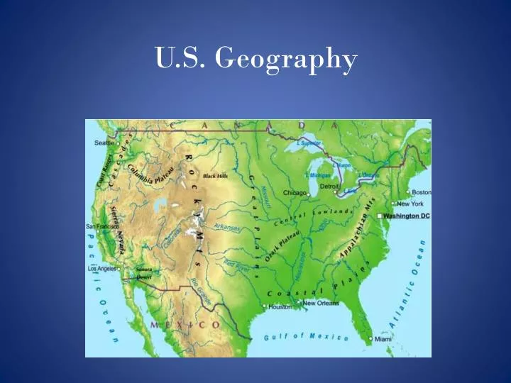
U.S. Geography. U.S. Geography Breakdown. Broken into 7 regions: The Atlantic-Gulf Coastal Plain Appalachian Highlands Interior Plains Interior Highlands Rocky Mountain System Intermountain Region Pacific Mountain System. U.S. Geography Shapes.

E N D
U.S. Geography Breakdown • Broken into 7 regions: • The Atlantic-Gulf Coastal Plain • Appalachian Highlands • Interior Plains • Interior Highlands • Rocky Mountain System • Intermountain Region • Pacific Mountain System
U.S. Geography Shapes • The terrain of the northern United States was formed by continental ice sheets • Mountains and lakes were formed by glaciers • Rivers came from glacial runoff as the world became warmer
The East and Gulf Coast • The Atlantic- Gulf Coast plain runs from SE MA to the Rio Grande River in TX • This region is consists of: • Estuaries 5. Sandspits • Embankments 6. Lagoons • Islands 7. Bays • Harbors • The Atlantic Coastal Plain rises into the Piedmont – an area of rolling hills between the coast and Appalachian Mountains
Interior Plains and Highlands • Extend over 1,000 miles from the Appalachian Mts. to the Rocky Mts. • Once covered by an inland sea and comprised of sedimentary rock • Drained by the Mississippi and Missouri River • Divided into 2 regions: • Central Lowlands • Great Plains • The BLACK HILLS are the region’s only upland area
Western Mts. And Great Basin • Rocky mountain system divided into 4 sections: • Northern Rockies • Middle Rockies • Wyoming (Great Divide) Basin • Southern Rockies • Continental Divide:A drainage divide where water is drained to a different sea on each side
Western Mts. And Great BasinContinued • Intermountain Region: Lies between the Rockies and Coastal Ranges • Comprised of: • Plateaus • Basins • Ranges • This region includes the Colorado Plateau which is where the Grand Canyon formed from the Colorado River • Lowest point in N. America is Death Valley
Pacific Mountain System • Made up of 2 ranges: • Cascade Mts. • Sierra Nevada Mts. • These mountains were formed from faulting and volcanism
The Pacific • The Pacific coast lies along the San Andreas Fault from San Francisco, CA to NW Mexico • It is a Coastline of Emergence – Often the mountains plunge directly into the sea and there are few islands or quality harbors • Major Harbors Include: • Puget Sound • San Francisco • San Diego
Alaska and Hawaii • Alaska is Broken into 4 regions: • Arctic Lowlands • Rocky Mountain System • Central Basins and Highlands • Pacific Mountain System • Much of the Pacific Mountain System is high in volcanic activity • The Hawaiian Islands make up part of the Pacific Mt. System and are mainly extinct volcanoes except for Mauna Kea and Mauna Loa (both on Hawaii)
Major Rivers and Lakes • The Mississippi-Missouri River system is the longest in the U.S. (3890 mi. long) • Major Tributaries Include: • Red River • Ohio River • Arkansas River • The Great Lakes are the largest in North America • Superior, Michigan, Huron, Erie, Ontario • Great Salt Lake and Lake Lliamna are the largest outside the great Lakes