Download
1 / 39
390 likes | 589 Views
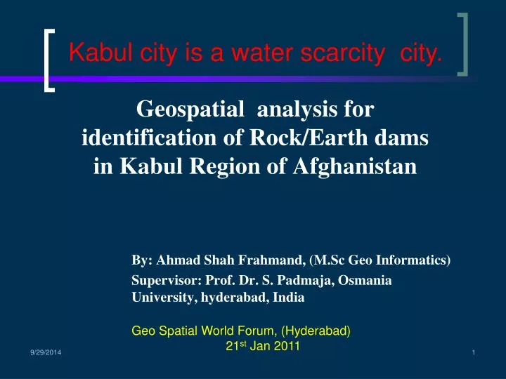
Geospatial analysis for identification of Rock/Earth dams in Kabul Region of Afghanistan. By: Ahmad Shah Frahmand, (M.Sc Geo Informatics) Supervisor: Prof. Dr. S. Padmaja, Osmania University, hyderabad, India. Kabul city is a water scarcity city. Geo Spatial World Forum, (Hyderabad)

E N D
Geospatial analysis for identification of Rock/Earth dams in Kabul Region of Afghanistan By: Ahmad Shah Frahmand, (M.Sc Geo Informatics) Supervisor: Prof. Dr. S. Padmaja, Osmania University, hyderabad, India Kabul city is a water scarcity city. Geo Spatial World Forum, (Hyderabad) 21st Jan 2011
Contents Introduction Study Area GIS Analysis and solutions Conclusion Open Discussion
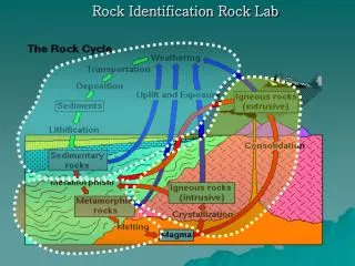
Introduction Relief is the representation of the shapes of hills, valleys, streams, or terrain features on the earth's surface. Relief is an important physical variable which has an immense impact on other surfacial variables on the earth’s surface. Relief is the foremost topographic variable represented by various contour values. The relief provides the nature of terrain and its pattern as existing in a region. It is closely associated with drainage, as it determines the flow directions, slope, aspect etc.
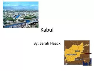
Study Area Afghanistan is a rugged, land locked country in south central Asia. Afghanistan lies along the great tectonic upheaval that has produced the world’s highest mountain ranges, Himalayas, Karakoram, Pamirs and Hindukush rising over 7000m, running in a north east – south west direction. This study area centers around Kabul region where the future demand for water seems to be enormous Keeping this in view an area encompassing about 20487 km2 lying between (680-700 East and 330 -360 of North) is slected for the study purpose. The climate is arid to semi arid with cold winters and hot summers.
Main river basins in Afghanistan are divided as fallows: • Northern basin (includes Amu Darya River basin covering 24% of the country’s area (about 156.000sqkm) • Morghab–Harirood basin(Covers about 12% of the country’s area (about 78,000sqkm) • South-eastern basin((farah –Helmand). This basin covers 52% of the country’s area (about 338000 sqkm) • Indus – Kabul basin(The basin totally covers 12% of the country’s area (about 78000 sqkm) Kabul river basin having 53000 sqkm of area is discharged into Indus River in Pakistan)
Tectonic map Study Area Physical map of Afghanistan
Ground water analysis The quality of ground water is an important issue to be considered as it affects the human health both directly as well as indirectly. The quality of ground water in the vicinity of Kabul city varies in some areas, the high concentration of dissolved solids and the presence of some constituents at concentrations are deemed harmful to humans and crops alike. However, the quality of ground water is significantly affected by sewage in the vicinity of the built up areas. Of particular concern are higher concentrations of Nitrate, Boron and Dissolved solids.
Causes of contamination of Groundwater in Kabul city • Population explosion. • Low precipitation(Depletion) • Sewage system is not exist. • Drought • Destroying upper layer of the river for construction purpose. • Dumping waste material directly in the river. • Flowing of industrial water directly to the river.
Ground water quality is greatly affected in the Kabul environs. The groundwater quality parameters show higher values compared to the standards.
The data base is generated from both toposheets with the scale of 1:100000. Contours derived from imageries in AGCHO with an interval of 200m. Drainage lines are derived from toposheets. Database and methodology
Toposhieets 1:100000 Derived Drainage lines
Relief analysis • This data set consist of elevation data in the form of contour. • Generating of Vector layer in the form of Triangulated Irregular Network. • Generating of Raster layer in the form of Digital Elevation Models. • Derivation of Slope, Flow direction, Flow accumulation, Stream definition, Stream segmentation using DEM with Arc Hydro in GIS platform.
Vector data (contour line) Interval (200m) Projected coordinate system (WGS_1984_UTM_zone42) Projection : Transverse Mercator. Linear Unit: Meters (m) Source: Afghan Geodesy and Cartography Head Office.
Input + Analysis = Result 3D Analyst Converting features into DEM
The TIN values range from 5088m to 1000m. Excepting the central region with values around 2000m, the rest of the study region accounts for higher TIN values. • DEM values range from 1000m to 5600m, as depicted by contours. The whole northern and north eastern region exhibit high values, whereas the whole central and southern region show less values. The south south eastern portion once again shows a rugged nature.
Importance of Analysis Kabul is suffering from lack of drinking water. Groundwater in Kabul city is depleting due to more usage day to day. This water is not enough for current population in Kabul city. To find the sources of water for better use of water in Kabul city. To find a best way for charging ground water. To find the stubble place for damming. To manage water resource in a logic way for sustainable development.
Rock/Earth dam sites to meet water demand in Kabul Region Rock and Earth dams are the most common and easy means of ground water replenishment. These sites are identified on the basis of not only elevations but also on the basis of drainage lines. These dam sites are chosen mainly to recharge the ground water aquifers in Kabul region.
The dam site around 1800m along with low lying zone below 1800m is shown The lowest elevation in the area comes out to be around 1000 m. • This can give rise to 3132 sqkm of utilizable area under the impact of continuous water supply due to gravity of flow in conformity with natural gradient from the dam site. • The utilizable area pertains to Kabul, Kapisa and Parwan regions. In fact, the utilizable area lies very close to Kabul city which can make use of the resources in a more effective way.
Conclusion GIS improves calculations for watershed characteristics, flow statistics, debris flow probability, and facilitates the watershed delineation by using Digital Elevation Models (DEMs). It provides a consistent method for watershed analysis using DEMs and standardized datasets such as land cover, soil properties, gauging station locations, and climate variables.