Download
1 / 22
220 likes | 393 Views
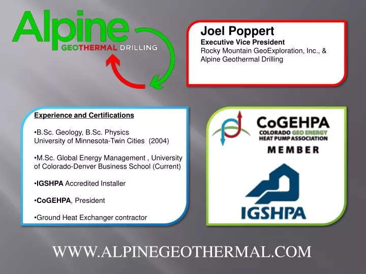
Joel Poppert Executive Vice President Rocky Mountain GeoExploration, Inc., & Alpine Geothermal Drilling. Experience and Certifications B.Sc. Geology, B.Sc. Physics University of Minnesota-Twin Cities (2004)

E N D
Joel Poppert Executive Vice President Rocky Mountain GeoExploration, Inc., & Alpine Geothermal Drilling • Experience and Certifications • B.Sc. Geology, B.Sc. Physics • University of Minnesota-Twin Cities (2004) • M.Sc. Global Energy Management , University of Colorado-Denver Business School (Current) • IGSHPA Accredited Installer • CoGEHPA, President • Ground Heat Exchanger contractor WWW.ALPINEGEOTHERMAL.COM
Analyzing Subsurface Geological Conditions: GHP Design and Vertical Borehole Installation
Introduction: Why is Subsurface Analysis So Important? • Design Considerations • Liability • Cost of Installation • Change Orders? • Schedule Preparation and Management
Tools that can be used to Analyze the Subsurface Conditions of your Project • Google Earth • Google Earth Geological Layers • Aerial View • Google Maps • Terrain • Street View • Water Well Permits • Aqua Map • Well Construction Reports • Geotechnical Site Specific Soils Report
Google Earth: Geological Map Overlay • Geological Map Overlay • Used to identify both the overburden and the underlying bedrock formations • Shows major geological structures such as fractures, faults, tilted bedrock • Can expose bedrock that could contain voids such as caves or fractures • Easy to identify glacial and river terrains
Google Earth: Aerial View • Google Earth Aerial View • Used to identify if bedrock is presence at or near the surface • Linear striations can indicate tectonic activity and dipping bedrock • Major outcropping visible indicates harder rock such as sandstone or granites • Can define glacial and river boundaries
Google Maps: Terrain View • Google Maps Terrain View • Terrain can be used to identify bedrock, alluvial fans, landslides, river and glacial deposits • Steep terrain indicates hard bedrock • Terrain inconsistent with surrounding terrain can indicate landslides, alluvial fans, and/or glacial moraines • Flat terrain in a valley indicates deeper overburden deposits • Flat terrain can also indicate horizontal bedrock such as seen in the western slope as buttes or mesas
Google Maps: Street View • Google Maps Street View • If you can’t personally visit the site, street view can be used to help visibly confirm your analysis • Can also be used to identify any site restrictions that may present difficulties for drilling operations
Water Well Permits: Aqua Map • Used to locate onsite and/or nearby water well permits #4620
Water Well Permits: Well Permit Search • Well Permit Search • Look up Permit # in Well Permit Search • Click tab Located at Bottom and Open Downloaded Documents
Water Well Permits: Construction Report • Water Well Construction Report • Review the drillers log and compare to your analysis • Does it confirm your analysis? • Are there any discrepancies? • What is the vicinity of the log to your project location? • Depth to Groundwater and Yield (GPM) • Establishes if groundwater may be present • Yield defines the volume of water in the formation • Beware; large volumes of water can come from 1-3’ fractures which will be sealed up with the grout • Sandstone tends to hold larger amounts of water that could be exposed to the loop pipe over longer depths
Water Well Permits: Construction Report • Download Construction Report • Review Driller’s Log • Look at Depth to Groundwater and Yield (GPM)
Geotechnical Subsurface Soils Report • Soils Report • Each new construction project should have this report available at your request • Gives an indication of near sub surface conditions (depths 0-45’ in many cases) • Indicates overburden thickness and type • Can determine bedrock depth and type in many cases • Valuable for estimating excavation costs and schedule
Understanding Subsurface Conditions: How it Can Impact Your Project? • Design • Reduces liability with the design • Could reduce costs by limiting over-design • Help determine the most cost effective design for the heat exchanger • Costs • Complicated geological conditions will increase installation costs • Understanding the subsurface can help identify proposals that haven't taken complicated subsurface conditions into consideration • Scheduling • Complicated subsurface conditions can affect your construction schedule • Drilling operations take up space and limit other contractors to execute their work • If it is likely potential problems may arise due to the subsurface, you can mitigate the impact to the schedule by scheduling drilling operations early or during a period that will minimize impacts to other construction activities
Thank You! Questions and Answers WWW.ALPINGEOTHERMAL.COM WWW.GOGEONOW.ORG
Relevant Links • Google Earth • http://www.google.com/earth/index.html • Google Maps • https://maps.google.com/maps?hl=en&authuser=0 • DWR Home Page • http://water.state.co.us/Home/Pages/default.aspx • Colorado Geological Survey (CGS) • http://geosurvey.state.co.us/Pages/CGSHome.aspx • Alpine Geothermal Drilling • www.alpinegeothermal.com