Download
1 / 13
130 likes | 248 Views
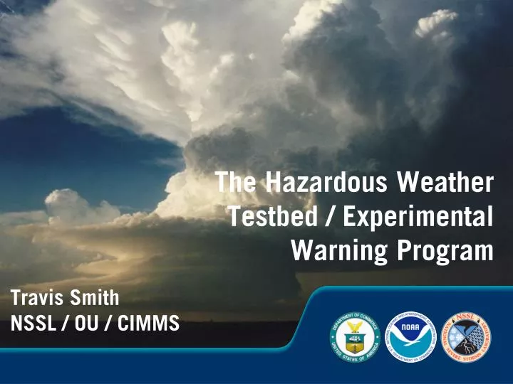
The Hazardous Weather Testbed / Experimental Warning Program. Travis Smith NSSL / OU / CIMMS. Experimental Warning Program. one half of the Hazardous Weather Testbed, focused on short-fused severe weather hazards

E N D
The Hazardous Weather Testbed / Experimental Warning Program Travis Smith NSSL / OU / CIMMS
Experimental Warning Program • one half of the Hazardous Weather Testbed, focused on short-fused severe weather hazards • EWP “Research” (NSSL / WRD / SWAT + friends) – develop severe weather warning applications and techniques to enhance warning decision-making • EWP “Operations” – collaborative evaluation of new techniques, applications, observing platforms, and technologies Warn-on-Forecast Kickoff Workshop – Feb 18, 2010
EWP Research We work at the crossroads of nearly everything in warning decision-making research. Warn-on-Forecast Kickoff Workshop – Feb 18, 2010
Near-surface reflectivity Reflectivity @ -20 C Total Lightning Density Max Expected Size of Hail (~6.5 km AGL) Example: Multi-sensor data fields • Show physical relationships between data fields from multiple sensors • Storm tracks and trends can be generated at any spatial scale, for any data fields • Future state predicted through extrapolation shows skill out to about an hour 4
EWP Operations • Forecaster / researcher collaboration • 60-70 participants • All NWS regions • International visitors • Valuable feedback! • Science and Technology showcase • Currently 6 weeks annually – could expand Warn-on-Forecast Kickoff Workshop – Feb 18, 2010
EWP Research / Operations and Warn-on-Forecast • What are the best approaches for radar data QC for assimilation into models? • How well are storm-scale processes depicted by data assimilation and model forecasts? • How will WoF information be used/visualized in NWS operations? • How will it be conveyed to the many different types of end-users? • How do we manage this paradigm shift? (deterministic versus probabilistic warning guidance)
Radar QC: current “best practices” and future capabilities Before After • Examples, not an exhaustive list: • 2D velocity dealiasing (Zhongqi and Wiener) • Staggered PRT range/velocity ambiguity reduction (Torres et al.) • Reflectivity QC neural network (Lakshamanan) • Dual-Pol Clutter Mitigation Decision algorithm (Hubbert et al.) • First step: human-QC’d data set of case studies for evaluation.
Collaborative evaluation and feedback 10 m/s updraft Ice and liquid water • Do models accurately depict: • current storm structure? • range of possible predicted storm evolutions? • How to best visualize the data? • Help forecasters understand the data
SHAVE VERIFICATION Evaluation Example: SHAVE • Phone calls to conduct surveys • Student-run, student-led • Remote high resolution verification of: • Hail • Wind damage • Flash floods
Integration into NWS operations • Integrate: • new science • new technologies • With: • new concepts of operations • new products and services HWT Collaboration (early and often!) Operational Implementation
Sociology of Probabilistic Warning Guidance • The meteorologist is the expert on interpreting the hazard and itsuncertainty. • The meteorologist cannot anticipate everyone’s exposure and response time • How can weather hazard information be made more adaptable to those that do know their own exposure and response time? Little Sioux Camp Concrete Dome Home
Getting “there” from “here” Statistics-based uncertainty / human-assisted & automated extrapolation “Warn on detection” (deterministic) Blended statistics / extrapolation w/ data assimilation NWP “Warn on forecast” Present Future WSR-88D Dual-Pol Radar GOES-R Gap-filling radar Phased Array Radar Existing storms Newly initiated convection Forecast convection (doesn’t yet exist)
The EWP “ résumé ” • Radar interpretation / analysis / visualization • Severe weather warning applications • Multi-sensor data blending and extrapolation-based nowcasting • Radar data QC / Human QC of data • Data mining of large data sets • Building enhanced verification data sets • Good relationships with many operational NWSFOs / regions (MICs, SOOs, WCMs, forecasters) • Live where research and operations meet.