Download
1 / 39
530 likes | 1.04k Views
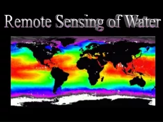
Remote Sensing of Water Resources. Lecture Notes 10 prepared by R. Lathrop 11/00 Revised 10/07. Learning Objectives. Remote sensing science concepts Understand fundamental interactions of light and water along with the effect of various constituents that determine water color

E N D
Remote Sensing of Water Resources Lecture Notes 10 prepared by R. Lathrop 11/00 Revised 10/07
Learning Objectives • Remote sensing science concepts • Understand fundamental interactions of light and water along with the effect of various constituents that determine water color • Understand how LiDAR works and potentially used to map bathymetry • How wetlands are classified • Skills • Photo-interpretation of various classes of wetlands
Reflectance of a water bodydepends on • Lu: reflectance signal at sensor • Lv: subsurface volumetric scattering • La: subsurface volumetric absorption • Lb: bottom backscattering • Lp: Atmospheric scattering • Ls: water surface scattering • Lu = [(LV + Lb )– La]+Ls + Lp
Reflectance of a water body • Lu: reflectance signal at sensor • Lv: subsurface volumetric scattering • La: subsurface volumetric absorption • Lb: bottom backscattering • Lp: Atmospheric scattering • Ls: water surface scattering • Lu = [(LV + Lb )– La]+Ls + Lp Lu Lp Incoming sunlight Ls Lv La Lb
Reflectance of a water bodydepends on • Subsurface volumetric scattering & absorption determined by H2O and constituents in the water • Water absorbs a large % of the incoming radiation, only a small % is reflected, therefore water appears dark in color and CIR imagery. • Atmospheric scattering due to haze can add greatly to the water reflecting signal. • Specular reflection off the water surface (sunglint) can obscure the water volume reflectance but can provide information on the surface sea state (wave heights and patterns).
Absorption & scattering characteristics of pure water • Minimal absorption( highest transmission) in the blue spectral wavelengths - minima near 460-480 nm • Scattering increases with shorter wavelength - maxima in the ultraviolet • Combined effects of absorption/scattering: highest reflectance in the blue visible region decreasing to very low reflectance in near ir and mid ir regions
Spectral reflectance curve of water Graphic from http://ceos.cnes.fr:8100/cdrom/ceos1/irsd/pages/intro2c.htm
Water Colora function of organic and inorganic constituents • Suspended sediment/mineral: brought into water body by erosion and transport or wind-driven resuspension of bottom sediments • Phytoplankton: single-celled plants also cyanobacteria • Dissolved organic matter (DOM): due to decomposition of phytoplankton/bacteria and terrestrially-derived tannins and humic substances
Water Colora function of organic and inorganic constituents • Suspended sediment/minerals: increases volumetric scattering and peak reflectance shifts toward longer wavelengths as more suspended sediments are added • Near IR reflectance also increases • Size and color of sediments may also affect the relative scattering in the visible
Relationship between suspended sediment concentration (SSC) in a water body and spectral reflectance: SSC Green & Red Graphic from http://www.ga.gov.au/map/east_coast/fig2.gif
Water Colora function of organic and inorganic constituents • Phytoplankton: contain photosynthetically active pigments including chlorophyll a which absorbs in the blue (400-500nm) and red (approx. 675nm) spectral regions; increase in green and NIR reflectance • Suspended sediment and DOM will confound the chlorophyll signal. Typical occurrence in coastal or Case II waters as compared to CASE I mid-ocean waters
Absorption coefficients for chlorophyll-rich green oceanic waters. aw is the absorption spectrum for clear water Note that the absorption coefficient is inverted as compared to the spectral reflectance: as CHL absorption the green, absorption in the blue and red. Decreasing reflectance Increasing absorption Graphic from http://www.ga.gov.au/map/east_coast/fig2.gif, originally from Morel and Prieur, 1977
Water Colora function of organic and inorganic constituents • Dissolved organic matter DOM: strongly absorbs shorter wavelengths (e.g., blue) • High DOM concentrations change the color of water to a ‘tea-stained’ yellow-brown color
Strong absorption by Dissolved Organic Color in the shorter blue to green wavelengths: DOC Blue Abs Blue Refl Graphic from http://www.aquabotanic.com/paper2-6.html
Water in Other Forms: Clouds and Snow • Clouds: generally high reflectance due to scattering across the visible, NIR and MidIR spectral regions • Snow: High reflectance across the visible and NIR but low in the MidIR due to absorption
Spectral Profile: Snow <> <> http://speclib.jpl.nasa.gov/forms/asp/water.htm
Note how reflectance decreases as the snow ages and compacts http://cires.colorado.edu/~maurerj/albedo/snow_reflectance.gif
Spectral reflectance of ice for remote sensing here on Planet Earth and beyond:H20, CO2 and CH4 Graphic from http://speclab.cr.usgs.gov/PAPERS.refl-mrs/refl4.html
Remote sensing of water depthand bottom type • If water is shallow and clear enough, light will be transmitted through the water column, reflect off the bottom and back through the water column to be received by the sensor. • Under these conditions the bottom type can be determined. Bright sandy bottoms and coral reefs are highly reflective and appear light. Submerged aquatic vegetation beds appear dark. • The change in water color/reflectance as one moves from shallow to deep water under consistent water volume and bottom type conditions, can be used to provide information on water depth (bathymetry).
Remote Sensing of the Benthos • Passive (Visible wavelengths) vs. Active (lidar or sonar) • Bathymetric mapping: mapping differences in depth • Bottom type mapping: detecting and differentiating different benthic habitat, from submerged aquatic vegetation to coral reefs
Example Imagery: Barnegat Bay New Jersey Quickbird Satellite Imagery (Fall 2004) Aerial Photography (Spring 2003)
Light Detection and Ranging (LIDAR) • LIDAR uses pulsed laser light to measure travel time from the laser transmitter to a target and back to determine ground surface elevation with high vertical accuracy, available as 2-D image graphic from http://soundwaves.usgs.gov/
Bathymetric LiDAR • Scanning Hydrographic Operational Airborne Lidar Survey (SHOALS) system. • SHOALS fires 2 lasers into the water: NIR & blue-green. • The NIR pulse is reflected off the water surface. • The blue-green pulse penetrates the surface and is reflected off the seafloor. • The water depth is then calculated from the time difference between the NIR surface return and the blue-green bottom return. http://shoals.sam.usace.army.mil/Pages/Welcome_to_shoals.htm
SHOALS Project Examples • Lake Worth, Florida navigational channel: 11 meters deep (dark blue/magenta) shoaling (cyan) http://shoals.sam.usace.army.mil/Pages/lake_worth.htm
NASA's Experimental Advanced Airborne Research Lidar (EAARL) Image by Robert Simmon http://earthobservatory.nasa.gov/Library/VCL/VCL_2.html • EAARL is a "multiple reflection" lidar instrument that measures the full "waveform" of the returned signal. • The unique shape of the waveform reveals where—in the space between the ground and the top of the canopy —the foliage, trunk, and branches are concentrated.
NASA EAARL Equipped with a green laser, EAARL is also useful for bathymetric and underwater topographic mapping graphic from http://gulfsci.usgs.gov/tampabay/data/1mapping/LiDAR/lidar.html
Ongoing Research Question: Can we use the EAARL system to map seagrass beds location and density in Barnegat Bay?
Wetlandslands where saturation with water is a dominating factor • Lands with predominantly hydrophytic (water-loving) vegetation cover • soil that is predominantly hydric • for areas without vegetation or soil, the land is flooded or saturated at some time during the growing season each year • Aerial photo interpretation is an important method for mapping wetlands
Wetlands classification systemCowardin et al. 1979USF&WS National Wetland Inventory • 1st level(System): marine, estuarine, riverine, lacustrine, palustrine • 2nd level (Subsystem): M/E -subtidal, intertidal R - tidal, perennial, intermittent L - limnetic, littoral • 3rd level (Class)
Wetlands classification systemClass types • rock bottom • unconsolidated bottom • aquatic bed • unconsolidated shore • moss-lichen wetland • emergent wetland • scrub-shrub wetland • forested wetland
Rock Bottom/Shore Door Peninsula, WI Tierra del Fuego, Chile
Unconsolidated Bottom/Shore Little Egg Harbor, NJ
Aquatic Bed Eelgrass bed, Barnegat Bay, NJ
Emergent wetlands Broad-leaved herbaceous vegetation Grass-sedge-rush vegetation
Emergent wetland: saline marsh Great Salt Lake, Utah Sheepshead Meadows, NJ
Emergent Wetlands: Phragmites around the world Great Salt Lake, UT Cheesequake, NJ Hampshire coast, UK
Scrub/shrub wetland Everglades, FL Scrubby tree islands Coastal Mangrove swamps
Forested Wetland Deciduous-dominated (red maple swamp) Pine Barrens, NJ Coniferous-dominated (A. white cedar swamp) Pine Barrens, NJ