Download
1 / 21
220 likes | 484 Views
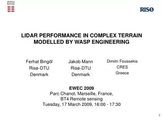
COMPARISON OF A PULSED DOPPLER LiDAR WITH A 200 M MET MAST IN COMPLEX TERRAIN. Tobias Klaas 1 , Doron Callies 1 Christoph Langenmayr 1 ,Lukas Pauscher 1 , Saskia Hagemann 1 , Zouhair Khadiri-Yazami 1 , Bernhard Lange 1 (1) Fraunhofer IWES, Kassel, Germany . Outline.

E N D
COMPARISON OF A PULSED DOPPLER LiDAR WITH A 200 M MET MAST IN COMPLEX TERRAIN Tobias Klaas1, Doron Callies1 Christoph Langenmayr1,Lukas Pauscher1, Saskia Hagemann1, Zouhair Khadiri-Yazami1, Bernhard Lange1(1) Fraunhofer IWES, Kassel, Germany
Outline • Measurement site at Rödeser Berg • Site description, measurement campaign, data basis • LiDAR measurements in complex terrain • Performance of LiDAR vs. mast measurements • Correction with WAsP Engineering and Meteodyn WT • Predicted bias compared to measured difference • Virtual met mast • Conclusion and Outlook
Forest Project „Utilization of Inland Wind Power“ • Complex Terrain • New onshore windturbines • Mesoscale modelling • Project duration 2012 – 2014 • Wind characteristics, LiDAR measurements, onshore wind energy potential Source: Die Auswärtige Presse, 2011 Source: RP Kassel, 2012
Measurement location in central Germany measurement site Source: Google Earth • Wind measurements in complex terrain at Rödeser Berg • Typical wind farm location in central / south Germany
Mast layout and specifications • 200 m wind measurement mast in complex forested terrain • IEC conform booms with 5,40 m length, orthogonal to main wind direction • 13 measurement heights • Co-located LiDAR measurements with LEOSPHERE Windcube WLS7 V1
Measurement campaign and data processing • Mast - LiDAR comparison • Measurement period: 21 Jan – 30 June 2012 • Periods of icing were removed by visual comparison of heated vs. unheated cups • Invalid and/or physically unreasonable values were removed • Measurements are compared at 120, 160 and 200 m • Mean wind profile • Scatter plots and linear regression • Diurnal pattern • Directional dependence of bias • Due to terrain complexity and wind LiDAR measurement principle we expect significant bias.
LiDAR availabilitywithheight • More than 80% of measured valuesin 10 minute averaging interval must be available • Periods of rain were removed • Availability decreases with height: • 85 % at 135m • 60 % at 200m
LiDAR vs. mastmeasurements:Mean wind profile • Mean profile fits well, LiDAR shows small underestimation • Strong effects from forest and terrain below 60m height
LiDAR vs. mast measurements:scatter plot at 120 m and 200 m • Compared to flat terrain (Hovsøre) the scatter is significantly higher Source: Gottschall, Courtney 2010
LiDAR vs. mastmeasurements:Diurnal variationat different heights • Significant diurnal pattern at all heights • Deviations between mast and LiDAR increase during nighttime
LiDAR vs. mastmeasurements:Directionaldependenceat 120 m only wind speeds > 4m s-1 • Mean bias approx. between -4% and +2%
LiDAR vs. mastmeasurements:Directionaldependenceat 120 m only wind speeds > 4m s-1 • Positive deviation for flow along the ridge
LiDAR vs. mast measurements:Directional dependence at 120 m only wind speeds > 4m s-1 • Significant underestimation in main wind direction
LiDAR vs. mast measurements:Directional dependence with height Lightningrod only wind speeds > 4m s-1 • Shape and mean bias similar for all heights • Height dependency of about 1%, depending on sector
LiDAR correction with flow simulation measurement site • LiDAR measurement bias is mainly caused by flow inhomogeneity • Flow simulation can be used to assess the wind conditions and develop correction methods • WAsP Engineering with Bingöl‘s correction script • Meteodyn WT and LiDAR correction module main wind dir. Source: Bingöl 2009
Comparison of different correction algorithms to measured bias • WEng estimation is much too high, but the pattern is reproduced • Bias estimated by Meteodyn WT fits much better, but is slightly too low
Correction with Meteodyn WT:Predicted bias for three heights • Less symmetry in estimation due to CFD simulation • Height-dependency of bias for certain sectors
Realization of a virtual met mast using three Pulsed Doppler LiDARs • Three Windcube v1 LiDARsmounted on maneuverable tilting platforms • Focusing of the three laser beams on one point • Automatically measuring heights from 40m to 200m • Results were compared to the 200m mast at Rödeser Berg
Conclusions • LiDAR shows error in complex terrain: • Patterns follow orography, effects are site specific • Deviation follows same pattern at all heights (up to 200m!) • Deviations approx. between -4% and +2% • Compensating effects in mean wind profile • Deviations during night time • Meteodyn and WEng correction: • Shape of predicted bias fits (fairly) well for both tools • Bias predicted by WEng is much too high • Very good reproduction of bias by Meteodyn WT
Outlook • Detailed evaluation of flow models at complex site with mast data • Different stabilities • Different forest/roughness parameterization • LiDAR vs. Mast in complex terrain at several other complex sites • More complex sites, more forested sites • Evaluation of different CFD-tools for LiDAR correction • Meteodyn WT / WindSim / WEng / OpenFoam • 3D-LiDAR experiments • Detailed comparison of virtual vs. real met. mast
Do not miss our related posters and presentations: • Pauscher, Lukas: Wind over complex, forested terrain: First year of measurement with 200m research mastTuesday, 5 February 2013 , Room: LEHAR 2-4 , 11:00 - 12:30 Wind Resources - Moving the barriers (part 1) • Khadiri-Yazami, Zouhair: The realization of a Virtual met mast based on three Doppler wind LiDAR, Poster No. 404 Thank you for your attentionVisit us at stand B-B77! M. Sc. Tobias Klaas Tobias.Klaas@iwes.fraunhofer.de Fraunhofer Institute for Wind Energy and Energy System Technology IWES Königstor 59, 34119 Kassel, Germany