Download
1 / 40
400 likes | 408 Views
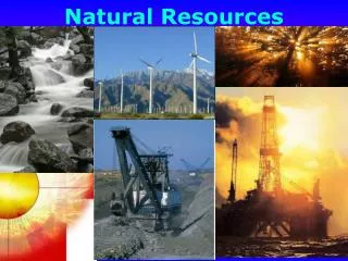
Explore the geological processes of continental drift, plate tectonics, weathering, and erosion that have shaped Central Texas' natural resources. Discover how these processes have created rivers, lakes, farming soils, hills and valleys, and valuable minerals like iron, coal, oil, gas, and uranium.

E N D
Earth’s crammed with heaven, And every common bush afire with God; But only he who sees takes off his shoes, The rest sit round it and pluck blackberries. Elizabeth Barrett Browning The Phantom Science: How Geology Created the Amazing Natural Resources of Central Texas Geological Resources Don Beaumont Texas Master Naturalists Land of Good Water Chapter March 23, 2010
Geological Resources Rivers and River Flood Plains Farming soils Hills and Valleys Grazing & farming soils How does geology provide these resources? Rivers, lakes, & ground water Water Rocks Iron, coal, oil & gas, and uranium
How does geology create natural resources? Four geological processes 1. Continental drift 2. Plate tectonics 3. Weathering 4. Erosion Five geological events Four Geological Processes 1. Continental Drift 1. Continental Drift positions the continents 2. Plate Tectonics shapes the continents 3. Weathering makes soils 4. Erosion creates topography & exposes ores 5. Glaciers determine human distribution
Continental Drift The slow movement of the crustal plates over the face of the earth
Continental Drift: Last 250 million years Present Day Four Geological Processes 2. Plate Tectonics http://schools.techno.ru/sch518/koridor/geograf /detrab/Tektonika/litosfera2.htm 250 million years ago
2. Plate Tectonics The deforming of continents as they move & when they collide Types of deformation: warping = major river systems crushing & melting = mountain ranges
2. Plate Tectonics Plate motion = warping = major rivers Plate collision = crushing & melting = mountain ranges Four Geological Processes 3. Weathering Crushing & melting Down warp
Four Geological Processes 3. Weathering The natural destruction of the surface of the earth’s rocky crust Weathering produces rock debris: 1. Clays combine with decaying organic matter to make soils 2. Clays, Ca solutions, & sand are carried by rivers to the continental margins Bed Rock (soils) of Texas
Bed Rock (soils) of Texas Each rock (color) weathers into a unique soil
Vegetational Areas of Texas Grand Prairies Blackland Prairies Four Geological Processes 4. Erosion Williamson County Edwards Plateau Similar soils produce these vegetational areas
4. Erosion The transport of weathered debris by water to the continental margins Erosion: 1. creates topography 2. exposes ores and oil at or near the earth’s surface 3. creates river flood plains Erosion Created Topography of Texas
Erosion Created Topography of Texas Plateaus Erosion Exposed Natural Resources that Shaped Human History Coastal Plains & Flood Plains Mountains
Erosion Exposed Natural Resources that Shaped Human History Flood Plains Created by Rivers Carrying Clays & Sand to the Ocean Iron , coal , and oil exposed by erosion in Texas
Flood Plains Created by Rivers Carrying Clays & Sand to the Ocean Five Geologic Events that Shaped Human History Major river floodplains
How does geology create natural resources? Four geological processes 1. Continental drift 2. Plate tectonics 3. Weathering 4. Erosion Five geological events that shaped the history of Texas 1. Continental Drift positions our continent 1. Continental Drift positions our continent 2. Plate Tectonics shapes our continent 3. Weathering makes our soils 4. Erosion creates our topography & exposes our ores 5. Glaciers determine human distribution
Five Geologic Events that Shaped Human History Continental Drift positioned Central Texas: A. determining when humans would arrive B. creates two limestones rocks: aquifers & springs Determining the migration path of humans
How has continental drift shaped human history? Next: How Plate Tectonics shaped human history? Eastern Hemisphere Western Hemisphere Created the Western and Eastern Hemispheres Critical to the migration of humans out of Africa
Five Geologic Events that Shaped Human History • Continental Drift shapes & positions the continents • Migration path of humans created 2. Plate Tectonics shapes the continents: A. Determines location of early nations 2. Plate Tectonics shapes the continents: A. Determines location of early nations B. Creates new rivers in Texas & muddy limestones = good farming soils C. Creates sandstone/shale rocks in Texas with coal
Geological Event # 2: 6000 mile mountain range created by Africa & India colliding with Eurasia Yellow Yangtze Tigris Euphrates Ganges Nile Indus Conclusions: Early civilization grew in: 1. the Northern Temperate Zone 2. major river flood plains Ideal trend for the early development of large scale farming civilizations Why no major nations in Texas?
Flood Plains Created by Rivers Carrying Clays & Sand to the Ocean Area adversely affected by the melting of the most recent continental glacier: 1. flooded with debris choked melt-water 2. hostile cold climate Plate Tectonics creates two limestones with aquifers, caves, and springs in Central Texas Major river floodplains Why no major nations in this Temperate Zone Flood Plain?
Five Geologic Events that Shaped Human History Continental Drift positioned Central Texas: A. determining when humans would arrive B. Plate Tectonics creates two limestones with aquifers, caves, and springs in Central Texas
Mid-Cretaceous: 90 million years ago Edwards Limestone Time So what is a limestone? Shallow water Edwards limestones forming in Texas Beach in southern Oklahoma No nearby rivers with mud & silt = pure limestone Area of Edwards Limestone Tropical Climate Zone
Typical Limestones in Sun City, Texas A dense limestone, no obvious shells, made of lime mud A limestone reef composed of rudists and many other shell fish. Just what is a limestone?
Limestones are Rocks Made of Sea Shells Limestones (CaCO3)Mineral: calcite Back to the Edwards Limestone formed in an ancient, tropical, island paradise Shells & Shell Debris (majority marine)
Paleogeographic Map: Gulf of Mexico Sun City Florida Texas Extent of the Edwards Limestone A modern example: the Great Barrier Reef of Australia
The Great Barrier Reef of Australia Shallow Ocean Environments = Limestone Facies Great Barrier Reef A modern equivalent of the Edwards
Shallow Ocean Environments = Limestone Facies Reef & Reef Mound Shells A Typical Limestone Formation Shell Debris Shell mud Composite
Cartoon of a Typical Limestone Formation Remember the Rudist Reef Rocks? Each bed contains one or more environments Scale: beds from inches thick to 10’s of feet thick
Remember the Rudist Reef Rocks? What is a rudist and how do they form reefs?
Rudists are Horn-shaped Sea Shells Rudists grow in colonies (reefs) Rudist forming Reefs: Typical of Cretaceous Limestones Rudist shells are very fragile so they are often destroyed by weathering leaving a cone shaped hole Edwards Limestone has thick (up to 50 feet thick) layers (beds) composed of RUDIST REEFS and REEF DEBRIS MOUNDS
A Rudist Reef Rock Outcrop The cavities in reef limestones often make: 1.good aquifers, 2. springs, 3. caves. Each hole was occupied by a rudist shell fish
Lower Cretaceous Edwards Limestone Reef Blue Hole City Park
Edwards Limestone Reefs and Caves I-35 Access Road Cut at Leander Road Reef spring water filled aquifer
A Cave in a Limestone Layer Cave formed by ground water solution of the Limestone Let’s look at a cartoon of a limestone cave
Block Diagram of Mammoth Cave Back to the Five Geologic Events that Shaped Human History (esp. in Texas)
Five Geologic Events that Shaped Human History • Continental Drift shapes & positions the continents • Migration path of humans created 2. Plate Tectonics shapes the continents: How are continents shaped? 1. mountain building 2. broad down-warping 3. broad up-warping 1. mountain building
Creating a Geologic Model for Mountain Building Mountain Building: When two crustal plates collide
Crustal Plates: Both Oceanic & Continental Continents are carried on their crustal plate
Mountain BuildingPlate Tectonic TheoryThree Types of Plate Collisions Mountains Continent Continent Oceanic Plate Continent Oceanic Plate Oceanic Plate