Download
1 / 22
350 likes | 779 Views
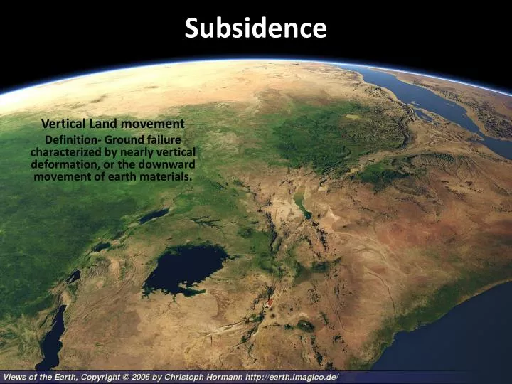
Subsidence. Vertical Land movement Definition- Ground failure characterized by nearly vertical deformation, or the downward movement of earth materials. Subsidence Processes. Dissolution Permafrost melting Sediment and soil compaction Sediment loading Expansive soils Earthquakes

E N D
Subsidence Vertical Land movement Definition- Ground failure characterized by nearly vertical deformation, or the downward movement of earth materials.
Subsidence Processes • Dissolution • Permafrost melting • Sediment and soil compaction • Sediment loading • Expansive soils • Earthquakes • Deflation of magma chambers
Dissolution • Karst topography – rough, uneven topo developed through surface and subsurface dissolution of Lm • Sinkholes • Cone-shaped collapse pits • Cavern systems • Diss along joints, fracture and bedding planes • Disappearing streams • Springs • Groundwater discharge at topo surface intersection
Guilin - one of China's top tourist attractions • Night mission danger in Vietnam during war • A submerged tower karst on the coast of Thailand - setting for scenes in the James Bond films Man with the Golden Gun and Tomorrow Never Dies • Less spectacular examples occur in Cuba and Puerto Rico Dissolution • Tower karst – • large, steep limestone remnants rising above local topographic levels • Rapid dissolution in a tropical environment
Thermokarst • Climate change • > temps in Arctic regions • Natural (climate change) • Man-made structures • Permafrost layer melting • > discharge in nearby rivers and streams • Weakening of substrate = < support for structures • Release of trapped methane
Coastal Erosion and Lake Evolution Near Cape Halkett, Alaska
Sediment loading and soil compaction • Fine sediment • Rapid deposition • Trapped water in voids, beds and grain layers • Soft-sediment deformation • Deltas • Flood plains • Basins - > seds = > weight = depression of crust • Organic soils • Marsh, bogs, swamps • High vegetation content • Drought removes water allowing compaction
Swelling clays • Smectite • Clay mineral group mostly derived from weathering of mafic volcanic rocks • Montmorillonite • Smallest clay crystals • Largest surface area to attract H2O • Bentonite – clay formed from alteration of volcanic ash • Climate • Wet/dry cycles – soil heaving • Drought • Vegetation • Draws water out of nearby clays resulting in shrinkages
Earthquake subsidence • Subduction zones • Descending plate lock-up • Over-riding plate buckling • Flooding of lowlands • Graben structures • Opposite facing normal faulting • Narrow elongate basins • Sediment filling • Continental rifting • Crustal thinning • Opposite facing normal faults • Creation of sed. basins, lakes • Shallow inland seas (transgressions) • Proto-ocean basins • Associated mafic volcanics
Earthquake subsidence • Subduction zones • Descending plate lock-up • Over-riding plate buckles • Flooding of lowlands
Earthquake subsidence • Graben structures • Opposite facing normal faulting • Narrow elongate basins • Sediment filling • Thingvellir Graben, Iceland
Earthquake subsidence • Thingvellir Graben, Iceland • Elevation model of area made for display
Volcanic subsidenceSantorini IsleMinoan Caldera • Calderas • Voidance of magma chambers • Volcanic collapse • Oceanic crust subsidence • Plate movement away from MOR’s • Cooling and sinking of new crustal material • Deep ocean basins
Regional hazards • Karst landscapes • Permafrost regions • Coastal areas • Continental rifts zones • Mining and oil/gas regions • Arid regions • Groundwater pumping
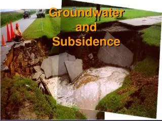
Effects of subsidence • Sinkhole collapse • Groundwater conditions • Melting permafrost • Coastal flooding and wetland loss • Expansion/contraction of soils
Linkages • Earthquakes • Volcanoes • Climate change • Flooding • Coastal erosion
Natural Service Functions • Water supply -25% of world supply; 40% U.S. • Karst aquifers • Pools during drought • Springs • Aesthetic and scientific resources • China • Caverns • Great Blue Sinkhole, Belize • Unique ecosystems • Extreme environment organisms
Human interactions • Groundwater retrieval • Mining • Hulubeir Grasslands – Coal mining • Construction in permafrost areas • River/delta channelization • Draining organic soils • Construction/landscaping
Minimizing subsidence hazards • Artificial fluid removal/recharge • Mining regulation • Construction and zoning laws • Levee breaching
Perception • Perception • Not a problem • Ignoring future groundwater problems • Adjustment • Geologic mapping • Surface features • Subsurface surveys
San Joaquin Valley • USGS: Approximate location of max subsidence in the US • Research efforts by Dr. Joseph F. Poland (pictured) • Signs on pole show approximate altitude of land surface in 1925, 1955, and 1977 • San Joaquin Valley southwest of Mendota, California • Compaction of unconsolidated aquifer systems accompanied excessive ground-water pumping • Resulted in permanent subsidence and related ground failures
SW US Subsidence levels • Arizona • Eloy 15ft • W of Phoenix 18ft • Tucson <1ft • Nevada • Las Vegas 6ft • California • Lancaster 6ft • SW of Mendota 29ft • Davis 4ft • Santa Clara Valley 4ft • Ventura 2ft • Texas • El Paso 1ft • Houston 9ft • New Mexico • Albuquerque <1ft • Mimbres Basin 2ft Y-fissure, Queen Creek, Az.