Download
1 / 28
280 likes | 299 Views
WindSat, also known as CMIS, is a satellite measuring ocean surface wind speed, direction, and more. Launched in January 2003, it provides valuable data to various agencies. Explore its capabilities, improvements, and calibration methods for accurate readings.

E N D
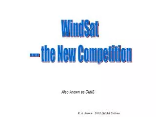
WindSat --- the New Competition Also known as CMIS R. A. Brown 2005 LIDAR Sedona
Radiometers Passive Radars Basic Concepts for The Radiometer R. A. Brown 2005 LIDAR Sedona
Same principal as Scatterometer but signal is much weaker Hence: speed only from SMMR, SSMI,….. R. A. Brown 2003 U. ConcepciÓn
Solar reflectance Brightness Temperature Two looks at the same spot R. A. Brown 2004
What is Ocean Observer? • Operational data for Navy and NOAA • Science data for NASA and NOAA • R&D sensor proof of concept for NASA • Operational transition for NASA and NOAA • Team approach to solving mutual problems at for OMB • Oceans mainly reduced agency cost
NPOESS WindSat becomes CMIS
Atmospheric Vertical Moisture Profile Downward Longwave Radiance (Sfc) Precipitable Water Electric Fields Precipitation Type/Rate Atmospheric VerticalTemperature Profile Imagery EDPs/Ionospheric Specification Pressure (Surface/Profile) Sea Surface Temperature Fresh Water Ice Radiation Belt/Low Energy Particles Sea Surface Winds Geomagnetic Field Sea Ice Age and EdgeMotion Soil Moisture Ice Surface Temperature Sea Surface Height/Topography Aerosol Optical Thickness In-situ Ion Drift Velocity Snow Cover/Depth Aerosol Particle Size In-situ Plasma Density Solar EUV Flux Albedo (Surface) In-situ Plasma Fluctuations Solar Irradiance Auroral Boundary In-situ Plasma Temperature Solar/Galactic Cosmic Ray Particles Auroral Imagery Insolation Supra-Thermal - Auroral Particles Cloud Base Height Ionospheric Scintillation Surface Wind Stress Cloud Cover/Layers Land Surface Temperature Suspended Matter Cloud Effective Particle Size Littoral Sediment Transport Total Auroral Energy Deposition Cloud Ice Water Path Net Heat Flux Total Longwave Radiance (TOA) Cloud Liquid Water Net Short Wave Radiance (TOA) Total Water Content Cloud Optical Depth/Transmittance NDPs/Neutral Atm Specification Turbidity Cloud Top Height Normalized Difference Vegetation Index Upper Atmospheric Airglow Cloud Top Pressure Ocean Color/Chlorophyll Vegetation Index/SurfaceType Cloud Top Temperature Ocean Wave Characteristics Currents (Ocean) Ozone - Total Column/Profile Environmental Data Records (EDRs) with Key Performance Parameters VIIRS CMIS OMPS SESS GPSOS ERBS TSIS ALT CrIS/ATMS Primary Contributions to EDRs by Sensor
Joint IPO/DoD/NASA Risk Reduction Demo WindSat/Coriolis (A stealth mission) Description:Measures Ocean Surface Wind Speed, Wind Direction, Using Polarimetric Radiometer on a Modified Satellite Bus, Launched Into a 830 km 98.7° Orbit by the Titan II Launch Vehicle. 3 Year Design Lifetime. ? Launched: January 2003 Data release: Sept. 2004 • Capability/Improvements • Measure Ocean Surface Wind Direction (Non- Precipitating Conditions). Two looks at same spot. • 25km spatial resolution • Secondary Measurements • Sea Surface Temperature, Soil Moisture, Rain Rate, Ice, and Snow Characteristics, Water Vapor R. A. Brown 2004
Neil Tyson’s address/campaignOn the Future of NASA Jan 20, 2005 President’s commission --- “Vision” (thing) • Winners:Space Exploration • Planetary Science • Astrobiology • Astrophysics • Astronomy • Losers:Einstein prerogatives • Earth Science “LEO (low earth orbits) are old hat and boring. NASA must do new stuff – space” R. A. Brown 2005 LIDAR Sedona
WindSAT Cal/Val with SLP Retrievals Ralph Foster, Applied Physics Laboratory, U. WA Jerome Patoux, R.A. Brown, Atmospheric Sciences, U. WA R. A. Brown 2005 LIDAR Sedona
Outline • Two questions: • How well does WindSAT perform when it’s working at its best? • Can Sea-Level Pressure (SLP) fields help improve model function and ambiguity selection? • Physics of SLP(U10) • QuikSCAT example • Methodology • WindSAT results • Comparison with ECMWF SLP Analyses & QuikSCAT wind distributions • Ambiguity selection procedure R. A. Brown 2005 LIDAR Sedona
SLP from Surface Winds • UW PBL similarity model • Use “inverse” PBL model to estimate from satellite • Use Least-Square optimization to find best fit SLP to swaths • Extensive verification from ERS-1/2, NSCAT, QuikSCAT (UGN ) (UGN ) R. A. Brown 2005 LIDAR Sedona
Surface Pressures QuikScat analysis ECMWF analysis
Surface Pressure as Surface Truth • For good quality and consistent U10 input, SLP fields are a good match to ECMWF analyses • SLP/Model-derived U10 is an “optimally smoothed” low-pass filtered comparison data set • Wind-sensor derived product only • Model U10 tend to agree with input U10 for good swath input • If SLP fields are wrong, pressure gradients and hence U10 are wrong. R. A. Brown 2005 LIDAR Sedona
Dashed: ECMWF
Dashed: ECMWF
Results • WindSAT is biased high for U10 ~ < 8 m/s • Too few winds U10 < 5 m/s • Too many winds 5 < U10 < 8 m/s • Implied grad(SLP) too high when U10 ~< 8 m/s • Implications for assimilation in NWP • Too few WindSAT winds in 8 < U10 < 12 m/s • Comparable to QuikSCAT 12 < U10 < 15 m/s • SLP agrees better in higher wind regime • Too small sample to assess higher winds R. A. Brown 2005 LIDAR Sedona
Use SLP to Assess Direction • Winds derived from SLP are optimal smooth winds • Arbitrary threshold of 35o from Model U10 used to distinguishpotentially wrong ambiguity choice • Look for a WindSAT ambiguity with closer direction to Model winds in these cases R. A. Brown 2005 LIDAR Sedona
Noisy directions • Front captured • Changed ambiguities away from clouds & low winds: Why?
Conclusions • There is a lot of wind vector information in the WindSAT swaths • The agreement of the WindSAT-derived SLP fields with ECMWF is surprisingly good for a first-cut model function. • Better in higher winds • An improved model function will produce better SLP • SLP can be used to assess and improve the WindSAT wind data R. A. Brown 2005 LIDAR Sedona
Conclusions (cont.) • SLP fields demonstrate that the current WindSAT model function often produces a poor wind speed distribution • Wind speed distribution can be robustly evaluated with SLP • Storm analyses will address high wind distribution • Wind directions are noisy and there there is room for ambiguity selection improvement. • SLP shows promise for this need R. A. Brown 2005 LIDAR Sedona
Next • SLP adds the robust ECMWF & NCEP surface analyses and buoy pressure observations to the WindSAT Cal/Val data • We are developing methods to use buoy/analysis pressures to identify & correct deficiencies in model function, e.g. Zeng and Brown (JAM37 1998) • Continue development of SLP ambiguity selection procedure • Combining SLP with water vapor, clouds & SST will greatly improve storms and fronts research and analysis R. A. Brown 2005 LIDAR Sedona


![Mastodon [also known as Mammut]](https://cdn1.slideserve.com/2690525/mastodon-also-known-as-mammut-dt.jpg)