Download
1 / 45
470 likes | 619 Views
Comparison of Network and State Space DGPS Services Real Time Tidal Monitoring for Seismic Data Collection Applications Richard Barker and Dariusz Lapucha Fugro Chance Inc. OVERVIEW. DGPS Positioning Services The Big Solar Event of Cycle 23 in 2003 Tidal Determination Using dDGPS

E N D
Comparison of Network and State Space DGPS Services Real Time Tidal Monitoring for Seismic Data Collection Applications Richard Barker and Dariusz Lapucha Fugro Chance Inc.
OVERVIEW • DGPS Positioning Services • The Big Solar Event of Cycle 23 in 2003 • Tidal Determination Using dDGPS • Normand Tonjer Seabed Mapping and Cable Route Survey Project at 71 Degrees N • 3D Seismic Data Processing With and Without Tidal Compensation
GPS ACCURACY • Stand Alone GPS: +/- 10m • No Augmentation • Differential GPS (DGPS): Sub meter - 3m • Code Error Computation • Decimeter dDGPS: 10 - 15cm H, 15 – 45cm V • GPS Carrier Phase • Network or State Space Solutions • Real Time Kinematic: cm at short range • RTK Integer Resolution
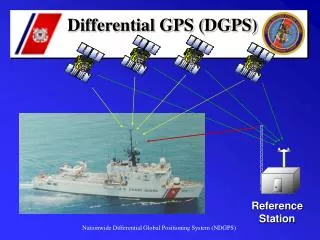
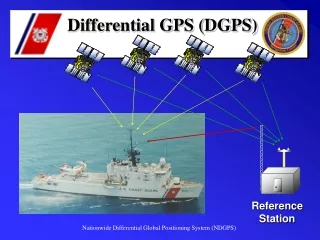
WHY DIFFERENTIAL GPS Differential GPS – DGPS / dDGPS • Increased level of position accuracy over stand alone or autonomous GPS by use of satellite range corrections from a reference receiver at a known location • Common error sources between reference and remote or user receiver are removed (e.g. iono, tropo, clock) • Remain subject to spatial (distance) and temporal (time) decorrelation (e.g. orbit errors and S/A) • .01 to 3 meter positioning possible depending on range and method (Integer RTK, Float RTK or standard DGPS)
Trim 212 Lafayette (30°13'12.501 "N 92° 3'19.685 "W) STAND ALONE GPS PERFORMANCE
Trim 212 W 750 RTCM Lafayette (30°13'12. 501 "N 92° 3‘ 19.685 "W) SINGLE SITE DIFFERENTIAL
STARFIX / SkyFix dDGPS SERVICES • Starfix GSS / SkyFix XP • Uses JPL Reference Network and Data Stream • Broadcast of Orbit and Clock corrections • Valid Globally • GSS/XP must separate Orbits/Clocks correctly, account for Earth Tide, Ocean Loading, Satellite Phase Windup etc… • Starfix HP • Independent Service From GSS/XP • Service Region Network Solution • Higher Vertical Accuracy
CHARACTERISTICS OF FUGRO HIGH ACCURACY PHASE BASED dDGPS SYSTEMS • GPS Code and Phase are Independent Observables • Code More Susceptible To: • Multipath • Reacquisition errors, e.g. during scintillations • State Space – Orbits and Clocks • Reference station independence • Less sensitivity to ionospheric problems • Network Solution • Higher Accuracy: Un modeled error reduction
JPL REFERENCE NETWORK DISTRIBUTION 30 Reference Stations
85 Reference Stations HP NETWORK SERVICEDEPLOYMENT 50 HP Stations World Wide
STARFIX HP LAFAYETTE 1 Sigma East = 3cm, North = 2cm, Vertical = 6cm
STARFIX GSS LAFAYETTE 1 Sigma East = 7cm, North = 5cm, Vertical = 8cm
SkyFix XP LAFAYETTE 1 Sigma East = 13 cm, North = 10 cm, Vertical = 14cm
OSLO STARFIX HP SOLUTION HP dDGPS Oslo NO (58°48‘38.0486"N 5°40’23.9901"E) 1 Sigma East = 4cm, North = 4cm, Vertical = 10cm
1 Sigma East = 4cm, North = 6cm, Vertical = 18cm OSLO STARFIX GSS SOLUTION
RMS = 4 cm East, 3 cm North, 8 cm Vertical JPL RTG PROCESSED DATA
UNIVERSITY OF SOUTHERN MISSISSIPPI TEST RESULTS(FROM ION GPS GNSS 2003) • Long Term Static Tests July 25 - August 7, 2003
http://science.msfc.nasa.gov/ssl/pad/solar/images/ssn_predict_l.gifhttp://science.msfc.nasa.gov/ssl/pad/solar/images/ssn_predict_l.gif SOLAR CYCLE 23
SOLAR EVENT OCTOBER 28/29, 2003 http://www.sec.noaa.gov/ftpmenu/plots/kp.html
IONOSPHERIC DELAY CALCULATION ct=f22/(f12- f22 )*(PR2-PR1) Iono=tREF- tMOB Ionosphere tREF Ref Stn Single Frequency System: tREF and tMOB ionospheric delay calculated from a model (Klobuchar) Dual Frequency System: tREF and tMOB delay calculated from dual frequency GPS measurements (Delay=40.3 *TEC/c*f2) tMOB Mobile
DIFFERENTIAL GPS WORKS BECAUSE … • Modern GPS receivers have high measurement precision and accuracy providing consistency between reference and rover receivers • At short ranges (< 50 km) most errors are correlated and canceled (Kinematic GPS cm level positioning) • At long ranges (> 500 km) many errors can be removed by DGPS / dDGPS Network and State Space (Orbit / Clock) methodology providing meter to decimeter level accuracies • With a “GOOD” GPS constellation the DGPS solution is statistically robust and reliable Any changes to the operating environment which adversely impacts the fundamentals will limit operational success.
BASELINE PLOT BELEM-RECEFE OCT 30, 2003 (1700 KM) Single Frequency DGPS : 12.8 m 95%Horizontal Starfix Plus: 1.2 m 95%Horizontal
Real Time Tidal Monitoring for Seismic Data Collection Applications
TIDAL DETERMINATION To Compute Real Time Observed Tide You Need: • Accurate vertical GPS ellipsoid height measurement • Mean Sea Surface (MSS) model relative to ellipsoid • Position of GPS antenna reduced to vessel reference • Heave and Draft correction to produce ‘Calm Sea’ height Difference between MSS and Calm Sea is observed tide Advantages: • More accurate than predicted tides • Repeatable reference to MSS • No offshore tide gauge and accompanying support
HPel = HP antenna Height Hel = Vessel Reference Point Height CSHel = Calm Sea Height MSSel = Mean Sea Surface OT = Observed Tide AVO = Average Vertical Offset PT = Predicted Tide HPel = HP antenna Height Hel = Vessel Reference Point Height CSHel = Calm Sea Height MSSel = Mean Sea Surface HPel = HP antenna Height HPel = HP antenna Height Hel = Vessel Reference Point Height CSHel = Calm Sea Height HPel = HP antenna Height Hel = Vessel Reference Point Height Height Calm Sea Wave Motion Predicted Tide GPSel Hel OT CSHel PT MSS Model (MSL) Geoid MSSel Gel Ellipsoid Time 12 hours AVO TIDAL DETERMINATION
TIDAL DETERMINATION • GPS measures Ellipsoid heights • Reduced to reference point and wave-movement removed • Mean Sea Surface (MSS) model applied to get sea level reference • MSS models are available • Geoid differ from MSS by 1m GPSel = GPS Antenna Height Hel = Vessel Reference Point Height CSHel = Calm Sea Height MSSel = Mean Sea Surface OT = Observed Tide AVO = Average Vertical Offset PT = Predicted Tide • Predicted tide used to calculate Average Vertical Offset (AVO) • If no predicted tide is available, the AVO is the tide
NORMAND TONJER PROJECT AT SNØHVIT 71 DEGREES NORTH Seabed Mapping and Cable Route Survey, June 2002
NORMAND TONJER PROJECT 100 km From: ”The Use of GPS Heights for Offshore Charting Purposes” Arne E. Ofstad – The Norwegian Hydrographic Service Jan Didrik Andersen – DeepOcean AS Havbunnskartlegging og inspeksjon, Geilo, February 2003
RAW DATA HEIGHT COMPARISON • 2 - Meter Change in Ellipsoid Height in 100 km • Between about 23rd June 19:00 UTC and 24th June 02:00 UTC, the vessel sailed more than 100 km from the Snøhvit field towards Hammerfest, this is reflected in the drop of 2 m in the ellipsoid height measured by dDGPS • dDGPS Raw Height • The difference in the point to point real time raw data agree to within 0.28 m (95%) (35 hours data) in height with independent water level estimates using tidal gauges • Use of Tidal Gauges • The difference between using and not using offshore tidal gauges amounts to about 0.5 m in the accuracy of height determination in this region
dDGPS Height above Sea level and Starfix MSS calculation dDGPS Height Starfix MSS External Tide Data NORMAND TONJER PROJECT
dDGPS MSS versus External Tidal Data NORMAND TONJER PROJECT
PROCESSED DATA COMPARISON • Real Time Tide Determination • Using a real time tide determination SW (here in replay mode), the difference in the point to point real time tide data agree to within 0.22 m (95%) in height with independent water level estimates using tidal gauges • Inaccuracies in External Tidal Information? • Some of the differences are likely to be due to inaccuracies in the externally estimated tide. GPS derived tidal information is independent of external data • Mean Sea Surface • In this project the geoidal data was based on the NKG96 Geoidal Model (Norwegian Mapping Authority). There are worldwide Mean Sea Surface models based on satellite altimetry available today, that can be used to reference measured ellipsoidal heights to the sea level
Static Shift Seismic Data Processing by Veritas DGC Ltd., London 3D SEISMIC SURVEY SPRING 2002JOB1 NEAR OFFSET CUBE TIMESLICE
Reduced Static Shift Seismic Data Processing by Veritas DGC Ltd., London JOB1 NEAR OFFSET CUBE TIMESLICE WITH TIDAL CORRECTIONS
Static Shift Seismic Data Processing by Veritas DGC Ltd., London 3D SEISMIC SURVEY SPRING 2002 WITHOUT TIDAL CORRECTIONS
Reduced Static Shift WITH TIDAL CORRECTIONS Seismic Data Processing by Veritas DGC Ltd., London
Seismic Data Processing by Veritas DGC Ltd., London Static Shift 3D SEISMIC SURVEY SPRING 2002 JOB 1 NEAR OFFSET CUBE CROSSLINE 5440
Seismic Data Processing by Veritas DGC Ltd., London Reduced Static Shift JOB 1 NEAR OFFSET CUBE CROSSLINE 5440 WITH TIDAL CORRECTIONS