Download
1 / 49
560 likes | 1.16k Views
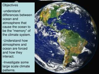
SO, HOW DID THE OCEANS FORM?. Earth was molten at first Heavy metals migrated to the center while lighter elements moved toward the surface Hydrogen and oxygen migrated toward the surface to form an atmosphere. Volcanic activity released gases, including water, trapped within the Earth.

E N D
Earth was molten at first Heavy metals migrated to the center while lighter elements moved toward the surface Hydrogen and oxygen migrated toward the surface to form an atmosphere
Volcanic activity released gases, including water, trapped within the Earth
Earth cooled, gases in the atmosphere condensed, and rain fell It may have rained for 10 million years
OCEAN FORMATION • Rain during the formation of Earth
Approximately 0.1 km3 of new water is added to the ocean each year, mostly from vents
Geographic Puzzle • Alfred Wegener noted that Africa and South America appear to fit together neatly, like the pieces of a jigsaw puzzle • He proposed that the continents had been joined and had since drifted apart
Pangaea • Wegener suggested that 225 million years ago all of the land masses were connected in a supercontinent called Pangaea, a Greek word meaning ‘all lands’ • Panthalessa, Greek for ‘all seas’, was the name given to the resulting world ocean.
Wegener’s Evidence • Fossil remains in continuous bands across continents • Cynognathus - a land reptile from the Triassic period and • Glossopteris – a tropical fern • mountain ranges and coal deposits run uninterrupted across both continents
Continental Drift • Wegener proposed that the continents floated somewhat like icebergs in water • And that the continents had drifted apart • He did not know what caused the continents to drift apart • His theories were not widely accepted
Wegener’s matching of mountain ranges on different continents
Science and the War • During WWII, Harry Hess was a captain in the Navy on a transport ship. • His vessel was equipped with an echo sounder (SONAR) which Hess used to map the ocean floor to aid the war effort • In the postwar period the Atlantic was extensively mapped and the Mid-Atlantic Ridge was discovered
Mid-Atlantic Ridge • a giant undersea mountain range extending north to south in the center of the Atlantic Ocean • Ocean sediments were discovered to be youngest near the ridge and oldest near the continental margins. • MAR is evidence of sea-floor spreading
Ocean Floor Has Mountain Ranges larger than those found on the surface
Sea-Floor Spreading • Hess’s theory that new ocean crust is formed at mid-ocean ridges and destroyed at subduction zones.
Paleomagnetism • The earth’s magnetic field has reversed many times over geologic time. • A record of these reversals is fixed in rock as new ocean crust is formed at the mid ocean rift Magnetic Stripes
In the late 1950’s scientists began studying the ocean floor with magnetometers invented in WW II Their purpose was to study compass distortions caused by magnetite on the seafloor
What did they find? A series of stripes along the ocean floor One stripe adds to the Earth’s magnetic field causing a strong signal on the magnetometer The stripes adjacent to this stripe subtracts from Earth’s magnetic field, causing a weak signal on the magnetometer These stripes were found to be symmetrical around the crests of the mid-ocean ridge
The cause of the reversals is unknown, but is thought to be associated with changes in the motion of the magnetic material of Earth’s outer core
In 1963 an interpretation of these stripes was developed Earth’s magnetic field reverses at regular intervals of a few hundred thousand years During a reversal, a compass points south, also causing the iron-bearing minerals in newly forming rocks to point south
APPARENT POLAR WANDERING • The location of the North Pole can be plotted from the magnetic orientation of rocks alone • When such data was plotted, it appeared that the North Pole was once in the middle of the Pacific
The Theory of Plate Tectonics • a combination of two earlier ideas, continental drift and sea-floor spreading. • According to the theory, the surface of the Earth is broken into large plates. • The size and position of these plates change over time. • The edges of these plates, where they move against each other, are sites of intense geologic activity, such as earthquakes, volcanoes, and mountain building
Plate Tectonics • Evidence from fossils • Seafloor spreading • Geomagnetic time scale (paleomagnetism)
Plate boundaries • Convergent Boundary– • mountain building – India Himalayas • Divergent Boundary– • rift (trenches) – Mid Atlantic Rift • Transform Boundary– • slide by each other – San Andreas fault
Plate Motion • ????????? • Convection • Magma- pushes up from the earth
Plate Boundaries • Convergent • Crust is destroyed • Ex: Marianas Trench, Himalayas forming in Asia
Plate Boundaries • Divergent • New crust forms • Ex: Mid-ocean rift
Plate Boundaries • Transform • Crust is not created or destroyed • Ex: San Andreas
Subduction Zone • Ocean crust is forced downward under the continental crust. • The crust melts, magma rises and volcanoes form
HOT SPOTS • Surface expressions of plumes of magma rising from stationary sources of heat in the mantle • As plates move over these fixed locations they are weakened from below by the heat • Volcanoes can form from these weakened areas
After a few million years the volcano is carried away from the hot spot and a new volcano can form Can result in a chain of volcanic islands Observe an animation of volcanic islands forming over a hot spot.
Hot spots can be anywhere on a plate No one knows what anchors them in place New evidence suggests that they might move over time Yellowstone National Park is believed to be over a hot spot beneath the westward-moving North American Plate
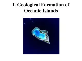
Example: Hawaiian Islands • An extension of old eroded undersea volcanoes called the Emperor Seamounts • Began to form 40 million years ago with Kauai (5.5 million years old) • Hawaii is the youngest and least eroded • A new island is being formed – Loihi – it will break the surface in 30,000 years • The sharp bend in the islands coincides to the collision of India into the Asian continent
ATOLLS • Ringed shaped islands of coral reefs centered over inactive volcanoes • Coral can only grow in shallow water • The remains of coral reefs associated with atolls are found in very deep water
How does this occur? As a volcano moves from a spreading center it cools and its density increases Sinking results due to isostatic equilibrium If the sinking is gradual, the coral can continue to grow on top of the dead, sinking coral
GUYOTS • Volcanic islands that sink as the island moves away from the spreading center • Their tops erode, becoming flat as the island sinks
AGE AND DISTRIBUTION OF SEDIMENTS • If the ocean basins are as old as the rest of Earth • Sediments should be very thick • Sediments are 15 to 20 times thinner than age would suggest
Spreading centers are almost free of sediment The oldest sediments are around 180 million years old