Download
1 / 41
470 likes | 1.59k Views
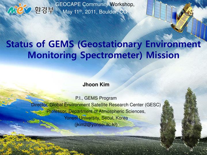
GEOCAPE Community Workshop, May 11 th , 2011, Boulder, CO. Status of GEMS (Geostationary Environment Monitoring Spectrometer ) Mission. Jhoon Kim P.I., GEMS Program Director, Global Environment Satellite Research Center (GESC) Professor, Department of Atmospheric Sciences,

E N D
GEOCAPE Community Workshop, May 11th, 2011, Boulder, CO Status of GEMS (Geostationary Environment Monitoring Spectrometer) Mission Jhoon Kim P.I., GEMS Program Director, Global Environment Satellite Research Center (GESC) Professor, Department of Atmospheric Sciences, Yonsei University, Seoul, Korea (jkim2@yonsei.ac.kr)
Contributors GEMS Science Team - KARI, Yonsei Univ., GIST, Pusan Nat’l Univ., SNU, KonkukUniv., EwhaWomen’s Univ. H. Lee (Yonsei University) Kelly Chance, Xiong Liu (Harvard Smithonian Center for Astrophysics) GEMS SAG(Science Advisory Group) - NASA, GSFC, JPL, ESA, JAXA, NCAR, NRL, MPI, NOAA, KNMI, Harvard Univ., UCLA, Univ of Alabama, Dalhousie Univ., Univ of Iowa, Univ of Bremen, Univ of Heidelberg, Univ of Tokyo, …) Ministry of Environment, Rep. of Korea NIER(National Institute of Environmental Research)
2010 COMS 2018 GEO KOMPSAT National Space Program of Korea GEO 1995~2006 KOREASAT 1-5 GEO 2009 STSAT-2 2008 Astronaut 2006 KOMPSAT-2 2003 STSAT-1 2010 KSLV-1 2009 KSLV-1 1999 KOMPSAT-1 2011 2011 KOMPSAT-5 (SAR) 1992-1999 KITSAT-1~3 2012 KOMPSAT-3A (EO) 2011 STSAT-3 2017 KOMPSAT-7 (EO) GEO 2020 Lunar Orbiter 2011 KOMPSAT-3 (EO) 2025 Lunar Mission 2014 CAS-1 2020 CAS-2 2017 2015 KOMPSAT-6 (SAR) 2017 KSLV-II
Collaborative Support from Government National Committee of Space Development Political Support MEST ME GEMS System/Bus AIT GEO KOMPSAT GOCI-2 Met. Payload KMA MLTM MEST : Ministry of Education, Science & Technology MLTM : Ministry of Land, Transport & Maritime Affairs ME : Ministry of Environment KMA : Korea Meteorological Administration
Spatial Coverage of GEMS NS: 5 S ~ 55 N, EW: 75 E~145 E POGEQA Sentinel-4 GEOCAPE GMAP-Asia GEMS (Richter, 2005)
Measurement of air quality in high temporal and spatial resolution CLIMATE FORCING LONG-RANGE TRANSPORT METEOROLOGY FEEDBACK Source Sink AIR QUALITY (local and regional) Atmospheric Correction for Ocean color Meteorology EMISSION (local and urban scale) Credit: CCSP Strategic Plan (illustrated by P. Rekacewicz).
Air quality forecast with weather observation NEW KNOWLEDGE Satellites Air quality monitoring & forecasting PM Air quality Source quantification, policing of environ- mental agreements Information Service to Public O3 Air quality CTM Long-range transport Biogeochemical cycling Aircraft, lidar Climate forcing Surface monitors Weather forecasting
IntegratedSimulation Data Assimilation Constrain / consistency? GEMS- retrieved Concentration N’i (t, x,y) Emission DB Si (l; t, x,y) Met Field Cloud, Wind, Vi (t, x,y,z) Temperature, T(t,x,y,z)… CTM Intercomparison Concentration, Ni (t, x,y,z) a (l, q, f; t, x,y) Surface Reflectance RTM GEMS Instrument Requirements GEMS Instrument Function Ri (l) Dynamic range Spectral range Spectral resolution SNR, MTF … NO2 SO2 O3 HCHO Aerosol Cloud GEMS Radiance Spectrum L (l; t, x,y) Retrieval Algorithm
Baseline products CHOCHO : Feasibility not confirmed yet
Radiance at GEMS • Radiance for GEMS: libRadtran SZA:0-70o Surface albedo 0.03 (Lambertian Surface) Gases: O3, SO2, HCHO, NO2 + Aerosol • Min. Clear sky condition based on CMAQ v4.5.1 • GEMS’s solid angle: 5×5 km 1.9×10⁻⁸sr • 0.2 nm sample, 0.6 nm resolution (FWHM) for GEMS
Radiance at GEMS Maximum gas column densities and AOD (BC) with the highest PDF value Min. Radiance 70 60 50 40 30 20 10 0 Nominal gas column densities and minimum AOD (Sulfate) Minimum gas column densities and AOD (Sulfate) with the highest PDF value Max. Radiance
Min. & Max. radiance at GEMS A. Minimum radiance obtained from maximum gas column densities and AOD (BC) with the highest PDF value B. Maximum radiance obtained from minimum gas column densities and AOD (Sulfate) with the highest PDF value
C. Radiance obtained from nominal gas column densities and minimum AOD (Sulfate)
Radiance simulation for GEMS • Cloud (K.M. Lee)
The percentage of clear sky region 1In terms of area at a given time 2The ratios in parentheses are the value when allowing 25% cloud fraction for clear sky region. (Y.S. Choi and J. Kim)
Case 1: spectrum for analysis (NO2) _ (420-450nm) Solar ZA:60 Solar AA:300 Satellite ZA:30 Satellite AA:300 (Y.J. Kim) 0.2 nm: original model spectra resolution 0.4, 0.6, and 0.8 nm: Virtual instrumental spectra resolution
Case 1: Result of NO2 SCD (Y.J. Kim)
Case 1: NO2 slant column density and Uncertainty(fitting interval: 430-450 nm) ± 3.7% ± 4.6% ± 5.4% ± 4.4% ± 10.0% relative error (Y.J. Kim)
Case 2: Result of SO2 SCD (Y.J. Kim)
Case 2: SO2 slant column density and Uncertainty(fitting interval: 310-330 nm) ± 3.4% ± 20.0% relative error ± 5.1% ± 12.9% ± 25.6% (Y.J. Kim)
Retrieved O3 and its % errors Retrieved O3 Column concentration (#/cm2) Relative Error (%) (R. Park) Spectral resolution (nm)
Retrieved HCHO and its % errors Retrieved HCHO Column concentration (#/cm2) Relative Error (%) (R. Park) Spectral resolution (nm)
SNR Requirements • For 8x8 km2 footprints • May consider spatial coadding
Space radiation • Heavy shielding could effectively protect the primary particles at the expense of mass and volume • As the incident energy increases, more thicker shielding is required. • Relation between the incident energy and shielding thickness is not linear for aluminum shielding. • 10 kg of Al shield was adopted in OMI whose total mass is 65 kg. Proton propagation in Al Al Shield Thickness vs. Proton Energy
Polarization • De-polarizer : use to minimize polarization effect • Major source of polarization : grating or prism • De-polarization method • Spatial averaging – employing birefringent crystal wedge devices (OMI case) • Usually used in LEO or in case of low spatial resolution (induce image degradation) • Spectral averaging – the basis of the Lyot depolarizer • In case of low spectral resolution (induce spectral degradation) • Temporal averaging – Time-Domain Polarization Scrambler (TDPS) • Use the photo-elastic modulator, now under development, No spatial/spectral degradation • Solution • First of all, the polarization sensitivity of optical system shall be minimized. • TDPS is best if possible, Lyot depolarizer is also suitable for GEO. Double Wedge Scrambler Lyot Polarization Scrambler TDPS test setup
GEMSInterface Requirement Interface Requirements - Volume < 800mm(XSAT) 1200mm(YSAT) 700mm(ZSAT) - Mass < 110 kg
GEMS GOCI-2 ABI Solar Panel Solar Panel GEO KOMPSAT Configuration 2A Sat. : Met Sensor 2B Sat. : GEMS, GOCI-2 (Twin Satellites) • GEMS and GOCI-2 may have • more volume and mass budget • Can increase capability in spatial resolution • or spectral coverage • Mission: Air Pollution Monitoring • Meteorological observation Ocean Color monitoring • Mass: Dry mass 1280.9 kg Launch mass 2640 kg • Power: In-orbit1500 W, Transfer orbit1100 W • Mission Life: 10 years
Status of GEO KOMPSAT Mission • GEMS Program Office • Established GEMS Program Office inside ME and GEMS Research Center at Yonsei University in 2009 • Started preliminary study in 2009 to setup requirements and instrument concept design by ME • Budget • Following the successful launch of COMS in June, 2010, the budget request proposal was approved on Dec. 2010 by the Government Budget Review Committee led by the Ministry of Planning and Finance. • RFP • Response to RFI received in Dec. 2010 • RFP planned to be issued in the fall, 2011 • Selection of main contractor by the end of 2011 • International Collaboration • Recognized as a part of ACC by CEOS • Established Technical Group on Atmospheric Composition Measurements from Geostationary Satellites with NASA • ToR for NASA-NIER/ME collaboration endorsed by NASA HQ and NIER/ME • MOU with NCAR(2010) and Harvard CfA (2011, ongoing) • Collaboration under discussion with Netherland and Japan
Global Environmental Monitoring Constellation of GEO Mission to study Air Quality GMAP Asia (Asia Pacific) GEO-CAPE (America) GEMS GEO KOMPSAT (Asia) Chinese GEO AQ Mission (Asia) • Constellation synergy • Improving spatial and temporal coverage • to monitor globalized pollutants • Sharing basic requirements on data products and instrument to maintain data quality • Consolidating socio-economic benefit analysis • Supporting QA and CAL/VAL POGEQA (Europe) GMES S4 MTG (Europe)
GEOCAPE Community Workshop, May 11th, 2011, Boulder, CO Status of GEMS (Geostationary Environment Monitoring Spectrometer) Jhoon Kim P.I., GEMS Program Director, Global Environment Satellite Research Center (GESC) Professor, Department of Atmospheric Sciences, Yonsei University, Seoul, Korea (jkim2@yonsei.ac.kr)