Download
1 / 38
380 likes | 512 Views
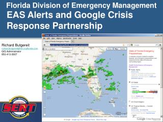
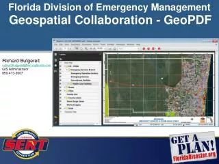
Florida Division of Emergency Management GIS Data Discovery. Richard Butgereit GIS Administrator 850-413-9907 richard.butgereit@em.myflorida.com. floridadisaster.org/gis. Critical Facilities Inventory. A Statewide Geodatabase of Structures and Facilities. What is a Critical Facility?.

E N D
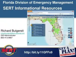
Florida Division of Emergency ManagementGIS Data Discovery Richard Butgereit GIS Administrator 850-413-9907 richard.butgereit@em.myflorida.com floridadisaster.org/gis
Critical Facilities Inventory A Statewide Geodatabase of Structures and Facilities
What is a Critical Facility? • Critical Facility - structures from which essential services and functions for victim survival, continuation of public safety actions, and disaster recovery are performed or provided.
In Contrast with Critical Infrastructure • Critical Infrastructure - those systems and assets, whether physical or virtual, so vital that the incapacity or destruction of such systems and assets would have a debilitating impact on security, economy, public health or safety, or any combination of these elements.
The domain of the SERT GIS is specifically related to "critical facilities", while working closely with Florida's Regional Domestic Security Task Forces and other partners to ensure a safe and secure Florida.
Examples of Critical Facilities…unique to emergency management • Shelters • Emergency Operation Centers • Hazardous Material Facilities • Points of Distribution • Disaster Recovery Centers • Logistic Staging Areas
Examples of Critical Facilities…coordinated with other agencies • Public Health Facilities • Public Drinking Water Facilities • Wastewater Treatment Facilities • Schools • Fire Stations • Police Stations
13 feature classes are spread across 4 feature datasets, representing emergency management branches • Emergency Services • Human Services • Operations Branch • Infrastructure Branch
Can there be too much data? • FEMA HAZUS Essential Facilities • USGS Structures • NGA Homeland Security Infrastructure Program (HSIP)
Improved Metadata Over 10 Million Individual Records • 184 feature classes in 2005 release • 300+ feature classes in 2007 release
HSIP Communication Framework State DHS or Emergency Management Agency State GIS
Homeland Infrastructure Foundation-Level Database Working Group
Web Portal and Desktop The standardized role-basedapplication to update statewideHAZUS-MH datasets Training – November 17-21, 2008
Geodetic Control • Ortho-imagery • Elevation • Transportation • Hydrography • Governmental Units • Cadastral Information
Resolution 1 arc second – 30 meter 1/3 arc second – 10 meter 1/9 arc second – 3 meter
2000 FIU’s International Hurricane Center – Broward “Utilization of the airborne LIDAR data resulted in considerable reduction of predicted flood areas, as a first cut without further refinements and upgrading of the SLOSH numerical model. Broward County Emergency Management officials were able to remove 175,000 people from being unnecessarily evacuated in the event of a hurricane.“ http://www.ihc.fiu.edu/lcr/research/windstorm_simulation/airborne_lidar_mapping.htm
Project Overview Begun FY 06-07 Complete FY 07-08 Begun FY 06-07 Complete FY 07-08 FY 08-09 Light Detection and Ranging LiDAR Data Processing Development for SLOSH Sea, Lake, Overland Surge from Hurricanes SLOSH Models Regional Evacuation Studies Analyses Vulnerability Behavioral Demographics Transportation Begun FY 06-07 Complete FY 08-09 FY 08-09 Storm Surge Zones FY 08-09
Florida is 54,250 square miles Project Footprint 8,600 14,600 1,300 2,200 1,400 28,100 total square miles
Compiled from Regional Evacuation Studies undertaken by the Regional Planning Councils -- • Storm Surge Zones • Evacuation Routes • Both currently being updated by RPC’s • FloridaDisaster.org/gis/data
Increasingly, we are turning to the web for direct use of web mapping services and online data sources (WMS and/or KML) • National Weather Service (watches and warnings, radar, storm reports) • USGS Emergency Operations Hazards Data Distribution System • ESRI Imagery and more
Tropical Storm Fay • Quantitative Precipitation Forecast • Hourly/Daily/Weekly Rainfall • Storm Surge – Operational and Probabilistic
Florida Adopts the USNG • USNG was officially adopted by the FFCA • FDEM adopted the USNG in the CEMP • Florida Fire College, Florida Fire Chiefs Association, Fl National Guard have developed curriculum and instructor manuals • FloridaDisaster.org/gis/usng
Florida Geographic Data Library • Hosts 1,000 meter and 100 meter grids for each Florida county • Data is also available via the National Map
Questions? FloridaDisaster.org/gis