Download
1 / 32
430 likes | 1.14k Views
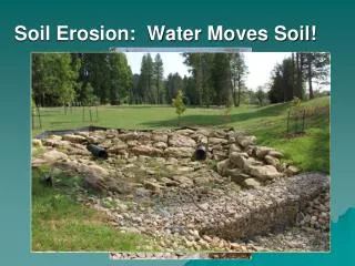
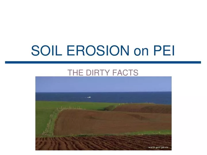
SOIL EROSION on PEI. THE DIRTY FACTS . Soil Erosion is.. The process of soil particles being carried away by the natural processes of wind and water. WHAT IS SOIL EROSION. Soil formation on PEI can take up to 300 to 500 years to create 1 inch of soil under natural conditions.

E N D
SOIL EROSION on PEI THE DIRTY FACTS
Soil Erosion is.. The process of soil particles being carried away by the natural processes of wind and water. WHAT IS SOIL EROSION
Soil formation on PEI can take up to 300 to 500 years to create 1 inch of soil under natural conditions. Good agricultural land has 6-8 inches of topsoil, after this, “B” layer of poorer material. http://www.youtube.com/watch?v=ChEHQUMEkXw TOPSOIL TIDBITS
Erosion by water is a naturally occurring process and should remain less than the rate of new soil formation under undisturbed conditions. A tolerable soil loss rate should not exceed 7.0 tonnes/ha (3 tons/acre). Erosion is site specific and the two biggest factors are the length and degree of slope. EROSION RATES
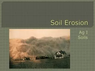
The average rate of soil loss on PEI is 10 to 15 tonnes per acre per year. Some fields lose up to 20 tonnes/year/acre. This means that in 8 years, one inch of valuable topsoil is lost. TOPSOIL LOSS
EROSION ? HOW COME? Factors that contribute to soil loss on PEI
Erosion closely linked to rainfall intensity, duration and distribution. Cycles of freezing and thawing has a major affect with the top 20-55 mm thawing and below it still frozen. Up to 80% of annual erosion can occur this way. Wind erosion occurs when soil is dry and recently loosened as in the spring cropping season or... During the winter when fields are exposed due to a lack of snow or cover. FACTORS AFFECTING SOIL EROSION CLIMATE
Two major factors in a soils potential to erode are Organic matter content The soils abality to absorb water, hold water and remain stable are largely dependent on the types and amounts of organic material. Particle size Soil high in silts and clay loams are very erodible as they permit the rain to penetrate slowly increasing run-off. FACTORS AFFECTING SOIL EROSION ERODIBILITY
Slope and steepness directly affect erosion rates. FACTORS AFFECTING SOIL EROSION TOPOGRAPHY
It is estimated that on PEI 100,000 acres of farmed land is very susceptiblile to erosion due to the topography. If the slope is doubled the soil loss is increased 1.5 times If the steepness is doubled the soil loss is increased 2.5 times FACTORS AFFECTING SOIL EROSION TOPOGRAPHY
Erosion is decreased when soil has permanent cover or crop residue left on it. FACTORS AFFECTING SOIL EROSION VEGETATIVE COVER
PEI’s main sources of silt and erosion are from:http://www.youtube.com/watch?v=DRu-3LkzJx0 Agriculture Forestry Highway Construction and Maintenance FACTORS AFFECTING SOIL EROSION CULTURAL PRACTISES
This type of erosion is caused by high winds over dry or frozen unprotected soil. It is a problem for PEI due to the prevailing constant winds Increased by excessive tilling, failing to leave crop residue or removing hedgerows or windbreaks TYPES OF SOIL EROSION WIND EROSION
Caused by raindrops falling on soil particles that detach and then carry them off the field One raindrop can be so explosive it can hurl a particle 3 metershigh and more than 3 meters away TYPES OF SOIL EROSION SPLASH EROSION
Thin sheets of soil are removed as water moves over the soil surface One of the greatest sources of topsoil loss Difficult to see as it removes soil equally over the field TYPES OF SOIL EROSION SHEET EROSION
Seen as many small narrow ditches cut into the surface. This is another major source of topsoil loss Trenches are usually less than 1 foot deep but may be many across a field TYPES OF SOIL EROSION RILL EROSION
Large gullies cut out of the field. It is the most visible type but actually represents less total soil loss than sheet or rill. Trenches are more than 1 foot deep TYPES OF SOIL EROSION GULLY EROSION
Streambank erosion can occur both at agricultural and non-agricultural areas It is compounded by having livestock in the stream. Trampled vegetation exposes soil to erosion increasing silt in the stream Bacterial contamination and increased nutrient levels also occur due to livestock access. TYPES OF SOIL EROSION STREAMBANK EROSION
When silt is deposited in the stream from poor cultural practices the water becomes too shallow from the build up of silt. This results in water warming up quickly making it inhospitable to fish species Sometimes it is so bad, only a small trickle remains reducing the amount available to fish Increased silt levels also cover over spawning areas suffocating eggs or fry that have hatched. EFFECTS OF SOIL EROSION IN STREAMS
Erosion, combined with sea levels rising, with turn PEI into PEI’s
HOW DO WE CLEAN UP THIS MESS? CONSERVATION METHODS TO REDUCE SOIL EROSION
Winter/Cover crops - planting crops early in the fall to hold the soil together through a developed root system. If too late, covering the crop with mulched straw. Cross-slope farming - ploughing and planting fields with a gentle slope across the slope rather than with the slope. CONSERVATION PRACTICES CROPPING SYSTEMS
Crop rotations - new legislation now regulates the rotation of crops; row, forage and grain into a three year rotation Strip cropping - used on gentle slopes alternating the three crops row, grain and forage never planting row crops last in the field CONSERVATION PRACTICES CROPPING SYSTEMS
Grassed waterways - broad, shallow channels planted with grasses to help slow the speed of water and trap sediments before they leave the field. CONSERVATION PRACTICES STRUCTURAL CONTROLS
Diversion terraces - are used where the slope length of a field is greater than the accepted limit for cross slope farming or strip cropping. Terraces break up long slopes into a series of shorter ones. Diversion terraces will transport substantial amounts of runoff and must be permanently vegetated. CONSERVATION PRACTICES STRUCTURAL CONTROLS
Hedgerows - are treed windbreaks that protect fields from wind erosion. They control soil erosion by reducing wind speed at ground level and by trapping snow, leaving soil less exposed during the winter months. Buffer Strips - refers to a permanent vegetated zone bordering streams, ponds and estuaries that serve to filter sediments leaving the field. Generally should be 20-30 meters but depend on the slope of the field and cover crop. CONSERVATION PRACTICES STRUCTURAL CONTROLS
New Orleans is Sinking • http://www.cbsnews.com/2100-18560_162-1056304.html • http://www.youtube.com/watch?v=LAZUsCONjIQ
New Orleans was built at the bottom of the Mississippi River Delta. Problem # 1 The river is full of sediment which is deposited on the river bottom and also at the mouth of the river (forming a delta). This deposition also raises the level of the river each year. New Orleans is a bustling big city, that can not just raise it’s height. Every year the river increases in height, and the city decreases as it’s been built on a bog. Problem #2 As the Mississippi has been dammed many times, not nearly as much sediment reaches the Gulf of Mexico. This is causing the outer reaches of the delta to not have more sediment replenishing wind and wave erosion. Thus much of the outer delta and islands are disappearing.
The city has had to build levee’s in order to hold the water back. The problem though is the water height increases each year and the city sinks each year. Many people in the outlying areas (outside the city walls) build their home on stilts (to be ready for the flooding each spring)
Hurricane Katrina was a Category 5 Hurricane that flooded the city, killed 1800 people and caused over $81 billion dollars in damage. 80% of the city was flooded. As the city is below sea level, the water had to be pumped out. The water flooded the city for over 3 weeks. Much of the city has never been rebuilt, as the homeowners are too scared to rebuild. Over 150,000 people left the city after the hurricane (out of a population of 500,000)