Download
1 / 5
50 likes | 227 Views
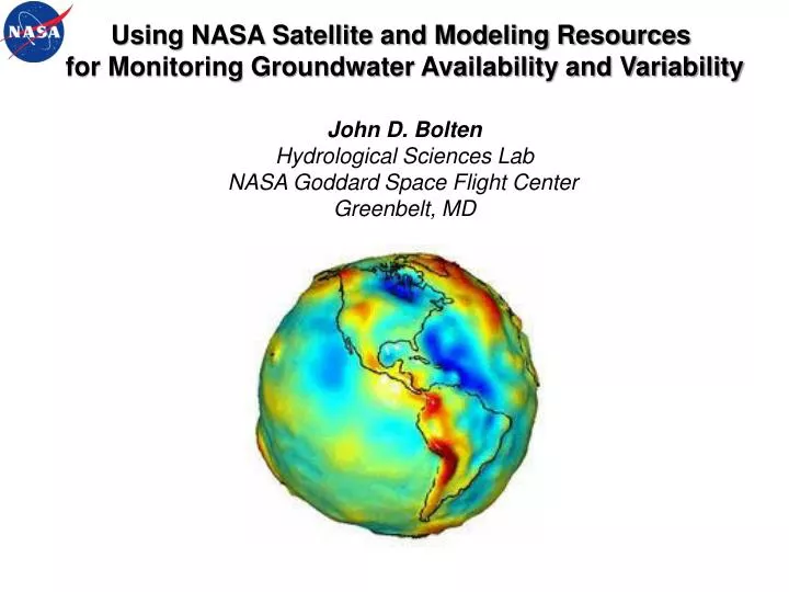
Using NASA Satellite and Modeling Resources for Monitoring Groundwater Availability and Variability. John D. Bolten Hydrological Sciences Lab NASA Goddard Space Flight Center Greenbelt, MD. Identifying Areas of Water Stress and Replenishment. Changes in Annual-Mean Terrestrial

E N D
Using NASA Satellite and Modeling Resources for Monitoring Groundwater Availability and Variability John D. Bolten Hydrological Sciences Lab NASA Goddard Space Flight Center Greenbelt, MD
Identifying Areas of Water Stress and Replenishment Changes in Annual-Mean Terrestrial Water Storage Between 2009 and 2010 Water Storage Anomalies in Northwestern India cm Observations from NASA’s Gravity Recovery and Climate Experiment (GRACE) mission provide estimates of terrestrial water storage variability (the sum of groundwater, soil water, surface water, snow, and ice). Source: Matt Rodell, NASA GSFC
Quantifying Changes in Soil Water Storage is Essential for Sustainable Water Management Mississippi River basin GRACE groundwater estimate Groundwater well observations GRACE groundwater estimates (smoothed) Rodell et al., Hydrogeology, 2006 Illinois Yeh et al., WRR, 2006 When combined with a numerical model (top) or in situ observations (bottom), groundwater can be isolated from GRACE terrestrial water storage observations. Source: Matt Rodell, NASA GSFC
JPL Airborne Radar Sounder for High-Resolution Mapping of Shallow Aquifers Instrument Short pulse sounding radar (< 20 ns) at 40 and 75 MHz center frequencies 20 and 40 MHz bandwidths at 40 and 75 MHz Multiple antennas Platform: Kuwait police Dauphin helicopter and Kuwait Air Force P3 • Aircraft - based radar provides high-resolution mapping of the regional distribution of shallow aquifers in the hyper-arid areas. Source: EssamHeggy, JPL
NASA Points of Contact • John Bolten - NASA GSFC (john.bolten@nasa.gov) • Matt Rodell - NASA GSFC (matthew.rodell@nasa.gov) • EssamHeggy - NASA JPL (eheggy@jpl.nasa.gov)