Download
1 / 34
340 likes | 445 Views
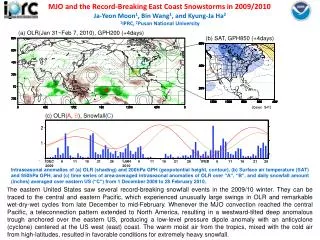
Investigating Mesoscale Precipitation Banding in Two East Coast Snowstorms. Adam Frumkin. Outline . Motivation Introduction and Background Objectives/Methods Introduction to the Two Cases Results Conclusions. Motivation. Snowfall rates in mesoscale snowbands can exceed 4in/h

E N D
Investigating Mesoscale PrecipitationBanding in Two East Coast Snowstorms Adam Frumkin
Outline • Motivation • Introduction and Background • Objectives/Methods • Introduction to the Two Cases • Results • Conclusions
Motivation • Snowfall rates in mesoscale snowbands can exceed 4in/h • Due to their small scale, mesoscalesnowbands can result in large gradients in snow accumulation • They are a challenge to diagnose and predict • Few operational models use a high enough resolution to resolve individual bands • Bands arethe result of many factors (e.g. CSI) • The conditions in midlatitude cyclones are often ideal for the generation and release of CSI • Operational models can resolve the conditions known to produce bands
Introduction/Background • CSI is a form of Moist Symmetric Instability (MSI) and is released through moist slantwise convection • The ingredients for MSI are moisture, instability, and lift. • MSI is released when a parcel is lifted slantwise past the LCL to the level of free slantwise convection
Introduction/Background • Frontogenetical forcing is an efficient way to lift a parcel and to release MSI • Topographic forcing is another way • Frontogenesis and CSI can coexist • Difficult to distinguish CSI vs. frontogenesis bands • Heavy bands can also be due to: • Conditional Instability (CI), a type of gravitational instability • CI will dominate over CSI • CSI can induce CI
Introduction/Background Schultz and Schumacher (1999) suggest using MPVg* instead of MG (more versatile) Novak et al., (2005)
Objective/Methods • Objective: Investigate the instabilities and forcing mechanisms in two significant mesoscale snowband events on the East Coast • Methods: Following the suggestions of Schultz and Schumacher (1999) • Identify the location of mesoscale snowbands in the two events on radar • Using RUC 0hr forecasts • Plot spatial maps of: • MSLP -> Track low pressure center • 800hPa frontogenesis -> diagnose regions of enhanced lifting • Plot cross sections of • MPVg* -> Where do Θe* lines slope more steeply than Mg lines • Θe* -> diagnose CI vs CSI • RH -> saturation is necessary for the release of the instability • Frontogenesis -> do frontogenesis and instability overlap?
Two Case Studies NJ 26 Dec 2010 MA 09 Dec 2005 • Low pressure deepened as it tracked northward along the eastern seaboard • Hurricane force winds • Thunder and lightning • Low pressure rapidly deepened over Cape Cod • Hurricane force winds • Thunder and lightning http://www.nohrsc.nws.gov/ http://www.cocorahs.org/
Summary • 2 strong midlatitude cyclones developed • Well-defined frontogenesis regions in the NW quadrant • Banding is present in both cases • In MA case, banding appears around the time the CSI is evident • Occurs later in NJ case • CSI and CI are present at the same time at nearly every time step • CSI (also CI) and frontogenesis nearly always overlap
Questions/References • Novak. R. D., J. S. Waldstreicher, D. Keyser, and L. F. Bosart, 2006: A forecast strategy for anticipating cold season mesoscale band formation within eastern U.S. cyclones. Wea. Forecasting, 21, 3–23. • Nicosia, D. J., and R. H. Grumm, 1999: Mesoscale band formation in three major northeastern United States snowstorms. Wea. Forecasting, 14, 346–368. • Schultz, D. M., and P. N. Schumacher, 1999: The use and misuse of conditional symmetric instability. Mon. Wea. Rev., 127, 2709–2732. • COMET Module, http://www.meted.ucar.edu/export/csi/ • The Conditional Symmetric Instability (CSI) Homepage, David Schultz and Phil Schumacher