Download
1 / 35
350 likes | 601 Views
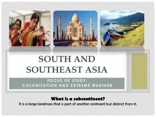
South Asia/Indian Subcontinent. Subcontinent separate part of continent: a large area that is an identifiably separate part of a continent isolated by geographic features India - 2nd to China in population Nations India, Pakistan, Bangladesh, Nepal, Bhutan

E N D
South Asia/Indian Subcontinent • Subcontinent • separate part of continent: a large area that is an identifiably separate part of a continent • isolated by geographic features • India - 2nd to China in population • Nations • India, Pakistan, Bangladesh, Nepal, Bhutan • Island Nations: Sri Lanka, Republic of MaldivesTransition: Afghanistan
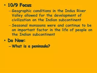
Indian Subcontinent Geography (South Asia) Instructions: Using page 161-170, find evidence in the section to support each of the following generalizations. • The terrain of the Indian subcontinent varies widely. • The Himalayas and the Hindu Kush are important to the subcontinent’s water supply. • Farming is an important way of life for millions of people on the subcontinent. • Geographic barriers influenced the development of different regional cultures on the subcontinent. • Rivers play many vital roles in the life of South Asia.
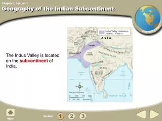
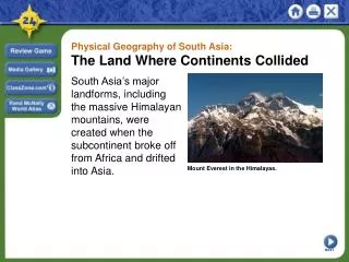
The Indian Subcontinent • A subcontinentis a large landmass that is smaller than a continent. • The Indian subcontinent was formed when pieces of the landmass of Gondwanaland collided with Laurasia. • The ensuing collision created the Himalaya and Hindu Kush mountains. • Although people were able to travel through passes in these mountains, its settlers developed a unique culture.
a. The Terrain of the Indian subcontinent varies widely. • Northern Mountain: • Himalayas (Mt. Everest), Hindu Kush • Khyber Pass: mountain through Hindu Kush = traders & invaders • Kashmir : mountain valley – farming & herding - song • Mineral resources – lacks oil for industry • Rain shadow effect
Northern Mountains • The Himalaya Mountains stretch 1,500 miles from east to west. • Many of the world’s highest mountains are in the Himalayas. • At least 50 of the mountains are more than 5 miles high, including Mt. Everest. • To the northwest of the continent lie the Hindu Kush Mountains. • Although smaller in area than the Himalayas, the Hindu Kush are nearly as high and rugged. • The Arabic word kush means “death.”
Mountain Valleys • In between the northern mountains lie many remote valleys. • Through these valleys flow the headwaters of many of the subcontinent’s rivers. • People in these isolated valleys developed their own ways of life. • In the Kashmir Valley, goats produce a fine wool called cashmere.
a. The Terrain of the Indian subcontinent varies widely. • Northern Plains/Indo-Gangetic Plain • Pakistan to India to Bangladesh • Rivers: Indus, Ganges, Brahmaputra • Farming=Densely populated • Steady source of water • Fertile land • Long growing season • Thar Desert: western end of plains = nomads • Mineral resources – lacks oil for industry
a. The Terrain of the Indian subcontinent varies widely. • Deccan Plateau • Surrounded by Ghats and Vindhya mountains • Triangular, high, flat land, rivers, water harder to find • ½ of South Asia • Millions of tiny farms rely on monsoons
b. The Himalayas and the Hindu Kush are important to the subcontinent’s water supply. • Melting snow is the source of streams that feed river system
c. Farming is an important way of life for millions of people on the subcontinent. • ¾ are farmer • Indo-Gangetic = Plain densely populated • Monsoons: Deccan Plateau relies on the monsoons • Key to life, wet and dry (see handout) • Ganges River Delta (Bay of Bengal) (video) • Ganges, Brahmaputra, Meghna rivers • Bangladesh • Densely populated • Below sea level • Cyclones • Influences art and literature • Read page 162 and page 166 • advance past video
Monsoons • Some people consider monsoon forecasts the most important weather predictions on earth. • The monsoon is a seasonal wind that dominates the climate of South Asia. • The word monsoon means “season” in Arabic. • Two monsoons define the seasons in South Asia: the wet monsoon of summer and the dry monsoon of winter.
Flooding and Storms • Because of the rich soil on the delta formed by the Ganges and Brahmaputra Rivers, Bangladesh is one of the most densely populated nations in the world. • Because much of the land is barely above sea level, seasonal flooding is common. • In addition, fierce tropical cyclones sweep in from the Bay of Bengal every five to seven years. • These storms have a devastating effect on the people in Bangladesh.
Back 2:40
d. Geographic barriers influenced the development of different regional cultures on the subcontinent. • Mountains: separate and isolate • Hindu Kush, Himalayas, Ghats, Vindhya (read page 164) • Cultural diversity • Separate people into regional and local groups • Food, clothing • Language • India: 15 official languages, 700 dialects • Hindi: most widely spoken • English • Religion: • Hinduism, Islam, Buddhism, Christianity, Sikhism, Jainism, Zoroastrianism • 3 Migrations: • 1. other parts of Asia, 2. Middle East, 3. Europe
There are more than 80 recorded ways to wear a sari • The most common style is for the sari to be wrapped around the waist, with the loose end of the drape to be worn over the shoulder, baring the midriff • However, the sari can be draped in several different styles, though some styles do require a sari of a particular length or form
e. Rivers play many vital roles in the life of South Asia • Essential to life = farming and religion • Ganges holiest river to Hinduism • Supported earliest civilizations of the region • Ganges River delta/Delta on the Bay of Bengal = fertile supports life
Closure One sentence summary.