Download
1 / 26
260 likes | 274 Views
Learn how to interpret weather maps to understand cloud movements, pressure patterns, and significant weather events. Identify high and low-level clouds, temperature gradients, jet streaks, and more.

E N D
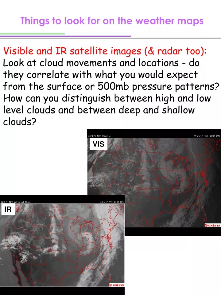
Things to look for on the weather maps Visible and IR satellite images (& radar too): Look at cloud movements and locations - do they correlate with what you would expect from the surface or 500mb pressure patterns? How can you distinguish between high and low level clouds and between deep and shallow clouds? VIS IR
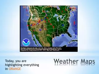
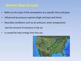
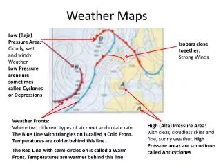
Things to look for on the weather maps Surface: Look for locations of high and low pressure centers, warm and cold fronts, regions of high winds, rain, snow, drylines, or other significant weather.
Things to look for on the weather maps 850mb: Use this map to look at temperature gradients, and to find regions of warm or cold air advection. It is also important to look at the moisture field and advection at this level if available (low-level moisture).
Things to look for on the weather maps 500mb: Where are the troughs and ridges? Where are the troughs and ridges in relation to the high and low pressure systems on surface maps (Positive Vorticity Advection & Negative Vorticity Advection)?
Things to look for on the weather maps 300mb: Use this map to look for jet streaks, or elongated pockets of very strong winds embedded in the jet stream. Jet streaks generally occur above regions of strong temperature gradients that you would find on the 850mb map. Why?
Forces Forces govern the atmospheric motions Pressure gradient force Coriolis force Gravity Friction Momentum equations
v2= w d v1 d * x O reference point (fixed star) * O B O w x<<d Coriolis Force ball Deflect to the right on the northern hemisphere, and to the left on the southern hemisphere.
v2= w d v1 d x O w x<<d Coriolis Force Given Coriolis acceleration a, the distance is Travel time:
Coriolis Force If is that due to the earth’s rotation about a local vertical axis, such that Then (= Coriolis force if M = 1 kg)
Forces Forces govern the atmospheric motions Pressure gradient force Coriolis force Gravity Friction Momentum equations
Pressure Gradient & Pressure Gradient Force 960mb 960mb 1000mb 1000mb Positive pressure gradient but negative pressure gradient force in the x direction. Negative pressure gradient but positive pressure gradient force in the x direction. Pressure gradient Pressure gradient force • Why do we want to know sea level pressure (SLP)? • Why do we want to know pressure gradient?
V y s n x Nature coordinate s: along the wind direction n: perpendicular to the wind direction, positive to the left. The nature coordinate can be obtained by rotating the Cartesian Coordinate until the x direction is along the wind direction. Then, x is in the s direction and y is in the n direction. And u=V and v=0
P2 H Po P1 L Estimate Pressure Gradient How to calculate pressure gradient at point O? P2(xo,y2) P2(x2,yo) O (x0,yo) P1(x1,yo) P1(xo,y1)
How to calculate real distance 1 o lat = ? km Re Pressure Gradient & Pressure Gradient Force Dy Dlat = lat2 – lat1 Dy= Dlat x 111 km per degree
How to calculate real distance Dx r 1 o long = ? km Re Pressure Gradient & Pressure Gradient Force Dlong = long2 – long1 Dx= Dlong x 111 km x cos(j)
P2 H Po P1 L Pressure Gradient & Pressure Gradient Force Pressure gradient at point O: O (x0,yo) P2(x2,yo) P1(x1,yo)
P2 H Po P1 L Pressure Gradient & Pressure Gradient Force Pressure gradient at point O: P2(xo,y2) O (x0,yo) P1(xo,y1)
P2 y2 H Po P2(x4,y4) P1 x2 x1 O O P1(x3,y3) L y1 Pressure Gradient & Pressure Gradient Force Or using the nature coordinates (x0,yo) (y4-y3) (x4-x3)
Pressure Gradient Horizontal pressure gradient vs. vertical pressure gradient Vertical pressure gradient force is much greater than the horizontal one, but is mostly balanced out by gravity. So, the motion in the atmosphere is dominated by horizontal winds.
P . 988 P . 992 P . C 996 C . C P 1000 O Geostrophic flow (Vg) The horizontal pressure gradient force (P) is balanced by the Coriolis force (C). rest Not happen often in the real world. If it does, this is seen in large scale.
P C > P C L H P P > C C Gradient wind flow (VG) fVG > fVg = VG < Vg => VG > Vg Subgeostrophic Supergeostrophic If one uses geostrophic wind to approximate gradient winds, what happens? This is for large scale flow since Coriolis force is important.
Gradient wind flow (VG) 500 mb Wind Vectors
Surface Weather Map Any difference from the 500-mb one? Because of what? Friction! L
Friction 996 P P P P 1000 F F 1004 F C C C C 1008 balance with friction geostrophic balance unbalanced flow Friction is proportional to the roughness of the Earth’s surface and wind speed, and is opposite to the wind moving direction. Wind turns toward to the low pressure side !!!
L H Flow with friction Divergence Good weather but potentially bad for air quality Convergence Stormy weather This is for large scale flow too since Coriolis force is important.
L L P P Cyclostrophic wind flow This is for small scale when Coriolis force is not important! This flow can exist only around a low pressure, and the force needed to change the wind direction is provided by the pressure gradient force. So, dust devils and tornadoes can turn either cyclonically or anticyclonically.