Download
1 / 30
300 likes | 378 Views
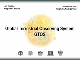
GCOS SC, Geneva, 29 Sep. Riccardo Valentini (GTOS Chair). GTOS Forward Looking 2010 – 2015. What was unique? Ecosystem services. Regulating Benefits obtained from regulation of ecosystem processes. Provisioning Goods produced or provided by ecosystems. Cultural

E N D
GCOS SC, Geneva, 29 Sep Riccardo Valentini (GTOS Chair) GTOS Forward Looking 2010 – 2015
What was unique?Ecosystem services • Regulating • Benefits obtained from regulation of ecosystem processes Provisioning Goods produced or provided by ecosystems Cultural Non-material benefits from ecosystems Photo credits (left to right, top to bottom): Purdue University, WomenAid.org, LSUP, NASA, unknown, CEH Wallingford, unknown, W. Reid, Staffan Widstrand
GTOS strengths Many successes (see biennial and other reports); e.g.: • Panels’ work: • GOFC-GOLD: land cover methods and products, fire methods and products, REDD contributions, advocacy for satellite observations continuity, numerous regional networks • TCOIGCO: CarboAfrica and its outputs, in situ methods documentation,.. • TOPCGCOSUNFCCC: ECV definition and documentation, analyzing and documenting status for improvements in observations,.. • Other: • framework for standardization (UN ISO) • IGOS, GEOIGOL, .. • GTNs: -Glaciers, -Hydrology, -Permafrost; -Lakes, -Rivers, -Mountains
GTOS Structure GTOS POSITION Paris, UNESCO HQ 30 Nov - 2 Dec 2009 GTOS is grounded on the scientific community but with an operational mandate • FAO: LADA, GLADA, REDD; • ICSU: DIVERSITAS, IGBP, WCRP, WDS; • UNEP: Environment Watch Strategy, WCMC, DEWA/ Global Environmental Outlook; • UNESCO: PECS, SUMAMAD, GCOS, GOOS; • WMO: IPCC, GFCS • COCOS; ICOS; IMECC; GCP; CARBOAFRICA; CARBOEUROPE; NACP; projects in ESA The Living Planet program, ICOS, NASA, GEO GTOS UNFCC CBD UNCCD RAMSAR
GTOS 2010-2015 VISION International policy decisions based on timely, reliable and comprehensive information about the status of the terrestrial environment, its components, and the natural resources it provides for humans and other species. MISSION To facilitate the development, implementation and operation of systems, processes and collaborative arrangements that enable the acquisition of consistent, timely and accurate information on the global (and large- scale regional) terrestrial environment and its changes.
GTOS 2010-2015 ROLE To fulfill its mission, GTOS’ main roles are to: Formulate, lead, monitor and revise as appropriate the overall approach to global terrestrial observations; Identify systematic observations/variables that are required and define their characteristics (e.g., standardization in observations and reporting); Advocate in the relevant international policy arena the adoption of the proposed variables, approaches and methods and take the steps necessary to ensure their ongoing provision, availability and use.
GTOS Products Two main products categories : • Development of guidelines and standards for improved terrestrial observation systems. • 2. Synthesis products, position papers, databases, georeferenced analysis of global/regional/national terrestrial ecosystems services and their changes GTOS is -
GTOS Steering Committee 4th Session Paris, UNESCO HQ 30 Nov - 2 Dec 2009 PRODUCTS GTOS is -
GTOS DOMAINS FOR OBSERVATIONS • The priority for GTOS is : the support and coordination of a terrestrial monitoring system at global and regional level (going wherever possible also at national level, for specific key studies and especially if required and endorsed by a country). • Focus will be given to: • climate change, • land degradation and terrestrial carbon (stocks and fluxes) and • loss of biodiversity • Particular attention will be given to the impact of the above issues on ecosystem services. GTOS is -
CLIMATE WHY: Climate change is the major environmental challenge to society for the 21st century Terrestrial observations are needed to provide robust and effective adaptation plans WHAT: Continue supporting GCOSUNFCCC on ECVs Expand work on ECVs to include other drivers (i.e soil moisture). Last development: the workplan for UN-ISO framework and the development of standards for terrestrial ECVs is being submitted to UNFCCC right this week. A1: Framework Convention on Climate Change (UNFCCC)
4.1 Pg y-1 Atmosphere 45% 2.8 Pg y-1 + Land 30% 7.6 Pg C y-1 2.2 Pg y-1 Oceans 25% CARBON CYCLE (2000-2006) 1.5 Pg C y-1 Canadell et al. 2007, PNAS
CARBON CYCLE WHY: Terrestrial carbon plays an important role in shaping the greenhouse gas balance of the atmosphere both in terms of sources and sinks. Terrestrial carbon observations are becoming key issues of future climate policies WHAT: Continue support to IGCO / GEO C-strategy Develop capacities in regional/national carbon observations – Focus on AFRICA Contribute and advice to REDD A1: Framework Convention on Climate Change (UNFCCC)
Blue and Green Waters 100% 60% 40%
LAND DEGRADATION AND WATER SCARCITY WHY: Desertification, Land Degradation and Drought (DLDD) is a global problem affecting more than 2 billion people in over 100 countries, costing more than 40 billion dollars a year “to monitor the processes of degradation and improvement at global and regional scales without having to wait for generalization from detailed, local information” CST/UNCCD A Global Desertification Observing System (GDOS) proposed in 2009 Water scarcity and conflicts are becoming critical areas of terrestrial observations WHAT: Address monitoring capabilities for water (water catchment integrity, soil moisture) Link with LADA, GDOS and CST/UNCCD Establish a role for GTOS via modified Panel responsibilities A2: Convention to Combat Desertification (UNCCD)
BIODIVERSITY Habitat losses : implication for fauna Habitat Suitability maps under projected climate change SRES A1F1, 2030 & 2050 Alpine ibex National Park Adamello-Brenta
BIODIVERSITY WHY: Earth's biological resources vital to economic and social development, but survival of species and ecosystems is under increasing pressure and species extinction continues at an alarming rate COP/CBD expressed the need for integrated regional and sub-global ecosystem assessments and for improvements in the availability and interoperability of biodiversity data Space observations on habitat fragmentation, land cover, species recognition are a unique niche for GTOS WHAT: Establish a role for GTOS via modified Panel responsibilities Work with GEO BON and the SBSTTA/UNCBD Link with DIVERSITAS for the observation component Focus on protected areas and national parks/reference sites A2: Biodiversity Convention (UNCBD)
GTOS is - GTOS DOMAINS FOR OBSERVATIONS • Cross cutting priorities are vulnerable ecosystems. • coastal areas (particularly deltas and mangroves ecosystems), • mountains, • snow and ice cover, • and urban areas.
Sponsors CBD UNFCCC UNCCD GTOS Themes Land degradat. Carbon cycle Climate Biodiversity TCO TOPC GTOS activities, GT-Net, C-GTOS GOFC-GOLD
GTOS: Beneficiaries and Users • Target beneficiaries: • First target are GTOS sponsors: • FAO, ICSU, UNEP UNESCO and WMO • Then: • Multilateral Environmental Agreements (Rio Conventions) • National governments, policy makers • International/ inter-governmental science/research programs • Environmental managers • Non-governmental organizations (NGO)
GT-NET Global Terrestrial Observing Network Activities • Mountains • Permafrost • Glaciers • Hydrology • River discharge
GTOS - AFRICA CARBOAFRICA 2.5 M€ (2007-2010) ERC GRANT AFRICA GHG 2.5 M€ (2010-2014) CLIMAFRICA EU FP7 3 M€ 2010-2013 Climate change predictions in Sub-Saharan Africa: impacts and adaptations
GTOS CARBON OBSERVATIONS 1000 km 10 km Collaboration and support on definition of a Global Carbon Observation System (GEOCARBON) Links with ICOS/GEO Task CL-09-03 ha dm
GTOS – GEO GTOS contributed to the update of the GEO 2009-2011 WP and the relevant task sheets for the Beijing Summit. GTOS is involved in sixteen tasks/subtasks of the last GEO 2009-2011 WorkPlan. GTOS addresses four out of the nine GEO SBAs: Disasters, Climate, Ecosystems and Biodiversity. With 4 tasks/subtasks, the climate SBA is the most intensively addressed by GTOS.
GTOS – GEO Task AR-09-03a: Global Terrestrial Observations Leader & POC: GTOS Secretariat, TCO and TOPC Task AR-09-03c: Global Ocean Observation System Contributor: C-GTOS Task DA-09-03a: Global Land Cover Leader & POC: GOFC-GOLD and GTOS Secretariat Task CL-09-03a: Integrated Global Carbon Observation (IGCO) Leader and POC: GTOS and University of Tuscia Task CL-09-03b: Forest Carbon Tracking Leader: FAO, GTOS Secretariat and TCO Task DI-09-03b: Implementation of a Fire Warning System at Global Level Leader: GOFC-GOLD and GTOS Secretariat Task US-09-03b: Forest Mapping and Change Monitoring Leader and POC: FAO. Leaders: GOFC-GOLD, TCO and GTOS Secretariat
GTOS SUPERSITES Carboeurope/ICOS TCOS Fluxnet-Canada Asiaflux KoFlux Ameriflux Cinaflux USCCC LBA EUSTACH CarboAfrica Afriflux Ozflux
GTOS – TOPC XII Status of Standards and Guidelines for Terrestrial ECVs • Terrestrial ECVs • T1 River Discharge • T2 Water Use • T3 Ground Water • T4 Water Level • T5 Snow Cover • T6 Glaciers and Ice Caps • T7 Permafrost • T8 Albedo • T9 Land Cover • T10 FAPAR • T11 LAI • T12 Above-ground biomass • T13 Fire Disturbance • T14 Soil Moisture
Organizational aspects (1):Framework Presentation to SBSTA 33 November 2010
ECVs (4):Tier Content Tier 1 (High (H) – Medium (M) urgency, H-M readiness): Tier 1a = initial set: 5 ECVs: • ECV Biomass • ECV Glaciers and Ice Caps • ECV Land Cover • ECV Permafrost • ECV Soil Moisture Tier 1b = coincident with Tier 1a (provided resources are available): • ECV Leaf Area Index • ECV River Discharge Tier 2 (M-Low (L) urgency, H-M readiness): • ECV Albedo • ECV Fraction of Absorbed Photosynthetically Active Radiation • ECV Snow Cover Tier 3 (L urgency or L readiness): • ECV Fire Disturbance • ECV Lake Levels and Reservoir Storage • ECV Ground Water • ECV Water Use. Presentation to SBSTA 33 November 2010
Rome, 7 Sep 2010 END Thanks