Download
1 / 5
50 likes | 153 Views
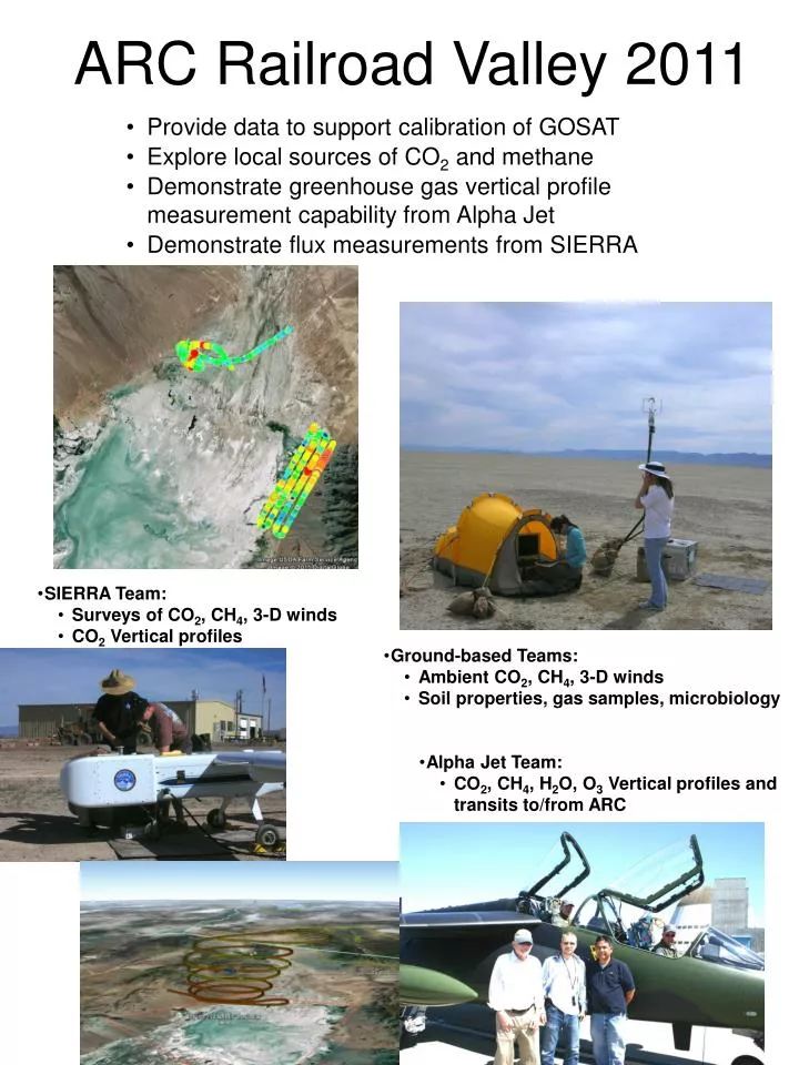
ARC Railroad Valley 2011. Provide data to support calibration of GOSAT Explore local sources of CO 2 and methane Demonstrate greenhouse gas vertical profile measurement capability from Alpha Jet Demonstrate flux measurements from SIERRA. SIERRA Team: Surveys of CO 2 , CH 4 , 3-D winds

E N D
ARC Railroad Valley 2011 • Provide data to support calibration of GOSAT • Explore local sources of CO2 and methane • Demonstrate greenhouse gas vertical profile measurement capability from Alpha Jet • Demonstrate flux measurements from SIERRA • SIERRA Team: • Surveys of CO2, CH4, 3-D winds • CO2 Vertical profiles • Ground-based Teams: • Ambient CO2, CH4, 3-D winds • Soil properties, gas samples, microbiology • Alpha Jet Team: • CO2, CH4, H2O, O3 Vertical profiles and transits to/from ARC
CO2, CH4 Data Sets • Ground-based • mid-day at base camp under GOSAT overpasses: June 19, 20, 22, 23, 25, 26 • diurnal cycles • mobile sleuthing • SIERRA • June 17: CH4 playa survey • June 18: CH4 at springs and oil wells • June 20*: CO2 stacked circles at base camp • June 21*: CH4 oil well mapping • June 22: CO2 stacked circles at base camp • (*MMS data also available) • Alpha Jet • vertical profiles under GOSAT • June 22, 23, 25, 26
SIERRA Highlights CO2 stacked circles mapping methane over playa mapping methane over springs mapping methane over oil wells
Diurnal Variability • CO2 at ground level • noon on 6/20 through noon on 6/21 • drawdown overnight: uptake into soil • consistent with other desert environments; magnitude currently an open research question
Soil and Microbiology Data Ground truthing for methane hotspots Kate Springs Bubble characteristics: CH4 = 84.32 ± 0.13 % C2H6= 7.88 ± 0.16 ppm C1/C2 = 105000 Sediment POC = 3.37 ± 0.8% Kate Springs