Download
1 / 30
300 likes | 418 Views
Mapping Coastal Wetlands in the Mississippi River Delta for the NHD. Sean Deinert Director of Technical Operations GDM International Services, Inc. James E. Mitchell , Ph.D . IT GIS Manager & Kurt L. Johnson IT GIS Technical Specialist

E N D
Mapping Coastal Wetlands in the Mississippi River Delta for the NHD Sean Deinert Director of Technical Operations GDM International Services, Inc. James E. Mitchell, Ph.D. IT GIS Manager & Kurt L. Johnson IT GIS Technical Specialist Louisiana Department of Transportation and Development
GDM and NHD • STRATMAP • Revised over 4,400 quadrangles of hydrographic data • Created High Resolution NHD for Texas • Louisiana Seamless Basemap Project • Collection, creation and revision of base map data • High Resolution NHD Revision
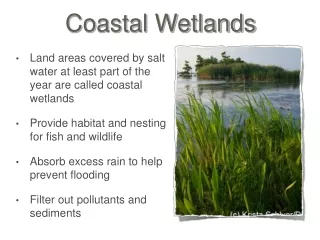
What makes Louisiana different? “Backward” distributary basins Extensive marsh area (almost no beaches) Hurricane frequency Subsidence and land-loss issues
Why the NHD requires updating… High Resolution NHD was built from “best available” data……old maps and imagery Eliminate inconsistencies related to the lack of contemporaneous source data from the original USGS maps Keep pace with the rate and frequency of change in the Louisiana coastal landscape
Where has all the coastline gone? Red features are from the NHD. Orange polygons are areas represented by NOAA as land in 1940 (most current data). These areas are now open water in the NHD.
NHD land/water interface Pass a Loutre WMA Southeast Pass Redfish Bay
Lake MaurepasPilot Project • Out of date data sources (USGS Quad Maps) require large scale revisions • Manual revision with NHD GeoEdit • Photorevision • Manual deletion of all features and accompanying NHDStatus records • Manual allocation of ReachCodes • Manual tabulation of NHDCrossReference • Appropriate Add/ModifyGeometryNHDStatus records
Pilot Project – Lake Maurepas • First “Coastal Louisiana” experience – Pass Manchac
08090301 Revision Initial Photorevision process begun in summer 2008 with 2005 post-Katrina imagery January 2009 - Production halted due to lack of resources Fall 2009 – Began reassessment of the practicality of revising 08090301 February & June, 2010 - NHDGeoEdit Tool Workshops conducted by NHD Staff
Challenges encountered on 08090301 • Time • Revisions are extensive and time-consuming • The amount (number and extent) of changes • The saltatory nature and erratic rate of feature change • The dataset size (number of FlowLine elements) and topological complexity (ArtificialPaths) • The NHDGeoEdit Tool is designed for single, isolated revisions, not wholesale feature replacement • Cost • Frequent, protracted revisions will greatly increase maintenance cost
Questions raised by 08090301 How can NHD effectively revise large HUCs with tens of thousands of complex features? How can future maintenance be sustained when the cost and effort to keep the data accurate and up to date is so great? What tools and methods are available to streamline these processes?
08090301 Solution - Step 1 • Methods for reducing basin complexity • Identify & assess basin for complexity • Develop strategy for revisions • Classification of coastal regime • 1. Upper basin-freshwater dominated zone • 2. Mid basin-freshwater/saltwater mixing zone • 3. Lower basin-saltwater dominated zone
Upper Basin Delineation Intercoastal Waterway – HUC 12 and Physical Barrier
Mid & Lower Basin Delineation Chabreck – Linscombe vegetative classification for determining saltwater species Green – Fresh Marsh, Non-Marsh, & Swamp Yellow – Intermediate Marsh Red – Saline Marsh
08090301 Solution - Step 2 • Development of Standards for Coastal Areas • “Estuary” features
08090301 Solution - Step 2 • Development of Standards for Coastal Areas • “Estuary” features • Delineation of Bays & other water features within Estuary
08090301 Solution - Step 2 • Development of Standards for Coastal Areas • “Estuary” features • Delineation of Bays & other water features within Estuary • Removal of Swamp/Marsh from Estuary to create a separate feature
08090301 Solution - Step 2 • Development of Standards for Coastal Areas • “Estuary” features • Delineation of Bays & other water features within Estuary • Removal of Swamp/Marsh from Estuary to create a separate feature • NHDFlowline pruning/redevelopment to maintain features essential to represent flow connectivity
08090301 Solution - Step 3 • NHD GeoConflation Toolset • Workshops in July, 2010 and April, 2011 • Provides for revisions using large-area datasets • Automates NHDStatus, NHDReachCrossReference, etc., generation
08090301 Final Results • Old method: • 60,000+ features revised • 8 months+ to update and revise • Manual table generation • New Method • 31,000+ features revised • ~5 months to update and revise • Automated table generation
08090301 Conclusions • Remaining Concerns • XML Extract size • Computer Limitations – Editor & USGS • Robustness of Standards
Looking Forward - Future Benefits • Reduction of initial revision time & cost • Provides a method for HUC12 assessment/revision following catastrophic natural events • Streamlines regularly scheduled HUC8 maintenance